
Coastal walk: Portsoy to Whitehills
Date: Saturday 17th September 2011
Company: Myself and Beinn
Time: 3Hrs 05Mins
I fancied a walk today but didn't want to drive any distance - a fifteen minute drive therefore saw me to the start of today's walk at Portsoy.
I have previously walked the Banffshire/Moray coast from Macduff to Buckie with the exception of the stretch of coast from Portsoy to Whitehills. Portsoy to Whitehills was therefore today's target.
Previous Banffshire/Moray coastal walks: Macduff to Whitehills, Portsoy to Sandend, Sandend to Cullen, Cullen Coast, Cullen to Buckie.
The North Sea Trail (Aberdeenshire Coastal Path) doesn't actually follow the coast between Portsoy and Whitehills - the route is along nearly 5 miles of the B9139. I set out today with the intention of trying to stick as much as possible to the coast, avoiding the B9139!
Click here to see a map of the route undertaken
I parked at the Old Harbour in Portsoy, set off towards the New Harbour and then along the road to Links Bay Caravan Site. Before reaching the Caravan Site, I passed a small museum/family history/venue called the Portsoy Salmon Bothy.
The Shore Inn, Old Harbour, Portsoy:

Beinn had a wee run about on the beach at Links Bay, the only half-decent beach in the stretch of coast between Portsoy and Whitehills.
Links Bay Caravan Site, Portsoy:

Beyond the road-end, I was pleasantly surprised at the nice grassy path heading off round the coast. I stuck to this path for a few hundred metres and then walked over the various rocks at the water's edge.
Coastal path beyond road-end, Links Bay, Portsoy:

Looking back to Portsoy:

Looking towards East Head:
Looking back towards Links Bay:

I thought the view back towards Portsoy from here was quite nice.
Looking back to Portsoy:

I saw a good number of Cormorant on this walk, as well as numerous gulls, Oystercatcher and Curlew.
Cormorant and gulls:

The walk past King's Head and round to Strathmarchin Bay, along a faint path, was quite straight-forward.
Heading towards King's Head:

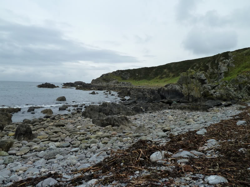
As I approached Strathmarchin Bay, I could see that the section of coast ahead had a number of small cliffs dropping into the sea. I would need to gain height for this section.
Approaching Strathmarchin Bay:

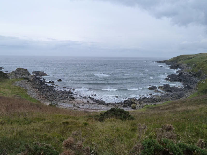
Strathmarchin Bay:
On reaching Strathmarchin Bay, I ascended slopes of very long grass to reach the fields at the top of the cliffs. Well that was the plan - it took three attempts to find a way up into the fields, avoiding gorse bushes!
Looking back from grassy ascent:

The walk through the fields was quite pleasant. This might have been a different story had the crops not been recently harvested.
Crossing through recently-harvested fields:

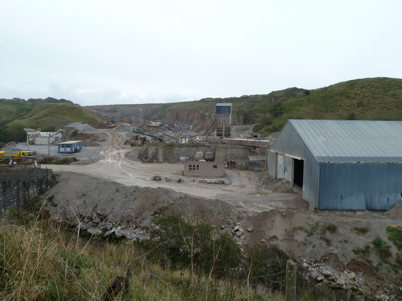
On reaching the end of a second field, I saw a couple of faded old signs advising "Danger Quarry". I checked my map and couldn't see any named quarry marked on the map, I therefore carried on. The signs were correct. There is a quarry at Boyne Bay. I walked through the site as there was no-one around today.
Approaching Boyne Bay Quarry:

Looking back to quarry:
I had a quick look at the small beach at Boyne Bay before following the quarry road up to the B9139 - I couldn't carry on along the edge of the fields as I couldn't get Beinn over a barbed-wire fence.
Boyne Bay beach:

At the road entrance, I saw a sign advising "No Unauthorised Persons". Oh well, there wasn't as sign advising that at the other end
Road entrance to Boyne Bay Quarry:

I had managed to avoid the B9139 thus far, but it was on to the Aberdeenshire non-coastal Coastal Path for the next 1.5km.
Boyndie windfarm from B9139:

The views along the B9139 were not that inspiring.
B9139:

About 0.5km past Easter Whyntie farm, I saw a sign advising access to the coast. I followed this good track which led down to a field with cattle in it.
Track leading towards coastal path near Bear's Head:

Heading towards Stake Ness:

I made my way down to the shore and picked-up a faint path leading out to Whitehills.
Looking back along coast towards Portsoy:

Whitehills in distance:

Looking back towards Stake Ness:

Before reaching Whitehills, I called home to confirm my whereabouts for a gratefully accepted lift back to Portsoy
Whitehills:

Cormorants:

Cormorants:

Downies Fish Shop:

Whitehills Marina:

Of the sections of Banffshire coast that I have walked, this was the most disappointing. A five mile walk along a B-road is not in my view a Coastal Path. A real Coastal Path starts off well from Portsoy and finishes well at Whitehills, but there is a sizeable section in the middle missing.
Very rough in places but still an enjoyable walk.