
Hill: Biod an Athair
Date: Saturday 8th September 2012
Company: John, Derrick, Brent and myself
The cloud was right down in Glen Brittle this morning, so I returned to North Skye to ascend my two remaining Marilyns: Biod and Athair and Beinn Bhreac. I was joined by John, Derrick and Brent.
We drove to Galtriggil for the ascent of Biod an Athair. The road to Galtriggil is fairly narrow and parking there is limited. There is a sign at the road-end advising “No Parking”, which we ignored as the sign was sort of half toppled-over.
Click here to see a map of the route undertaken
We followed a track and then a faint path from the start to the summit.
Looking back to start at Galtriggil:

Ruin:

The underfoot conditions were fairly good. Much of the ascent is via short grass.
Path just beyond the ruin:

During the ascent we had to climb over a barbed-wire fence and soon thereafter cross a small burn. Beyond the burn, it was a straight-forward ascent to the summit.
Ascending Biod an Athair:

Looking back across Loch Dunvegan towards Waternish:

We walked along the old grass-covered dyke.
Walking along an old grass-covered dyke:

Towards the end of the dyke, we came across what looked like an old pit. There were also a number of stone circles. I’m not sure of their former purpose.
Remains of an old pit?:

Heading towards the summit:

The summit of Biod an Athair is perched on the edge of a cliff, which drops 300m to the sea.
300m drop to the sea:

Drop below the summit:

We didn’t spend long at the summit as it was fairly windy up there.
Trig point and summit rocks:

From the summit, we returned to the car via the same route.
We then drove back to Dunvegan and then onto Claigan, for an ascent of Beinn Bhreac.
Hill: Beinn Bhreac
Date: Saturday 8th September 2012
Company: John, Derrick, Brent and myself
We parked in the Coral Beach car park, where there is room for circa 12 cars.
Click here to see a map of the route undertaken
Start of walk from Coral Beach car park:
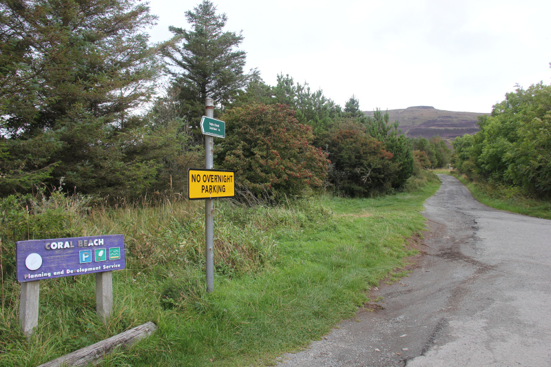
From the car park, we followed a track towards a locked gate with barbed-wire fence wrapped around it. There is however a stile to the side of the gate, which we used to gain access to the track beyond.
We followed the really good grass track for a couple of kilometres.
Nice grass track ascending the hill:

Looking towards the 314m top:

View from ascent:

Ascending the track:

On reaching the end of the track, we passed a Landrover. There was stalking being undertaken on the hill but we didn’t hear any shots.
Landrover at end of track (stalking):

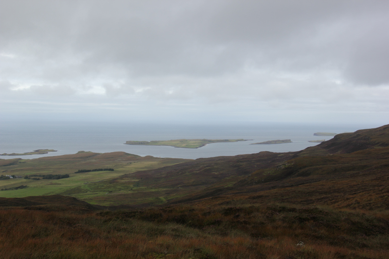
As we gained height, we got nice views across to the Isle of Iosaigh.
The Isle of Iosaigh:
Beyond the track, it was a pathless ascent to the summit.
Pathless ascent beyond the end of the track:

Lots of islands in Loch Dunvegan:

Final ascent to the summit:

We spent around five minutes at the summit before returning to the car via the same route.
The summit of Beinn Bhreac:

A good day out