
I set out this morning with the intention of ascending five Marilyns located within the South Downs. I decided to tackle them in a West to East direction starting with Chanctonbury Ring.
Hill: Chanctonbury Ring
Date: Saturday 21st September 2013
Company: Just myself
Distance: 5.3km, Ascent: 240m
Time: 1Hr 10Mins
Chanctonbury Ring was originally a hill fort dating back to 5th or 6th century BC. In 1760, a number of beech trees were planted within the earth bank of the fort. Many of the trees were destroyed in a storm in 1987.
Local legend has it that Chanctonbury Hill was created by the devil and that he can be summoned by running around the clump of trees seven times anti-clockwise. When he appears he will offer a bowl of soup for your soul
I parked at the end of the Chanctonbury Ring road near Great Barn Farm.
Click here to see a map of the route undertaken
I set off walking along a heavily-eroded track leading towards the South Downs Way. The track was quite slippery underfoot.
Restricted Byway from Great Barn Farm leading towards the South Downs Way:

Restricted Byway leading towards the South Downs Way:

Fifteen minutes after setting off, I reached the South Downs Way.
On the South Downs Way:

Once on the South Downs Way, I passed numerous other walkers.
Following the South Downs Way towards Chanctonbury Ring:

On reaching the following sign, I was extremely pleased that it was not 7am on the 1st May.
Chanctonbury Way Sign:

Looking towards the Chanctonbury Ring:

On reaching Chanctonbury Ring, I had a walk around looking for the highest point. I think there are two potential high points i) a rough area towards the centre of the ring ii) at the edge of the ring next to some trees.
Summit of Chanctonbury Ring:

From the summit of Chanctonbury Ring, I walked circa 400m beyond to reach the trig point.
Looking back to Chanctonbury Ring from the trig point:

View from the trig point towards Ashington:

From the trig point, I returned to the car via the same route. I enjoyed the ascent of Chanctonbury Hill. It is a nice walk with some interesting history.
From Chanctonbury Hill, I drove towards Ditchling for an ascent of Ditchling Beacon.
Hill: Ditchling Beacon
Date: Saturday 21st September 2013
Company: Just myself
Distance: 400m, Ascent: 20m
Time: 5Mins
If parking in the Ditchling Beacon car park the walk to the summit is really short.
Click here to see a map of the route undertaken
The car park is run by the National Trust. There are no pay and display machines in operation instead you have to make a phone call to pay using your mobile and credit card. I think this is a completely stupid idea. I couldn’t get a signal on my mobile.
National Trust Ditchling Beacon sign:
I therefore continued on up the hill as I reckoned it would only take five minutes.
National Trust Ditchling Beacon sign:
Through the gate towards Ditchling Beacon:
Traffic on the track leading to Ditchling Beacon summit:
I reached the summit three minutes after setting off.
Ditchling Beacon trig point:
I returned to the car via the same route and then drove towards Lewes for an ascent of Cliffe Hill.
Hill: Cliffe Hill
Date: Saturday 21st September 2013
Company: Just myself
Distance: 4km, Ascent: 180m
Time: 50Mins
Click here to see a map of the route undertaken
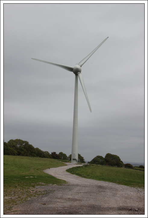
I parked just off the road beside a track leading to a lone wind turbine. I am quite surprised there are not dozens of wind turbines in this area but then again why ruin England’s landscape when you can just put them all over Scotland instead.
A lone turbine at the start of the walk:
The ascent of Cliffe Hill was pleasant. There is a good quality track for much of the way.
Initial track towards Cliffe Hill:

Cliffe Hill:

During the walk I passed a concrete bowl. I am not sure of the purpose of this bowl. I saw another one on a nearby hill too.
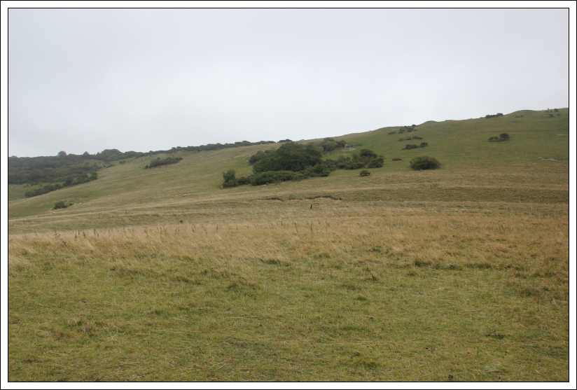
Ascending Saxon Down:

Looking back towards turbine at start of walk:

Looking towards Cliffe Hill from Saxon Down:

At the end of the track there is a stile leading onto the golf course beyond. I was a bit apprehensive walking across a golf course, so I stuck to the rough as much as I could. On passing three golfers, they all smiled and said hello – no problems encountered.
Stile onto the golf course:

I found it a bit strange to reach a trig point next to a golf course green.
Trig point near the green:

Trig point from nearby summit mound:

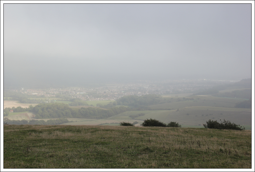
View from summit of Cliffe Hill:

From the summit there are good views down to Ringmer and to Lewes.
Ringmer:

Lewes from just beyond summit:

I returned to the car via the same route. I then drove towards Firle to ascend my fourth hill of the day.
Hill: Firle Beacon
Date: Saturday 21st September 2013
Company: Just myself
Distance: 3.6km, Ascent: 120m
Time: 43Mins
I parked in a large car park located on the South Downs Way to the West of Firle Beacon.
Click here to see a map of the route undertaken
I passed through a gate advising that using a metal detector on this land is a criminal offence. I wasn’t aware that the act of metal detecting could be an offence. This would appear to be the case where protected sites / scheduled monuments are concerned. There is an offence ‘unauthorised use of a metal detector’ with a resultant fine of up to £1000.
Gate at Firle Beacon car park:
Once beyond the gate it was a pleasant walk along a grass track to the summit of Firle Beacon.
Looking towards Firle Beacon:
Track towards Firle Beacon:
Summit mound with trig point just beyond:
View from summit of Firle Beacon:
I returned to the car via the same route. I then drove to Wilmington for an ascent of Wilmington Hill.
Hill: Wilmington Hill
Date: Saturday 21st September 2013
Company: Just myself
Distance: 3.3km, Ascent: 170m
Time: 1Hr
Click here to see a map of the route undertaken
On reaching Wilmington, I parked in the Long Man car park.
I hadn’t heard of the Long Man of Wilmington until last night on receiving a Facebook post from my friend John. The Long Man is highly visible from the car park.
The Long Man of Wilmington car park sign:

The Long Man of Wilmington from car park (zoom):

The Long Man is the length of 40 men. The origin of the Long Man is unclear. Recent archaeological work suggests the Long Man dates back to the 16th or 17th century and not >3500 years BC as previously suggested. The Long Man is definitely worth seeing.
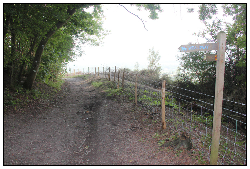
Start of footpath towards the Long Man:

The Long Man:

During the 2010 solstice, the Long Man was indeed a Long Man: see link (courtesy of Wikipedia).
Looking towards the summit of Wilmington Hill:
Instead of following the long zig-zag track, I opted to ascend steeply and directly up the hill.
Looking back towards Wilmington:

Approaching the summit of Wilmington Hill:

The summit is a large mound just beyond the trig point.
Trig point near the summit mound:

Instead of returning via the same route, a quick look at the map showed that I could undertake a circuit leading back to Wilmington.
Eastbourne:
Descent via the NE ridge:

Bridleway leading back to Wilmington:
I really enjoyed walking the hills in the South Downs. It would be great to do all of these hills in a traverse of the South Downs Way.