
Part 4 of 4 : Signalkuppe (4554m)
Apologies in advance, this is an epic report for what was an epic walk.
After spending a night in relative luxury in Staffal (Gressoney), we now needed to get back up into the mountains, specifically to the Mantova hut, our next nights’ accommodation.
We had to endure sitting in a nice pub all morning, eating fine Italian pizza and drinking various poisons, as all the uplifts were closed due to high winds.
We needed three uplifts to get back within the vicinity of the Mantova hut.
1) from Staffal to Gabiet, 2) from Gabiet to Passo Dei Salato and 3) from Passo Dei Salato to Indren.
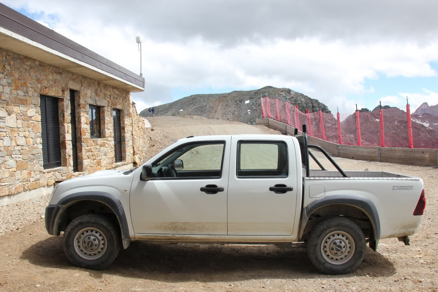
By 14:00, the bottom uplift was again operational and the top uplift was again operational, but the middle uplift was still closed due to winds in excess of 70kph. Poldo pulled out all the stops to get us up the hill, getting in touch with a friend to drive us up the mountain in a 4x4, from the top of the first uplift to the bottom of the third uplift. Great stuff Poldo!
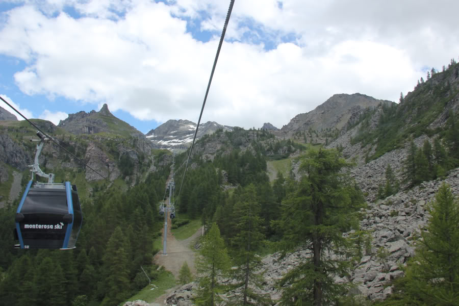
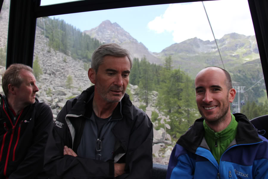
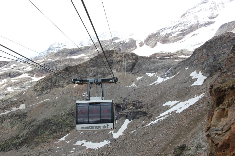
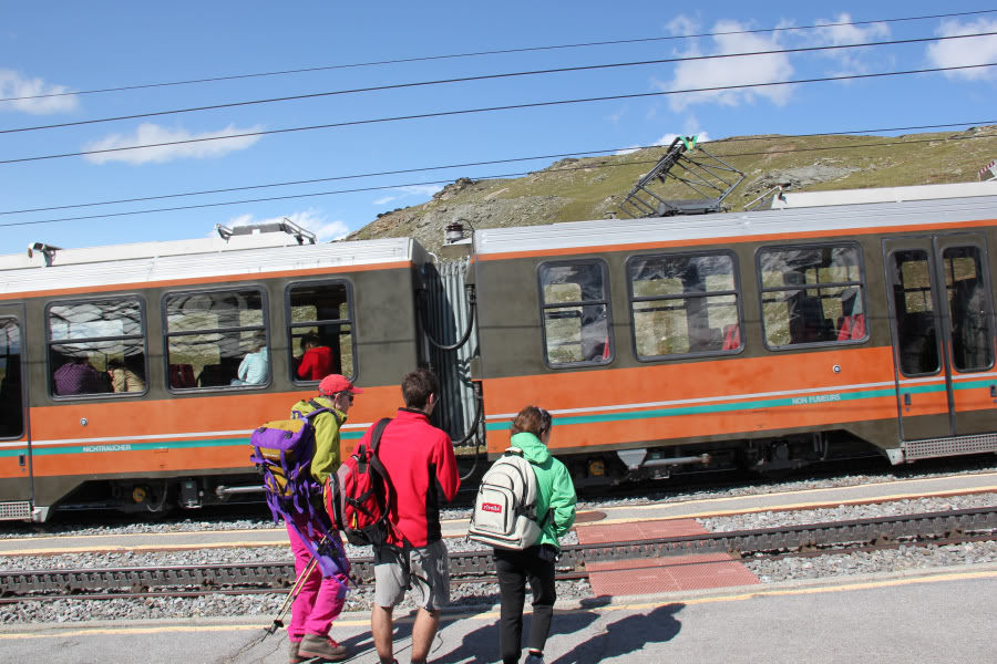
Just after 14:00, we set off back up the mountain in the uplift from Staffal to Gabiet.
Uplift from Staffal, Gressoney to Gabiet:
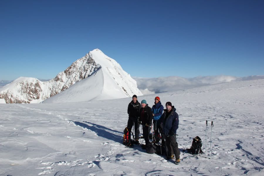
Chris, Iain and Mark happy to be getting back up into the mountains:
We were then transported by 4x4, all squeezed together in the back seat, with our rucksacks in the back, up to Passo Dei Salato.
4x4 transport from Gabiet to Passo Dei Salato:
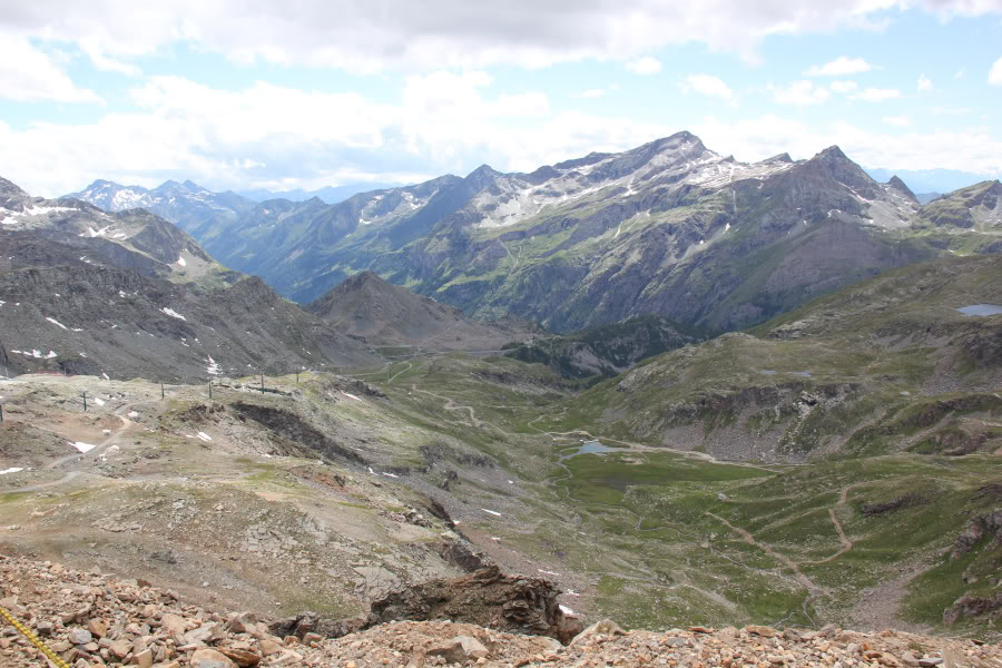
Looking back at section covered by 4x4:
On reaching Passo Dei Salato, we waited a short time for the next uplift. Given the middle uplift was closed, we were surprised at how many other people were also waiting for the third uplift. Most had come up from Alagna Valsesia, a different valley, where the uplifts were still all operational.
Uplift from Passo Dei Salato to Indren:
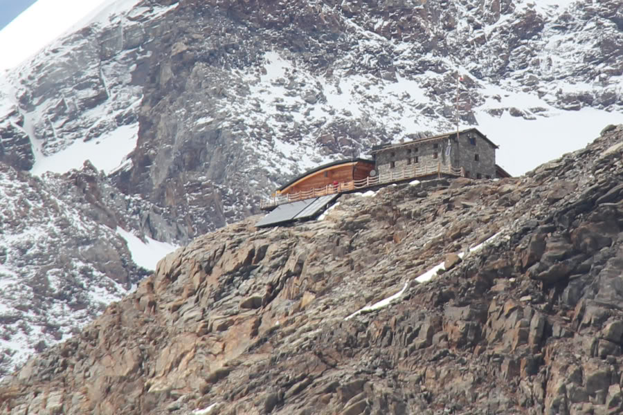
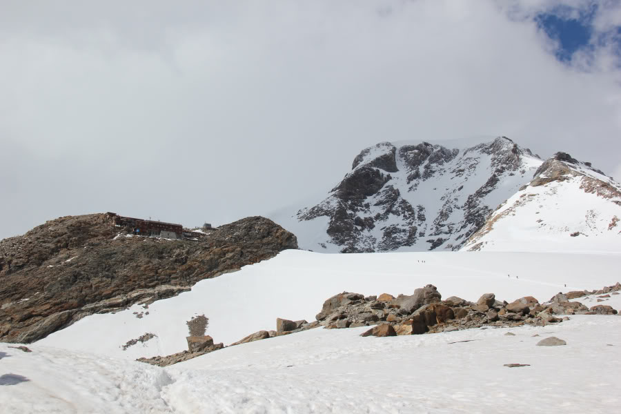
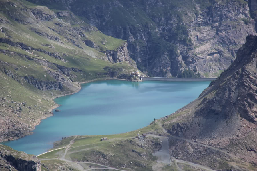
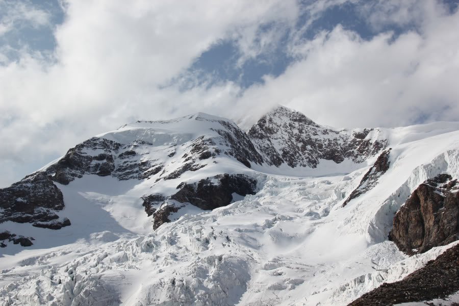
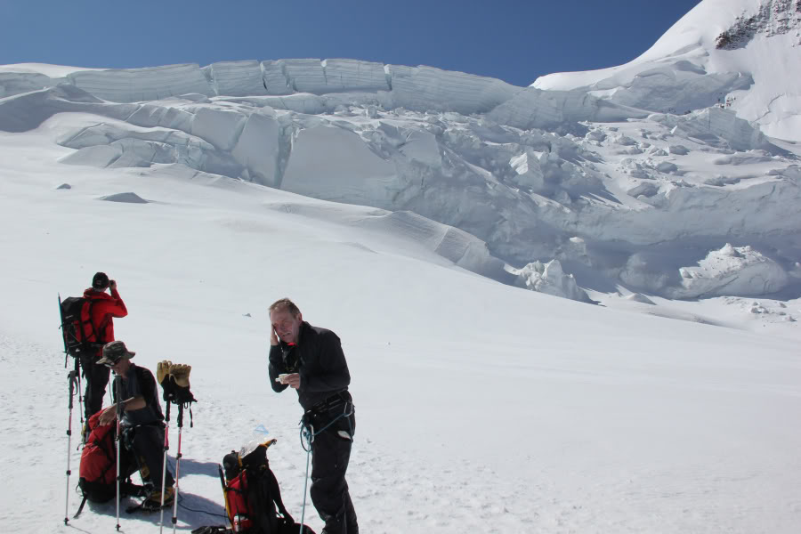
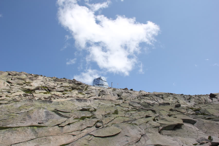
While waiting for the uplift, I took a photo of our accommodation, at 3498m.
Mantova Hut from Passo Dei Salato (zoom):
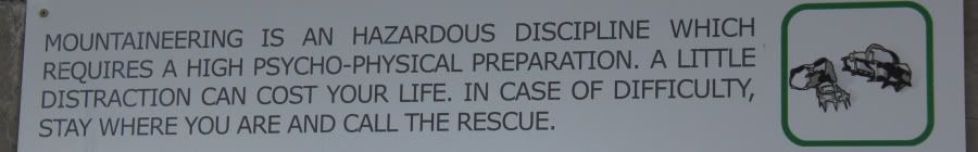
In the station, I read a sign which I found very useful. I knew the next day was going to be really arduous. To achieve the task, I would need to be in the right frame of mind as well as physically fit.
A useful notice at Passo Dei Salato:
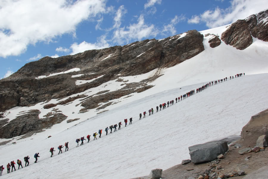
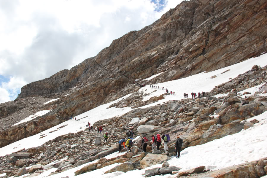
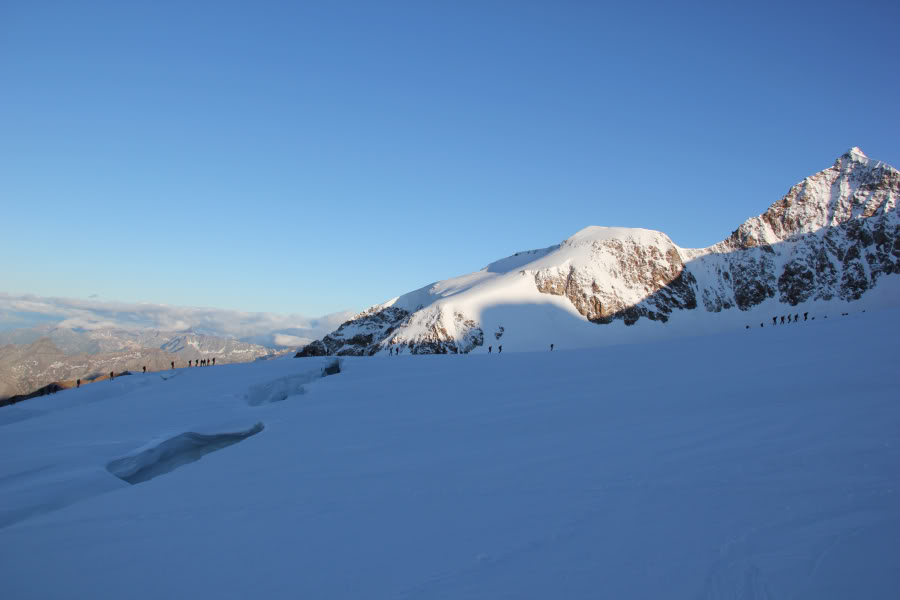
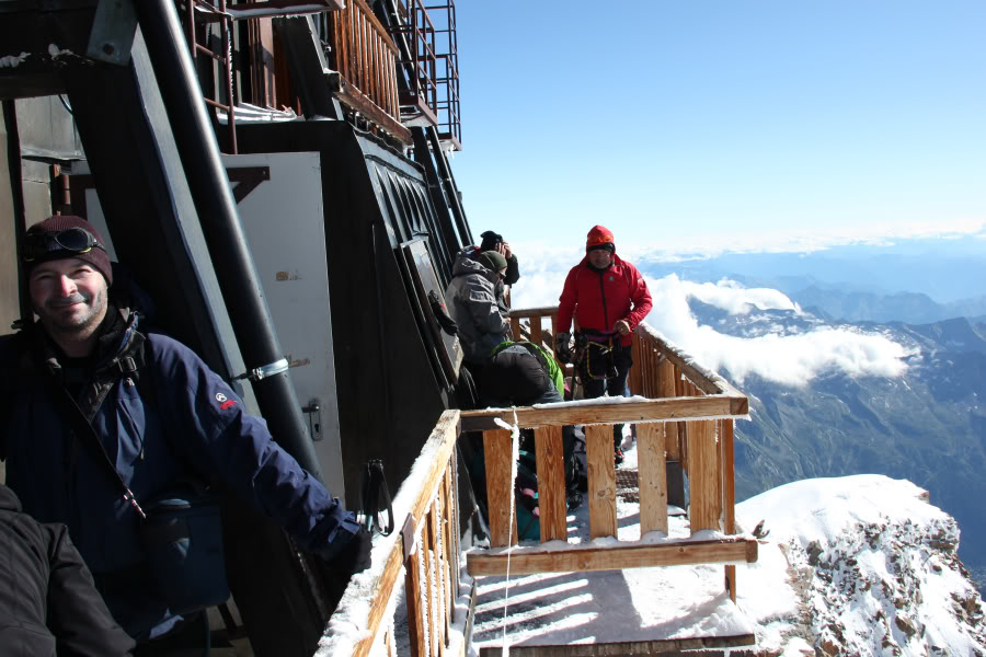
The uplift accommodates 60 people at a time. There were at least that number in the lift, all of whom set off together up the mountain towards either the Mantova hut or the Gniffetti hut.
Large number of people heading for Mantova hut and Gniffetti hut:
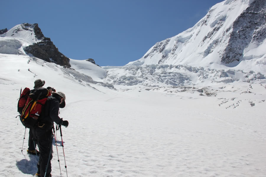
A short distance up the mountain, the large group split in two, as some headed for the Gniffetti hut (3611m), and others including ourselves headed for the Mantova hut (3498m).
Path split – lower path to Mantova hut, upper path to Gniffetti hut:
Looking back towards Indren station:
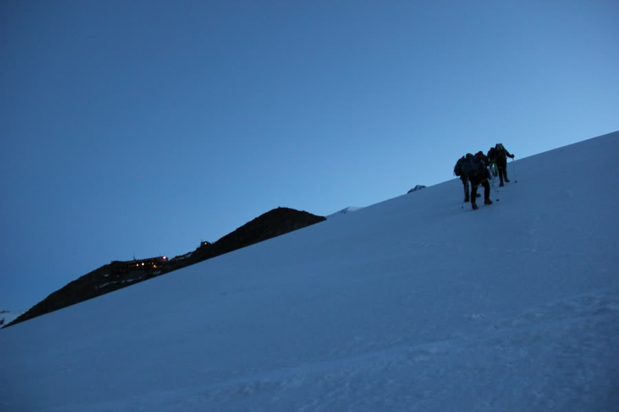
All the scrambly sections of the ascent had fixed ropes in place to assist.
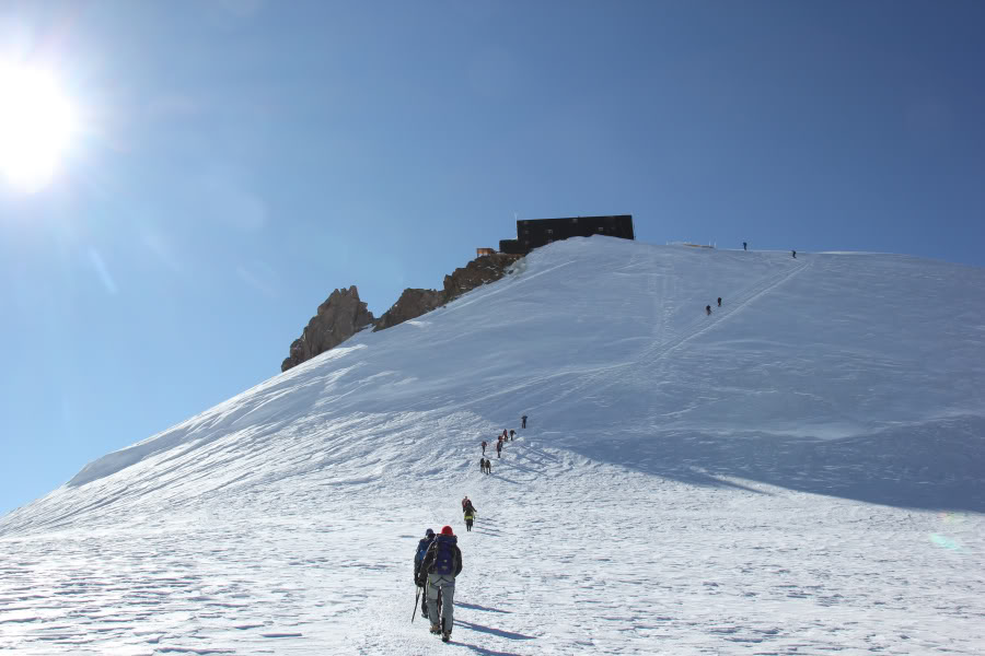
Final ascent towards Mantova hut:
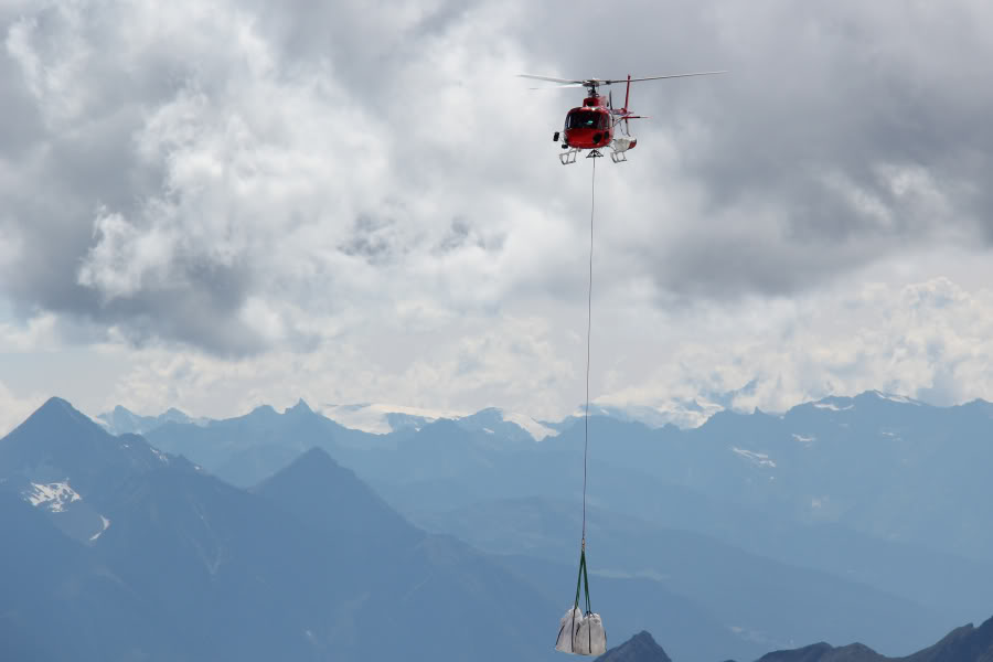
Just as we were arriving at the Mantova hut, we were fortunate to witness a helicopter dropping off some supplies to the hut.
Helicopter bringing in supplies to Mantova hut:
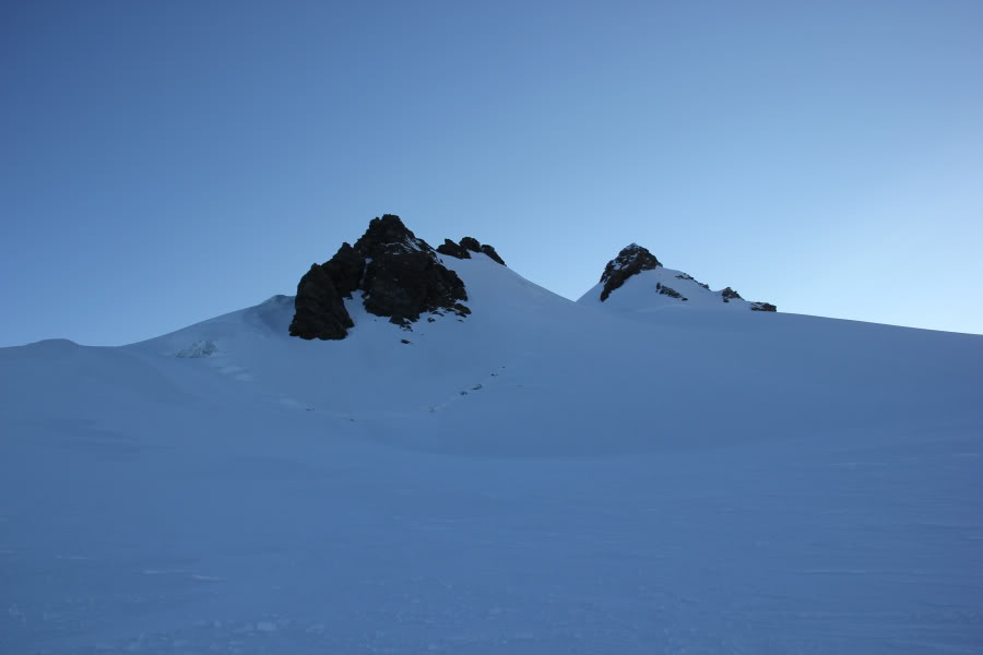
Looking towards the Gniffetti hut from the Mantova hut (zoom):
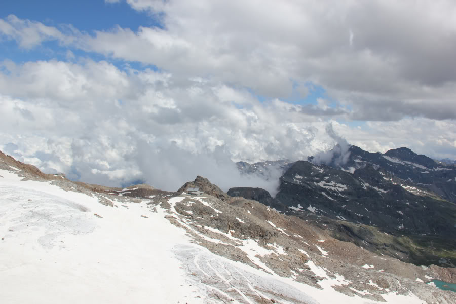
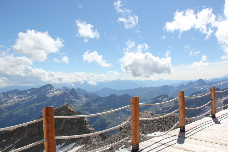
The views from the Mantova hut were quite superb.
View from the balcony of the Mantova hut:
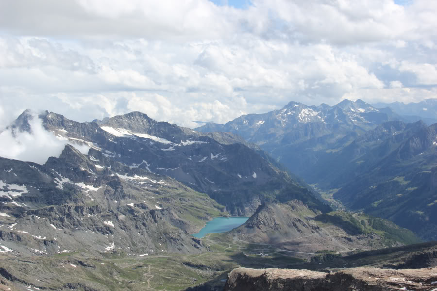
View from Mantova hut towards Lake Gabiet:
View from Mantova hut towards Castor:

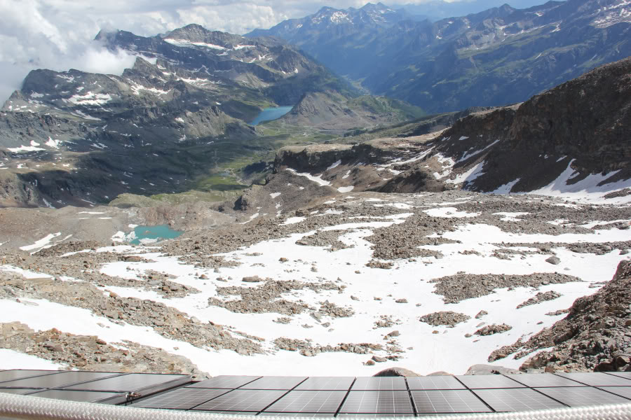
Looking down the solar panels of the Mantova hut:
Lake Gabiet (zoom):
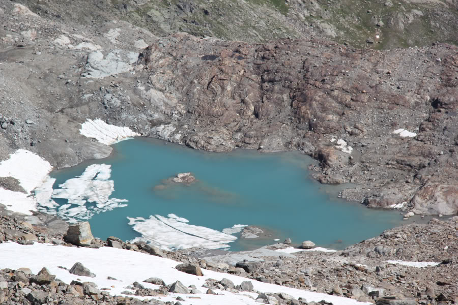
Nice blue lake (zoom):
From the balcony of the Mantova hut, we got a really good view of the ridge that we had descended the previous day, to escape the bad weather.
Looking across to Refugio Quintino Sella and the ridge descended the day previous:
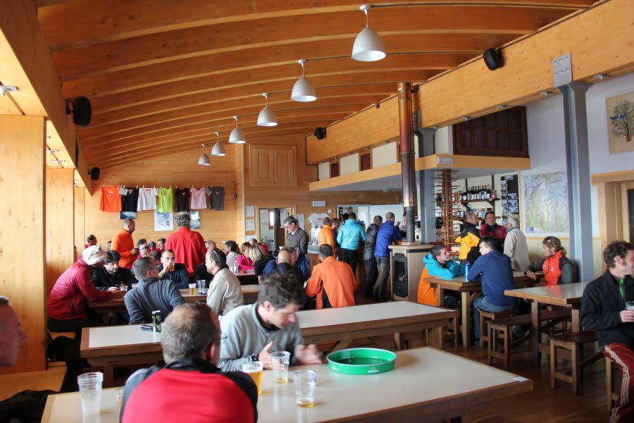
The Mantova hut is very new and really smart inside. Nice four person rooms instead of rooms that sleep 20+ on alpine bunks.
Although the hut was in superb condition, the food that was served was the worst of the trip. It was so bad, I didn’t eat it. I was glad that I had had a decent pizza at lunchtime.
Inside the Mantova hut:
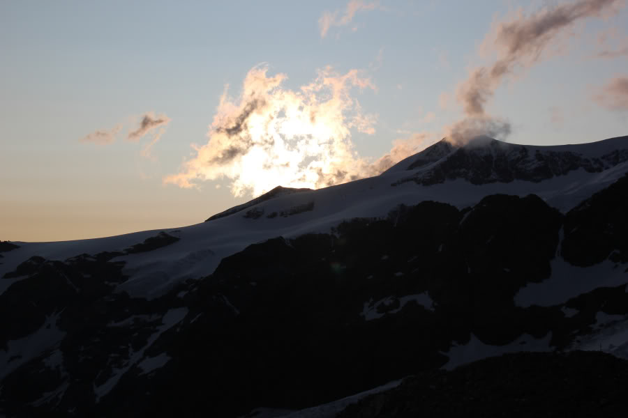
After dinner, I went out onto the balcony to witness my first Alpine sunset. I wasn’t disappointed.
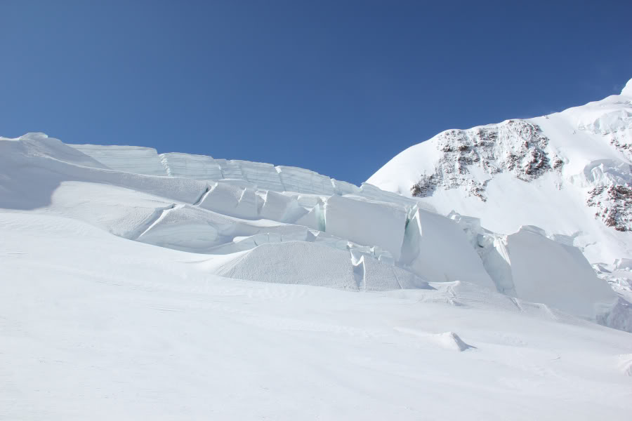
Glacier above Mantova hut:
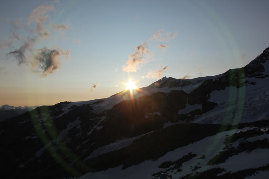
I had to switch the camera to manual for about the next five or six photos.
Sunset from Mantova hut:
I got an unexpected double concentric-circle effect by moving the camera to put the lens flare into the centre of the sun.
Sunset from Mantova hut:
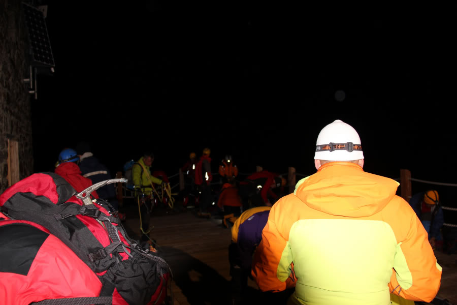
We then went to bed nice and early, as we were to be up at 03:50.
After not much sleep, probably due to a combination of altitude and anticipation of what lay ahead, we got up, fed and packed for a head-torch start. I enjoyed setting off in the dark with a head-torch, as I do back home in Scotland.
Today was going to be a big day for us - at least 1300m ascent, at least 2000m descent, at least 25km distance, at altitude, and almost all across glacier carrying a heavy pack, wearing heavy boots and crampons.
Shortly before 5.00am, a headtorch start:
A short time after setting off, we witnessed a beautiful sight. Pre-sunrise colours together with the Moon, Venus and Jupiter all close together.
Beautiful pre-sunrise morning with the Moon, Venus and Jupiter very prominent:

Beautiful pre-sunrise morning with the Moon, Venus and Jupiter very prominent:

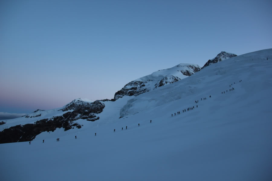
As we walked past the Gniffetti hut, the group of walkers from the Gniffetti hut merged with the group of walkers from the Mantova hut, resulting in a huge number of people ascending the glacier.
Ascending past the Gniffetti hut:
Mountaineers setting out from the Gniffetti hut:
Looking back towards the Gniffetti hut:
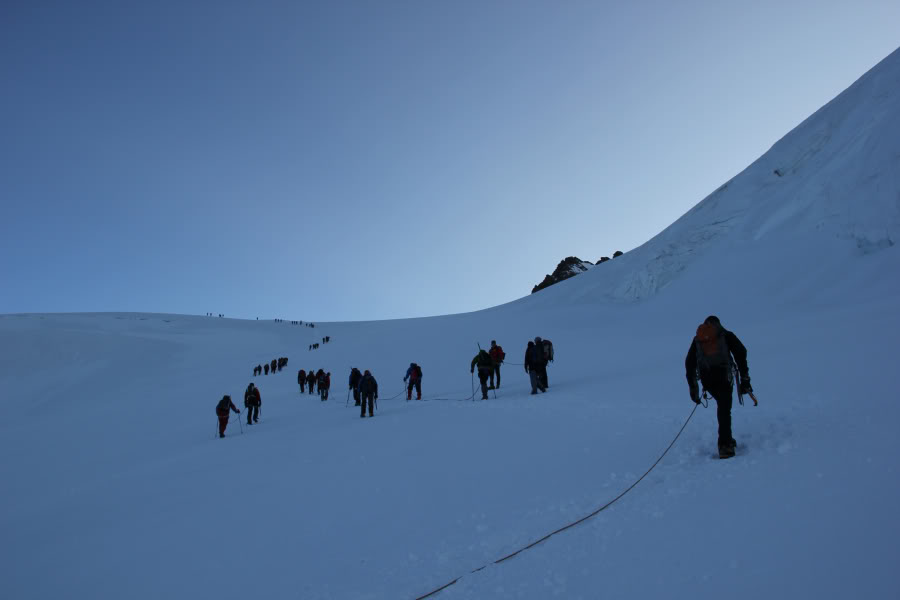
Our guide Poldo, took much better lines than almost everyone else ascending the mountain. Poldo seemed to know where all the crevasses were and the best route to avoid them. Poldo has been guiding in Monte Rosa for nearly 20 years!
Overtaking almost everyone else:
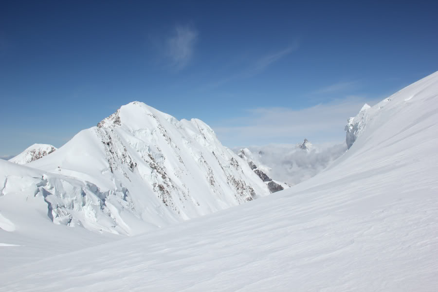
I was really impressed with Liskamm during the ascent. That is a mountain I would like to come back to climb.
Beautiful Liskamm:

Poldo had advised of a large crevasse at 4000m, so we knew our height when we reached the large crevasse.
Large crevasse at 4000m:
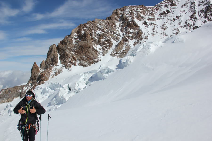
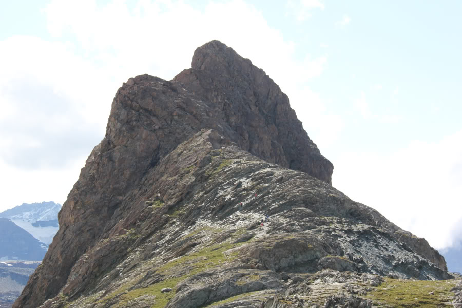
It was somewhat annoying to pass so close to several mountains that we should have ascended the day previous had the weather been less inclement.
Grrr, two we should have ascended the day previous!:
We stopped for our first real break of the day on reaching the Col de Lys. From the Col de Lys, we were not going to be permitted another stop until the summit of Signalkuppe!
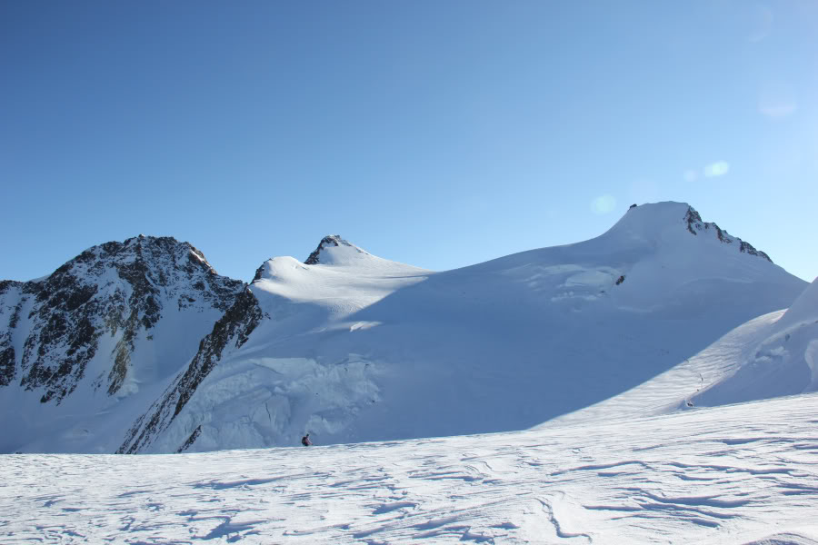
Signalkuppe and Parrotspitze from Col de Lys:
Dufourpsitze and Zumsteinspitze are two more mountains that I would like to get up at some point in the future.
Dufourspitze, Zumsteinspitze and Signalkuppe:
Group photo with Liskamm in the background:
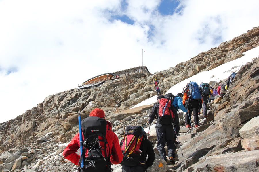
The final ascent to the summit of Signalkuppe was pretty-tough. It was steep and we were tired having just ascended over 1000m from the Mantova hut.
Final ascent to the Margherita hut at the summit of Signalkuppe:
On reaching the summit of Signalkuppe, Poldo did not permit us time to go into the hut, which annoyed me somewhat given we had just spent four hours getting there. But fair enough, we would have had to take off our crampons to go in. Instead, Poldo went in on our behalf and took out some beer and hot tea, as it was absolutely Baltic up there. Good man!
The night previous, Poldo had said from Mantova hut to Signalkuppe: 4Hrs - very good, 4Hrs 30Mins - average, 5Hrs - a bit slow, 6Hrs - too slow. We made the walk in 4Hrs 05Mins and yet he still wanted us to go faster
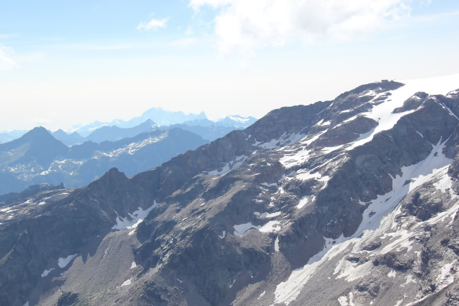
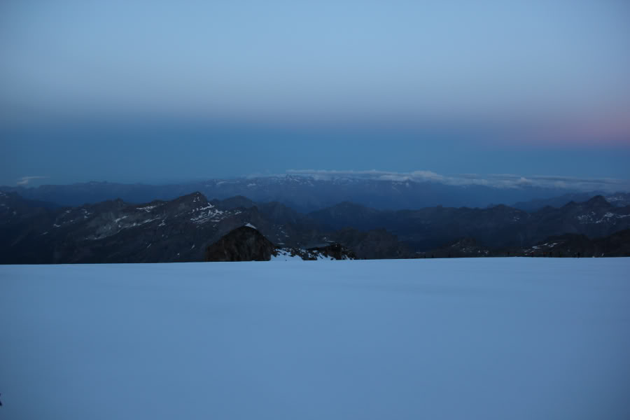
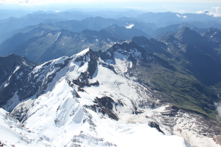
View from the summit of Signalkuppe:
On the balcony of the Margherita hut:
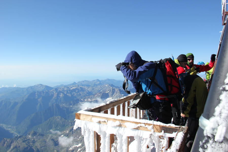
Myself on the balcony of the Margherita hut:
After the beer and tea were finished, we set off back down the steep slope, made more difficult by trying to avoid the stream of people still coming up the slope. Once down the steep slope, we took a direct line through deep, soft snow to reach the top of the Grenz Glacier. This also steered us well clear of the seracs on Parrotspitze.
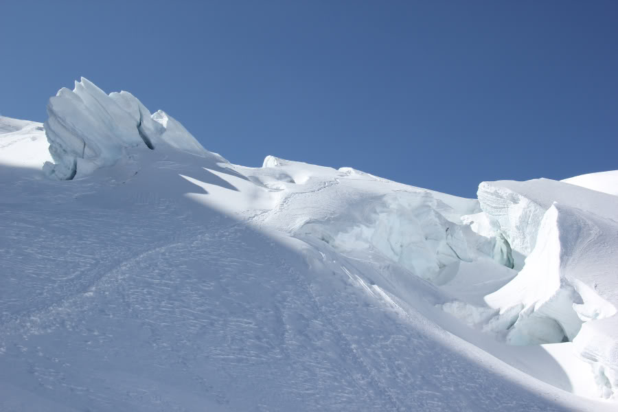
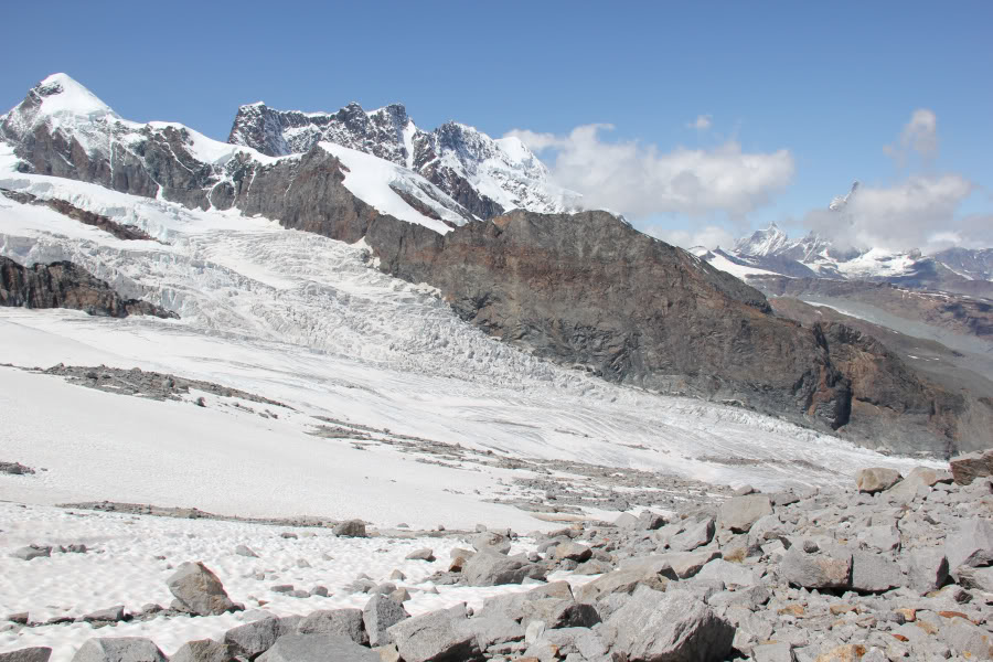
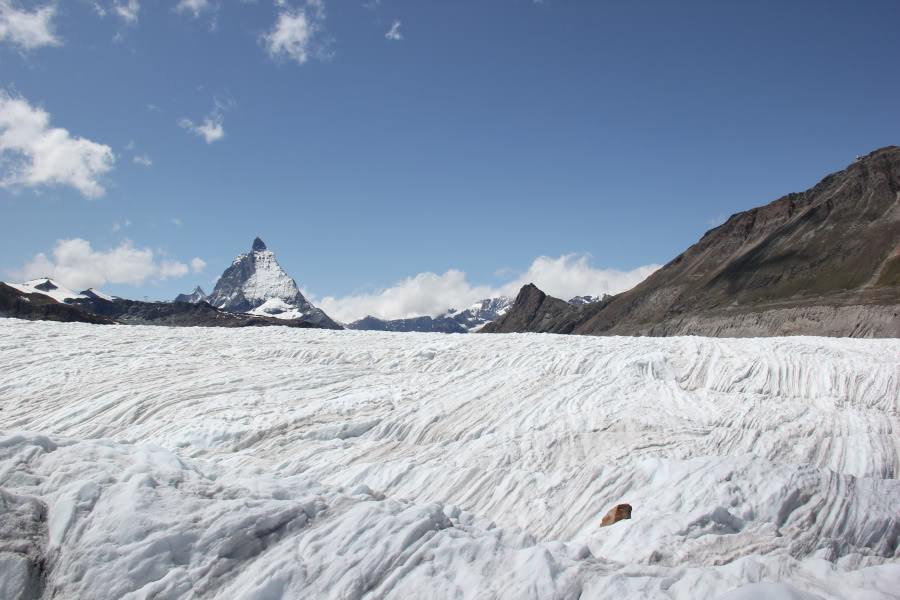
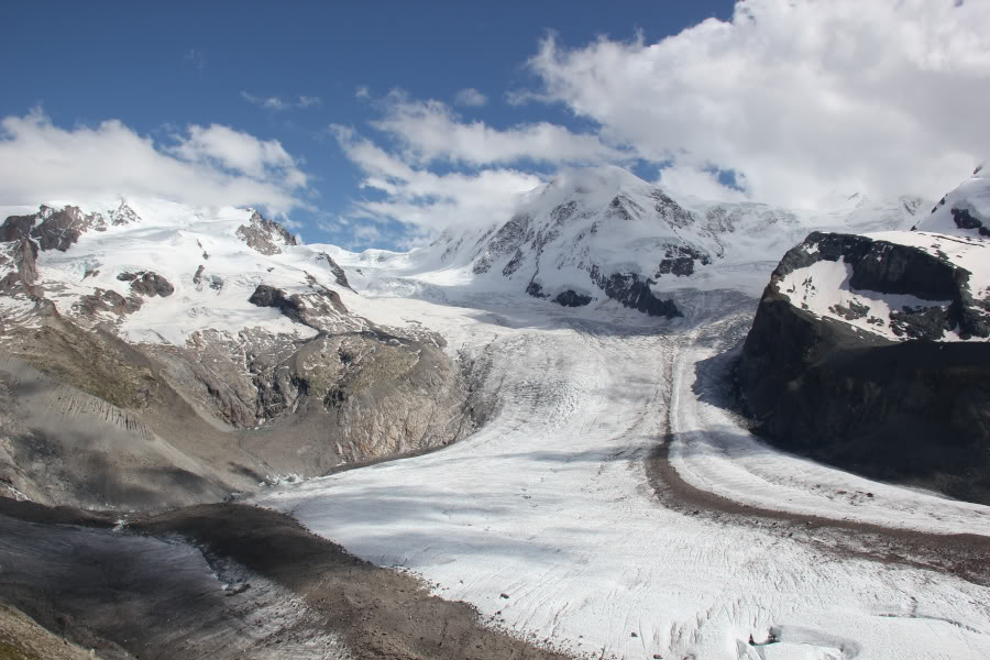
We now had a seriously long walk ahead of us descending almost the entire length of the Grenz Glacier – through numerous seracs and crevasses. This was a fascinating experience.
Descent towards the Grenz Glacier:
Looking back at descent path winding through the seracs:
Poldo having another cigarette:
Massive seracs across the glacier:
A wee break once well-past the seracs:
We were permitted several stops during the long descent. To get from the top of Signalkuppe to the Monte Rosa hut took nearly 3.5 hrs.
Still a long way to go to the end of the glacier:

Looking back at stretch of glacier already traversed:
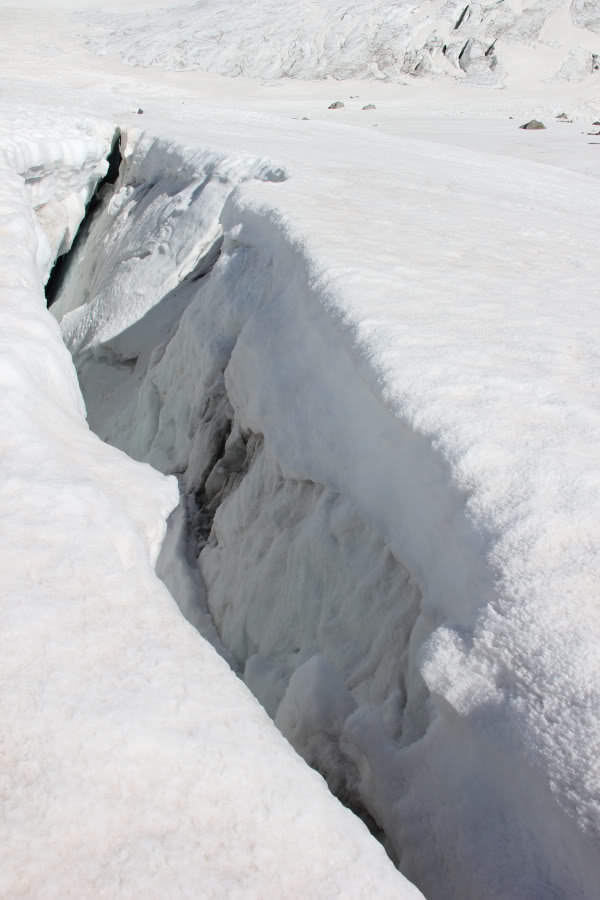
A crevasse:
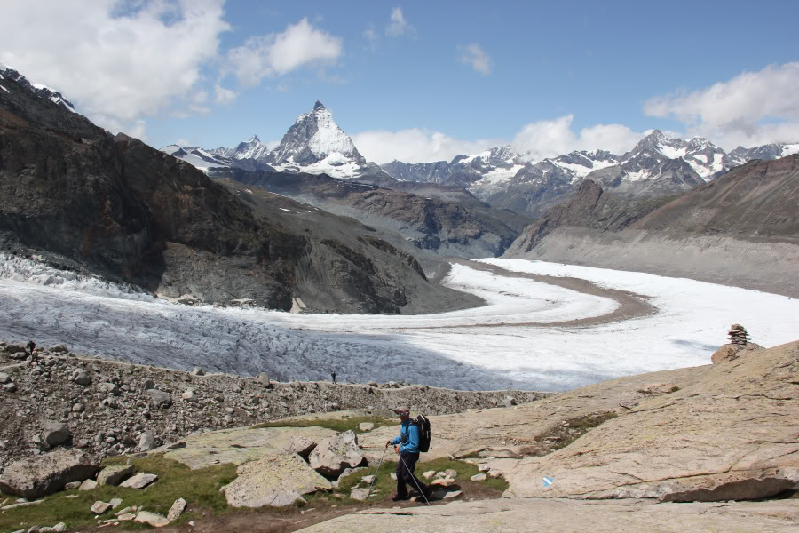
Moving off of ice and onto moraine:
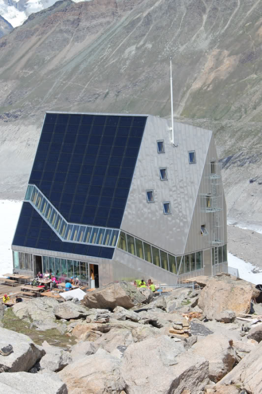
The Monte Rosa hut is a real modern-looking hut, that seems to be very difficult to get to from all directions. As I descended the final few hundred metres to the Monte Rosa hut, I twisted my back resulting in quite a bit of pain. This was on top of sore feet, with bruising under my toenails. Poldo, again come to the rescue with some Ibuprofen.
Approaching the Monte Rosa hut:
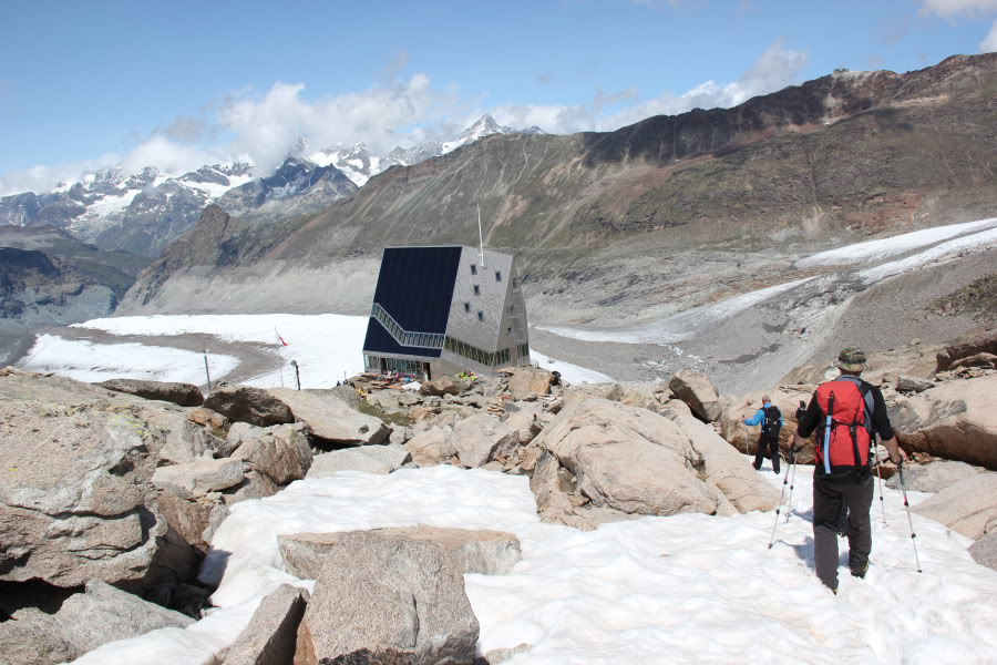
Monte Rosa hut:
From the Monte Rosa hut, I guessed we would be back in about an 1Hr 30 Mins. But oh, no, no, it was another 3Hrs 30Mins to reach the train – a total of 7Hrs descending the glacier from Signalkuppe.
We did however stop for 45minutes at the Monte Rosa to have a meal and a drink. Typical Swiss hut, everything extortionately priced. Poldo asked for an extra piece of bread and was told “No”. In Italian huts, you would get as much as you want.
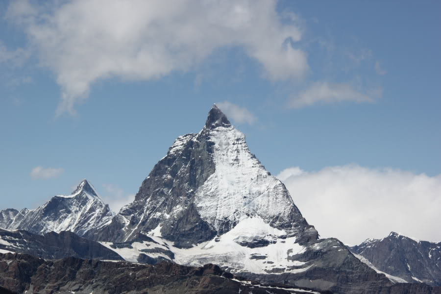
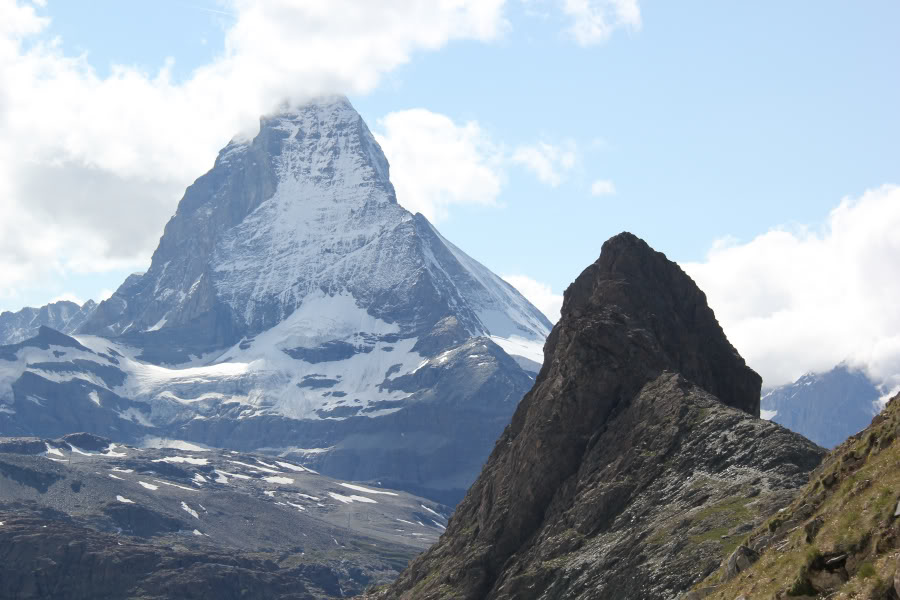
The view of the Matterhorn from the Monte Rosa hut was pretty good.
The Matterhorn from the Monte Rosa hut:
From the Monte Rosa hut, we descended on rock down onto the glacier. The final descent was down a series of iron steps.
Descent from the Monte Rosa hut back onto the glacier:
Looking back to the Monte Rosa hut:
Yes, we are about to go onto and walk across some of this, unroped!:

Moraine again:
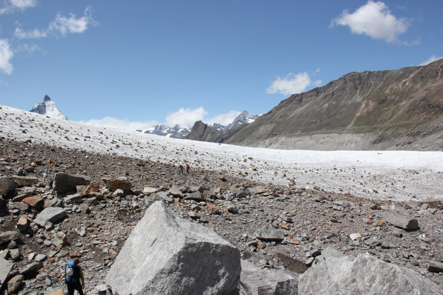
Back onto ice:
The next section of walk, was for me the scariest of the trip. We walked unroped and without crampons across the glacier. The glacier had some pretty-big crevasses, but all clearly visible. No-one else was roped-up either so I’m guessing that is normal for crossing a dry glacier.
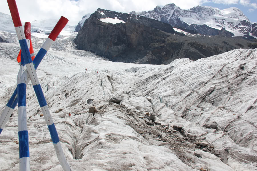
Route finding between poles, without falling down crevasses:
On reaching the end of the Gorner Glacier, I was looking forward to being back on safe ground, but no, no, no another challenge ahead. To get from the glacier onto the path above, we had to climb two large iron ladders. After that, it was plain sailing back to Rotenboden. A sign advising that Rotenboden was still 1Hr 05Mins away.
The walk back to Rotenboden was stunning, walking alongside the glacier and with literally dozens of different alpine flowers along the way. I wish that we had had more time to take photos.
Back on safe ground after crossing Grenz and Gorner glaciers:
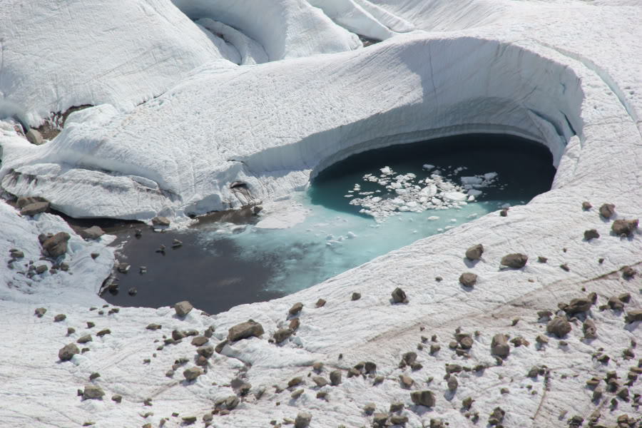
Glacial lake (zoom):
It was great to see the Riffelhorn again up close. I summitted this twice on my last visit to the Alps in 2003.
The Matterhorn and the Riffelhorn:
The Riffelhorn from Rotenboden:
What was even better was reaching the train, taking the backpack off and getting a seat.
A very welcome sight – the train back from Rotenboden to Zermatt:
On reaching Zermatt, we made directly for the nearest pub for a celebratory drink, before returning to Argentiere for another great meal at the White Chalet.
This turned out to be a very enjoyable trip. What have I learned?
- Being Scottish-hill fit is not the same as being Alpine-hill fit
- Altitude can be a real pain in the head
- Switzerland is a rip-off, next time do it all from Italy
- Sleeping in a mountain hut is a challenge
- Go faster and faster and your guide will still tell you to go faster
- Being mentally prepared is as important as being physically prepared
- That I need to buy new lighter gear
Had a great time.
Big thanks to Poldo, a seriously experienced mountaineer and skier.
Mark, Chris and Iain for companionship.
Martin, for great food and hospitality at the White Chalet.
McNab Alpine for making it all happen.
Geddes and Rachel for the inspiration.