
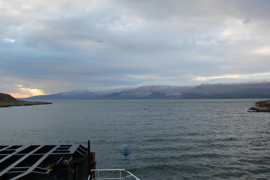
I set off from home at 04:30 this morning, destination the Isle of Mull. Circa five hours later, after picking up John en-route, we arrived at Lochaline. The ferry was really quiet today - only two other cars, one lorry and no passengers. A pleasant change from being packed on with only inches of room to spare
At Lochaline, looking towards the Isle of Mull:
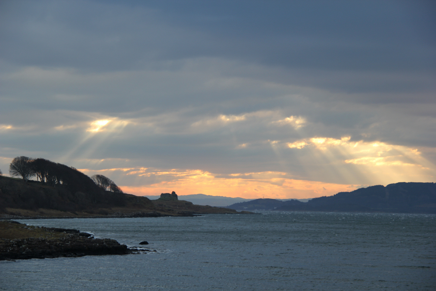
Castle at Ardtornish Point:
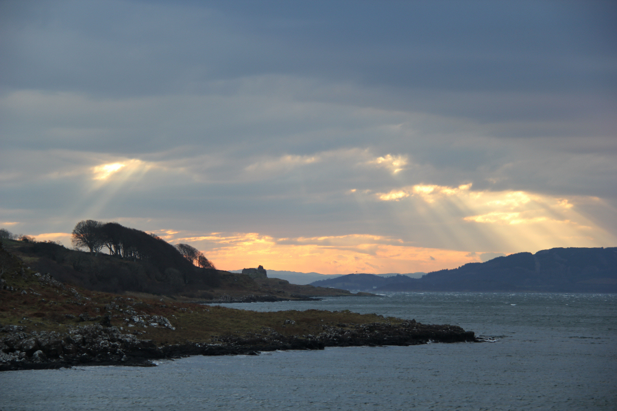
Castle at Ardtornish Point:
On arriving at Fishnish, we made our way round to Torness - the starting point for Sgurr Dearg.
Hill: Sgurr Dearg
Date: Friday 18th January 2013
Company: Myself and John
Distance: 4.6km, Ascent: 640m
Time: 2Hrs 40Mins
Click here to view a map of the route undertaken
The route we took up Sgurr Dearg was fairly direct. After walking a few hundred metres, we made our way across to a dry-stane dyke which we followed for a short distance up the hill. We then followed the Allt Caisreagach towards Coire nan Each.
John ascending the lower slopes of Sgurr Dearg:

View towards Ben Buie:
Ascending next to the Allt Caisreagach:
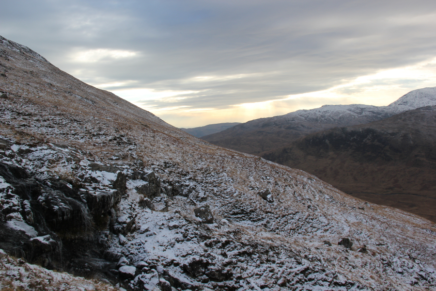
The snowline today was sitting around 300m. We both carried crampons today but didn’t need them as the snow was mostly soft.
Ascending Coire nan Each towards col between Sgurr Dearg and Beinn Bhearnach:

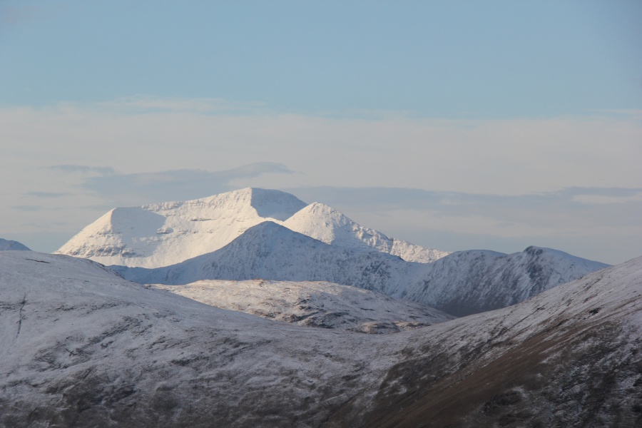
As we gained height, Ben More started to appear over the ridge of Beinn Talaidh.
Ben More and Beinn Talaidh from slopes of Sgurr Dearg:

Ben More (zoom):
By the time we reached 550m, it was a bit of a battle against the wind. The forecast today was for 75mpg gusts. By the time we reached 650m, we stopped to put on goggles as there was a fair amount of spindrift.
Fighting the gusts during the ascent:

Fighting the gusts videoclip:
We didn’t hang around long on reaching the summit.
John at the summit of Sgurr Dearg:
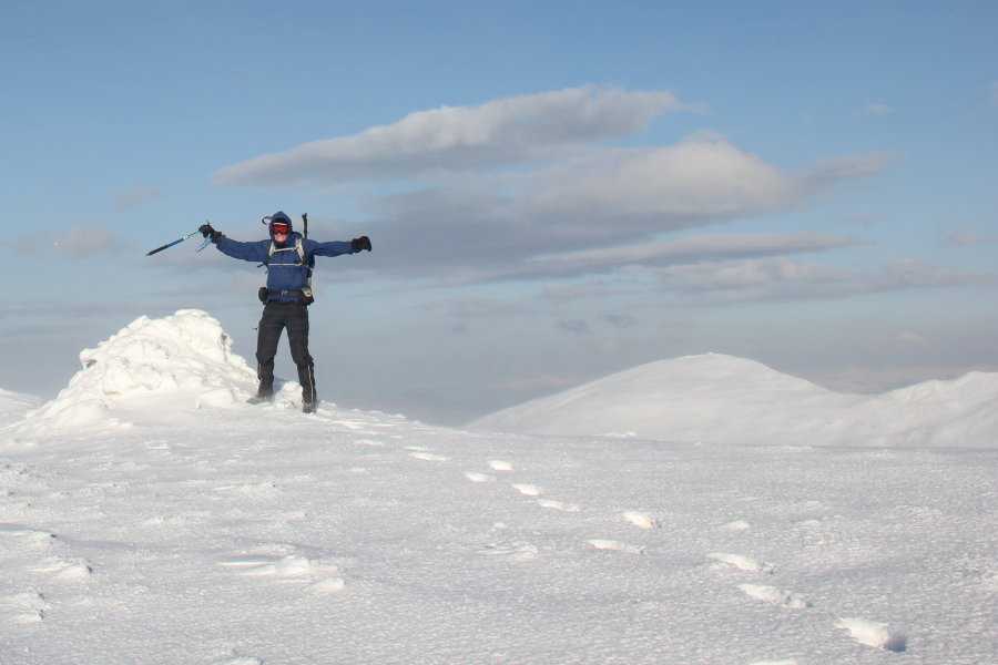
Myself at the summit of Sgurr Dearg:

After taking a few summit photos, we returned to the car via the same route. On reaching the car, we swapped four-season boots for three-season boots and made our way round to the starting point for an ascent of Carn Ban.
Hill: Carn Ban
Date: Friday 18th January 2013
Company: Myself and John
Distance: 7.2km, Ascent: 268m
Time: 2Hrs 05Mins
Click here to view a map of the route undertaken
To ascend Carn Ban, we followed the track towards Cnoc na Moine. The track was under several inches of water in places and churned-up in other places, owing to grazing cattle.
Looking towards Carn Ban:

We passed a number of Highland cattle during the walk-in.
Highland Coo:

As we progressed along the track we got increasingly good views. While Carn Ban may not be the most exciting of hills, it is a fantastic viewpoint – maximum reward for minimal effort.
Looking across to Sgurr Dearg and Dun da Ghaoithe:

Looking back towards Duart Point:

Looking towards Lady’s Rock lighthouse and lighthouse on Lismore (zoom):

After leaving the track, the final kilometre was across pathless terrain.
View from near the summit of Carn Ban:

On reaching the summit, I just happened to look up to see what I think were two white-tailed eagles circling above the summit. Always good to see eagles.
Trig point at the summit of Carn Ban:

Two white-tailed eagles above the summit of Carn Ban:

White-tailed eagle above Carn Ban:

White-tailed eagle above Carn Ban:

Oban from the summit of Carn Ban (zoom):

From the summit, we decided to descend via a different route back towards the track. This turned out worthwhile as we spotted a number of red deer during the descent.
Loch Spelve:

Red Deer on slopes of Carn Ban:

Red Deer on slopes of Carn Ban:

Approaching sunset:

A superb day out.