
Hill: Conostom
Date: Sunday 4th May 2014
Company: Just myself
Distance: 8km, Ascent: 275m
Time: 3Hrs
The weather today was poor. The cloud was down to almost road level and there was constant drizzle and rain showers throughout the day. I was a bit apprehensive about ascending great wee hills in near zero visibility. I therefore reluctantly set out to ascend Conostom and Coltraiseal Mor.
I parked in a small car park on the B8011 below Conostom.
Click here to see a map of the route undertaken
Right from the outset the terrain was fairly wet. This theme would continue throughout the day.
Looking back to car park for Conostom:

During the ascent and descent of Conostom I passed numerous shielings only some of which were marked on the map.
A shieling:

I decided to ascend via the ridge leading to Griosamol. The ascent to the summit of Griosamol was straight-forward in the mist.
On the ridge to Griosamol:

During the ascent I stopped to take a photo of a red grouse.
A red grouse:

Another shieling:

Walking in the mist towards Griosamol:

I reached the summit of Griosamol fifty minutes after setting off from the car.
Approaching the summit of Griosamol:

To descend from Griosamol I had to double-back a short distance to avoid descending via rocks.
Looking back to Griosamol:

I then made my way across towards Conostom. On reaching the small lochan, I crossed the middle of the loch via a small strip of land.
Lochan between Griosamol and Conostom:

I then reached the twin tops of Teathabhal the first of which I skirted round and the second I went over.
Crossing gneiss en-route to Conostom:

As I approached the final section to the summit of Conostom, I was confronted by crags. It was difficult to get a good look in the mist but it looked climbing territory. I therefore skirted my way round the crags until finding a grassy line leading up towards the summit followed by a short section of grass interspersed with rocks.
Approaching the Conostom summit crag:

Skirting round the summit crags:

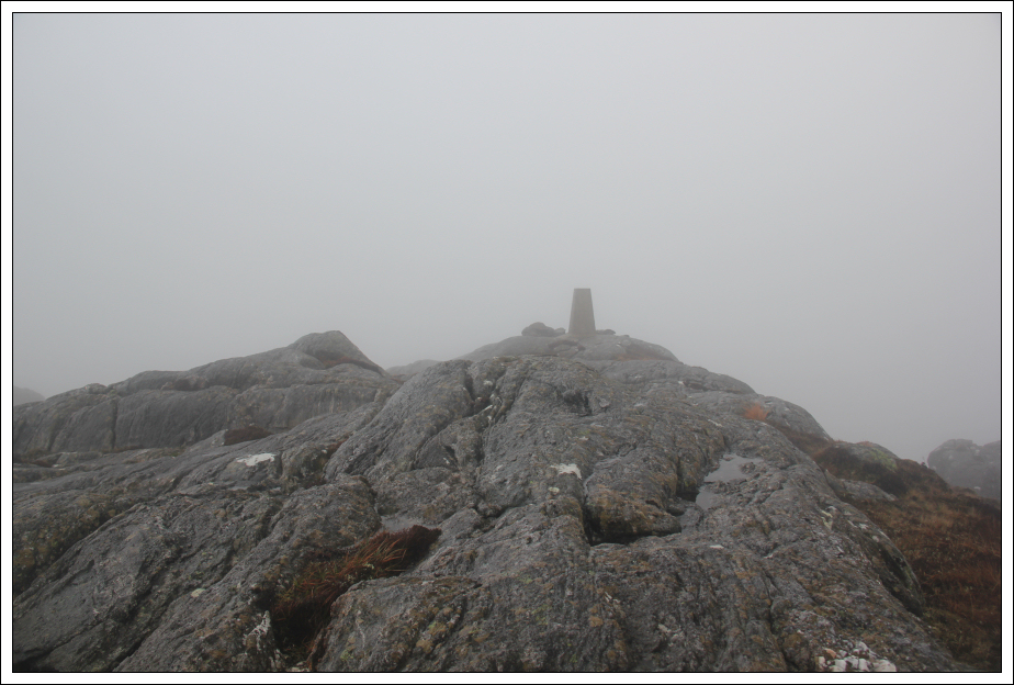
I visited the trig point and then the summit rock 18m South of the trig point.
Trig point near the summit of Conostom:

Looking back to the trig point from the summit of Conostom:
Conostom is a much rockier hill than the 1:50000 Landranger map lets on. There are a number of crags not marked on the map.
Instead of returning the same way, I opted to descend a nice grassy line down towards Loch Tungabhat.
Looking towards Loch Tungabhat in descent:

Looking towards Loch Athaltair and Loch Rog islands:

Looking back towards the summit of Conostom:

A shieling above Loch Tungabhat:

I was suprised to find such a mess along the shore of Loch Tungabhat. The large grey boxes would appear to be full of polystyrene balls. I assume these acted as floats for the metal structure like some kind of pontoon bridge.
A bit of a mess at the edge of Loch Tungabhat:

It didn't take long before abandoning the walk alongside the loch to head back instead towards my inbound track.
Looking back to Loch Tungabhat:

During the walk out I passed two shielings which were not marked on the map.
Another shieling:

And another shieling:

I think Conostom would be an excellent viewpoint on a fine day. It was disappointing to have walked it in clag.
On returning to the car, I drove circa three miles further along the B8011 to reach the starting point for Coltraiseal Mor.
Hill: Coltraiseal Mor
Date: Sunday 4th May 2014
Company: Just myself
Distance: 8km, Ascent: 300m
Time: 2Hrs 25Mins
Click here to see a map of the route undertaken
At the start of the walk I took a photo of a very young H'lan calf.
A H'lan calf:

I then walked along the private road leading to Morsgail Lodge.
Start of track towards Morsgail Lodge:

The road leading to Morsgail Lodge is really nice. It follows a lovely burn with lots of gorse which was in bloom and smelling strongly of coconut. I saw numerous birds during the walk in including a Dipper. Unfortunately, lots of Rhodedendron has seeded alongside the burn. The estate would appear to be trying and failing to control this alien species.
Following the road alongside the burn:

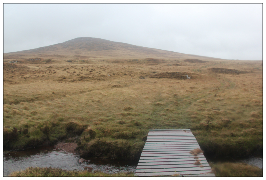
Coltraiseal Mor:

On reaching Loch Morsgail, I crossed the burn via a bridge and then followed a vehicle track leading towards Coltraiseal Mor.
Bridge at the outflow of Loch Morsgail:

Loch Morsgail and Morsgail Lodge:

The vehicle track was extremely wet underfoot. Some sections of the track consisted of black grass floating on top of bog.
Following the vehicle track towards Coltraiseal Mor:

A bridge over the burn:
I followed the vehicle track until reaching a height of 100m before abandoning the track to ascend directly to the summit.
Following the vehicle track towards Coltraiseal Mor:

Looking down to Loch Coire Geurad and Loch Langabhat:

On reaching the flat summit area, I visited both cairns.
Looking towards the summit of Coltraiseal Mor:

Neighbouring Coltraiseal Beag is allegedly only 2m lower than Coltraiseal Mor. Hopefully the height measurements are correct and I ascended the Marilyn.
Looking across to Coltraiseal Beag from the summit of Coltraiseal Mor:

Loch Coire Geurad, Loch a'Sguair and Loch Langabhat:

I returned to the car via approximately the same route.
Despite the lack height gain today, it was a fairly tiring day owing to fairly awful terrain.