
Hills: The Scrape, Pykestone Hill, Middle Hill and Drumelzier Law
Date: Saturday 15th November 2014
Company: Just myself
Distance: 17.1km, Ascent: 755m
Time: 4Hrs 25Mins
I set off this morning to ascend four of my fourteen remaining New Donalds. On arriving in Drumelzier I parked in a small car park a short distance along the track leading to the hills (room for four or five cars).
Click here to see a map of the route undertaken
Although the temperature gauge on the car was registering +3C there was some ground frost. It was nice to watch the sun rise above the hills. It was a beautiful but cold morning
Sun rising over the hills from farm at Drumelzier:

On researching these hills, I read the route description on Walk Highlands. The WH route suggests crossing a bridge and taking the track up behind the cottage advising this is a, "much better route". I disagree. Stick to the main track which provides for excellent walking. The path on the other side of the burn looked narrow and overgrown with bracken.
Excellent main track running alongside the Drumelzier Burn:

Following the track alongside the Drumelzier Burn:

On starting my ascent of Den Knowes, I stopped to photograph a plane high above.
Ascent towards small wood:

Plane (full zoom):

Looking back towards Drumelzier:

My OS map suggested the vehicle track would soon become a footpath. The Ordnance Survey need to update this map as it is now a vehicle track as far as Den Knowes Head.
It was nice to see the Culter hills during the ascent. I ascended the round of Culter Donalds in May this year.
View towards Culter hills and Tinto:

As I gained height, I got increasingly good views of hills tops with inversion below.
Inversion:

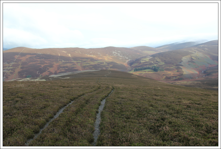
I eventually caught my first glimpse of the Scrape. I left the main track and followed a faint track leading towards the Scrape.
Looking towards the Scrape:

The Scrape is a New Donald but not a Donald. The summit is the small cairn next to the fence.
View from the summit of the Scrape:

View from the summit of the Scrape:

I didn't stop at the Scrape but instead continued on towards Pykestone Hill. As with many of the Donalds the going was in places fairly wet underfoot.
Heading from the Scrape to Pykestone Hill:

I followed the fence line up Pykestone Hill initially to a cairn and then a hundred metres or so beyond to the summit.
Final ascent of Pykestone Hill:

I had a brief stop at the summit of Pyksestone Hill to have a drink. This was my only stop of the day.
At the summit of Pykestone Hill:

From the summit of Pykestone Hill, I made my way across to a stone shelter where I thought I would find the Thief's Road. I found no trace of this 'road' on the ground where the map suggested it would be. I returned to follow the track next to the fenceline instead.
Descent from Pykestone Hill:

The walk from Pykestone Hill to Middle Hill took around 45 minutes. This section of the walk was fairly dull.
Following the fence towards Middle Hill:

The summit of Middle Hill is featureless albeit there is a fencepost in the ground close by.
At the summit of Middle Hill:

Last but not least I made my way across to the fourth New Donald of the day, Drumelzier Law. Drumelzier Law is the best viewpoint of the four hills.
During my ascent of Glenstivon Dod, I passed a well-built cairn. Not sure why this is located where it is. It isn't at the top of the hill and it is much better than any other cairn on the route.
Large cairn below summit of Glenstivon Dod:

During the descent of Glenstivon Dod, I took a short detour from the path to visit a quartzite cairn that looks very out of place amongst the heather. Again this cairn is on the side of the hill, so not sure why it is there.
Drumelzier Law from quartzite cairn on slopes of Glenstivon Dod:

Drumelzier Law from col:

The ascent of Drumelzier Law was straight-forward.
According to the Database of British Hills the cairn is the summit. I am not convinced. The ground circa 10m away appeared to be higher.
At the summit of Drumelzier Law:

View from Drumelzier Law:

From the summit of Drumelzier Law, I decided to follow the NW ridge and then descend via Finglen Rig. This is a nice descent route albeit it took longer than expected.
Descent via NW ridge:

Looking across to Worm Hill:

Descent via Finglen Rig:
A cloud-capped Scrape and Pykestone Hill:

Sheep pen:

Looking back towards Pykestone Hill:

As far as Donalds go, this was an enjoyable circuit