
Date: Monday 21st September 2015
Company: Just myself
Distance: 14.5km, Ascent: 1020m
Time: 6Hrs 40Mins
According to Saturday's forecast, today was going to be a day of persistent rain. According to Sunday's forecast it was going to remain dry. Which forecast to believe?
I packed my waterproofs (just in case) and drove this morning to Lettermay, near Lochgoilhead, for an ascent of Beinn Lochain and Stob na Boine Druim-fhinn. Had I undertaken this walk two weeks ago, I would have been ascending two Fionas. As Stob na Boine Druim-fhinn has since been demoted, I would now be ascending one Fiona and one HuMP. Stob na Boine Druim-fhinn has not changed in any way; it is still a fantastic hill, definitely worth doing.
I parked in a small lay-by at Lettermay. I last visited here in 2009 when I ascended Beinn Bheula.
Click here to see a map of the route undertaken
From Lettermay, I walked past several chalets and houses to gain access to the Cowal Way track. I walked several kilometres of the Cowal Way yesterday to ascend Creag Tharsuinn. I would be walking the Cowal Way again today as far as Curra Lochan.
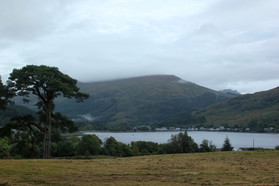
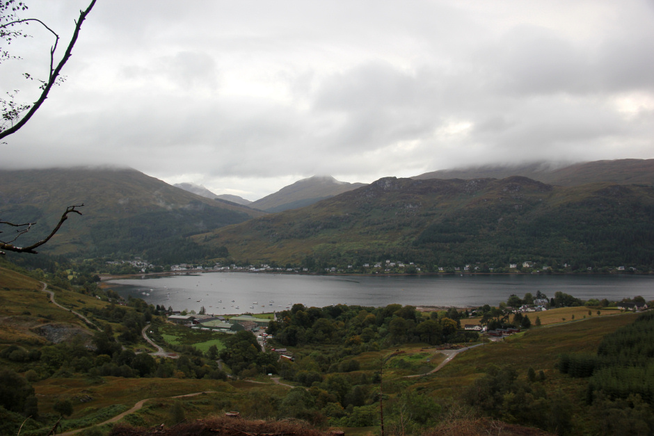
Looking back to Lochgoilhead from Cowal Way track:
Cowal Way sign:

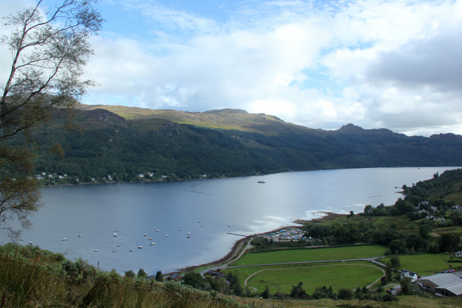
Lochgoilhead and Loch Goil are very scenic. What a stunning place to stay.
Lochgoilhead:
On reaching the track junction at NN1738701007, I continued along the main track instead of taking the right-fork. The right fork now leads to an area of felled trees. Continuing straight on now leads to an excellent new track that is not as yet marked on the OS map. The new track even has a bridge over the Lettermay Burn.
On the excellent new track not marked on OS map:
After crossing the bridge, I took a left-turn into a firebreak. The white marker post at the start of the firebreak shows this is the Cowal Way track.
Follow the Cowal Way white marker posts through the firebreak:

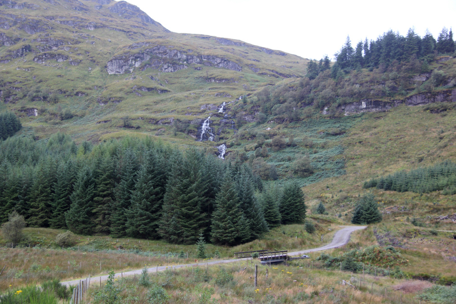
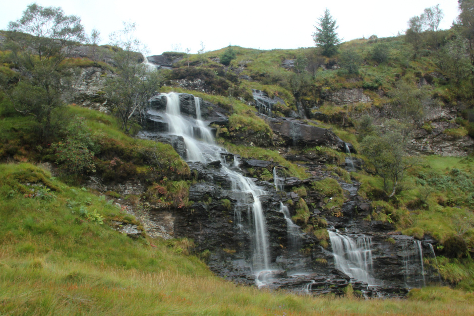
The firebreak leads up past two small waterfalls. The upper waterfall is the nicer of the two.
Nice waterfall:
Beyond the waterfalls, I followed a faint path zig-zagging uphill towards Curra Lochan.
Following the white marker posts up to Curra Lochan:

Beinn Bheula:

On reaching Curra Lochan, I crossed the outflow via some stepping stones and then skirted round the edge of the lochan until reaching a small stile. I crossed over the stile and then progressed up the hill.
Curra Lochan:

I had not researched this part of the walk previously so was unsure if I should be aiming in a particular direction to avoid the crags. Up seemed a good plan, so I went up.
Ascending Beinn Lochain's steep slopes:

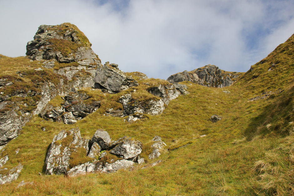
The ascent of the south face of Beinn Lochain is very steep and some care needs to be taken to avoid boulders and crags.
Steep ascent up through crags:

Looking back down to Curra Lochan:

Ascending Beinn Lochain:
I ended up reaching the ridge between Beinn Lochain and Beinn Lochain's South-East top. During the ascent, I passed an area of slope failure with large boulders and deep holes; very similar to a section of the ascent on nearby Ben Donich.
Lots of fractured rock:

On reaching the col, I skirted round Beinn Lochain to approach the summit via the North-East ridge.
Beinn Lochain from col:

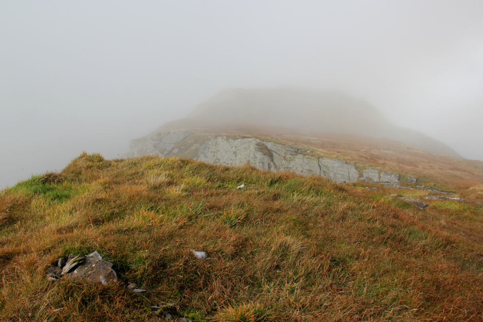
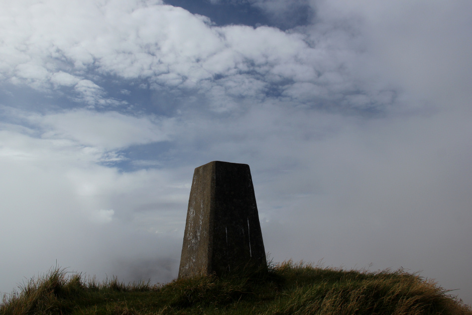
Unfortunately, on arriving at the summit, the cloud level dropped so I got no views.
At the summit of Beinn Lochain:
From the summit, I descended via the North East ridge. My next target of the day was not a hill, it was an aircraft crash site.
Prior to undertaking this walk, I input the grid reference of the crash site into Viewranger. I was therefore able to head straight to the crash site instead of wandering around trying to find it.
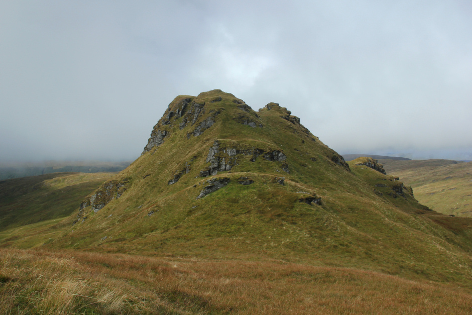
Beinn Tharsuinn:
Looking back to Beinn Lochain:

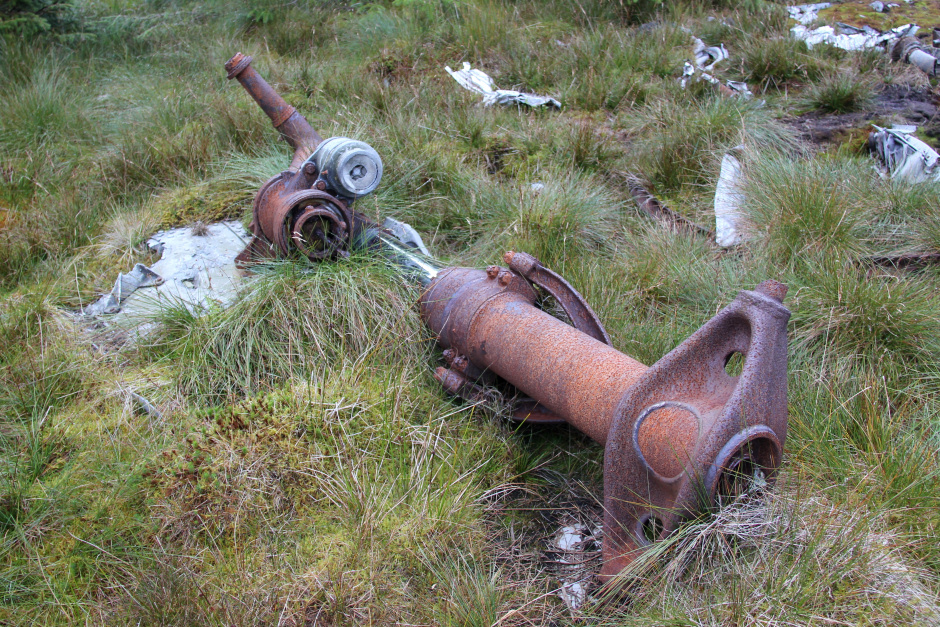
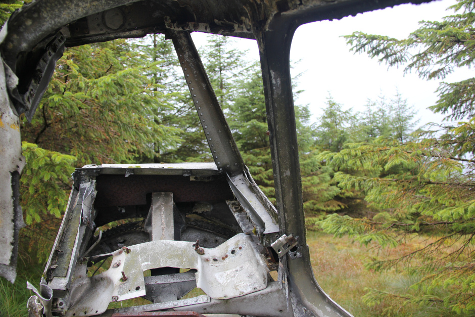
A Boeing B-29A Superfortress crashed here on 17th January 1949, killing all twenty passengers and crew. The Superfortress took off from RAF Scampton in Lincolnshire returning to Smoky Hill Air Force Base in Kansas, USA.
I felt sad standing amongst the wreckage and reading the memorial and also thought about my pal Heavy Whalley who was team leader in the RAF MRT for many years.
Boeing B-29A Superfortress crash site:
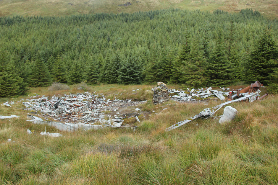
Wreckage:

Memorial cairn:
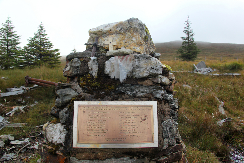
Memorial plaque:

Wreckage:
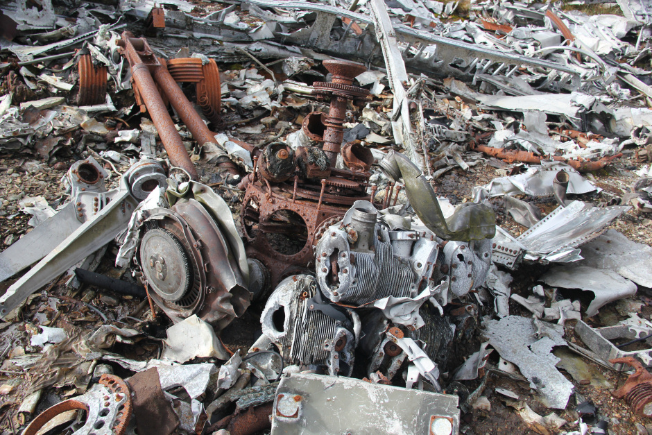
Wreckage:
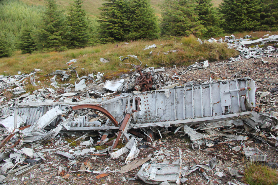
Wreckage:
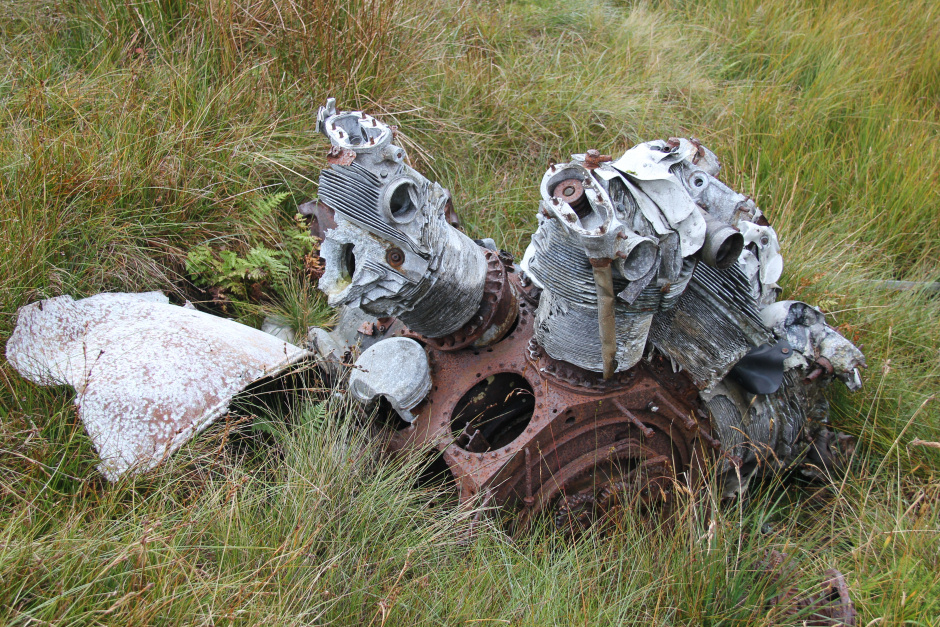
Wreckage:
Wreckage (tail turrett):

Wreckage (photo looking through tail turrett):
From the crash site, I made my way across to Stob na Boine Druim-fhinn, the demoted Fiona.
Heading for Stob na Boine Druim-fhinn:

The ascent of Stob na Boine Druim-fhinn was very straight-forward compared with the steep ascent of Beinn Lochain.
Looking towards the summit of Stob na Boine Druim-fhinn:

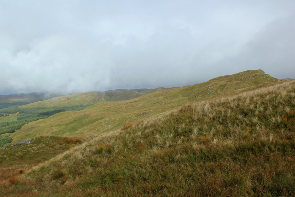
On reaching the summit, the cloud temporarily lifted providing some much-desired views of the descent route.
At the summit of Stob na Boine Druim-fhinn:
Looking down the south-east ridge from the summit of Stob na Boine Druim-fhinn:

The descent of the South-East ridge of Stob na Boine Druim-fhinn is not straight-forward. I would not recommend trying to descend this hill in the mist.
The initial few rocky outcrops can all be skirted on the left.
Looking back to summit of Stob na Boine Druim-fhinn:
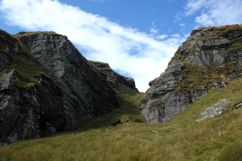
When the hill seems to split in two, it is essential to go down the cleft in the middle. Either side of the cleft are vertical crags.
Go down the cleft in descent:

Looking back at cleft:
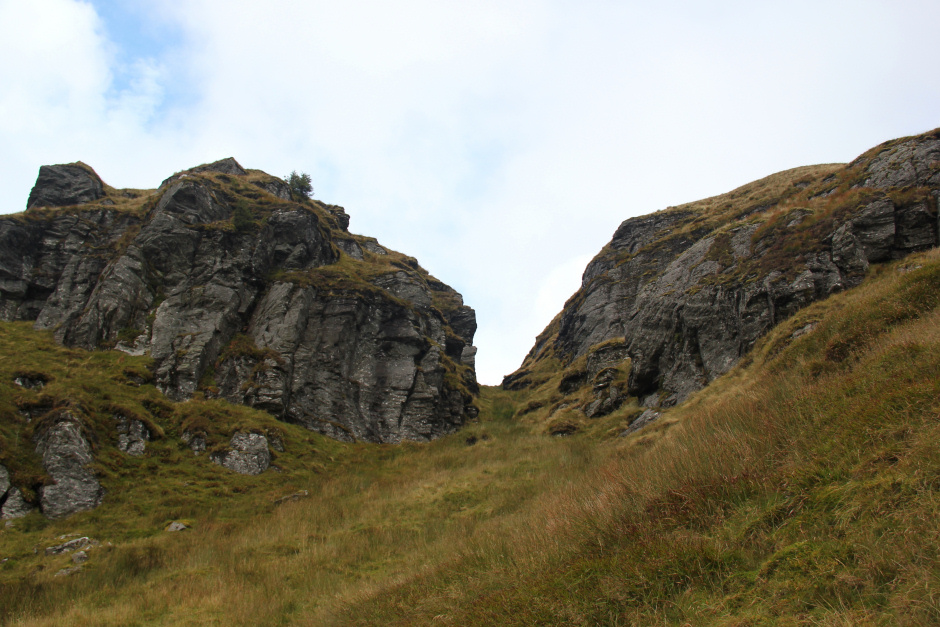
Beyond the first cleft is another cleft. Again follow this second cleft downhill. About half-way down this second cleft there is a tricky section that can be avoided by heading out left, descending a wee bit and then returning to the cleft.
Loch Goil:
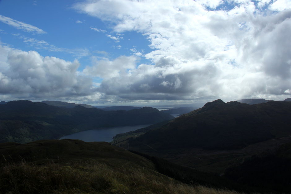
Beinn Lochain now free of cloud:

Looking back at cleft:
Beyond the clefts there are lots of grassy bumps to negotiate many of which have long tussocky grass.
Lots of grassy bumps to negotiate in descent:
Looking back at descent from Stob na Boine Druim-fhinn:

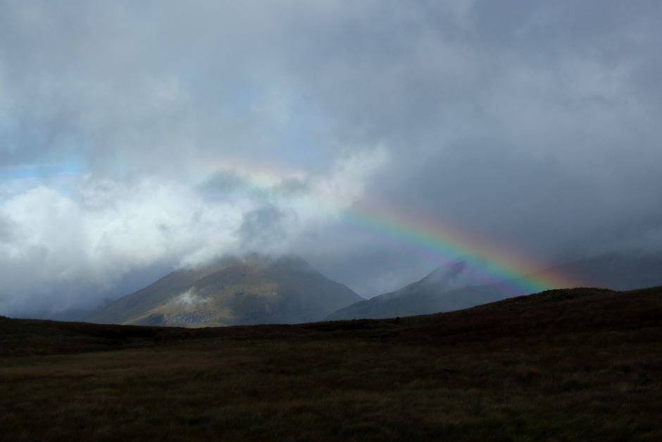
As I made my way down, I could see a shower in the distance. Fortunately it passed me by.
A wee rainbow:
Before reaching the top of the wide firebreak used in descent, there are more large rock outcrops to avoid. I don't think I took the best way down to reach the start of the firebreak.
Descent towards Lochgoilhead:

Once into the firebreak, it was just a case of make my way down between the two fences.
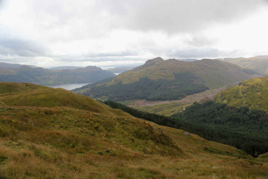
Loch Goil from the wide firebreak:

Loch Goil from the wide firebreak:
It was with some relief that I reached the good track leading back down from Corrow to Lettermay. Half-way down the firebreak, I crossed over another good track but decided against trying to follow it to see where it went.
This is an excellent walk over fairly rough/tough terrain.