
Date: Friday 20th November 2015
Company: Just myself
Distance: 10.3km, Ascent: 725m
Time: 3Hrs 15Mins
After spending last night in Aviemore, I set off this morning towards Fort William for an ascent of Druim Fada (Stob a' Ghrianain). The MWIS and MetOffice forecast for West Highlands today included rain, hail, snow, thunder, low-cloud, sun and wind; a real mixed-bag of weather.
Most seem to ascend Stob a' Ghrianain from Puiteachan. On looking at the map, I fancied starting from Inverskilavulin to ascend via the gradual East ridge. I wasn't sure however how easy it would be to get up through the forest. JohnnyCorbett's report on WalkHighlands confirmed there was a way up through the trees.
I parked at the start of the track where there is room for one or two cars.
Click here to see a map of the route undertaken
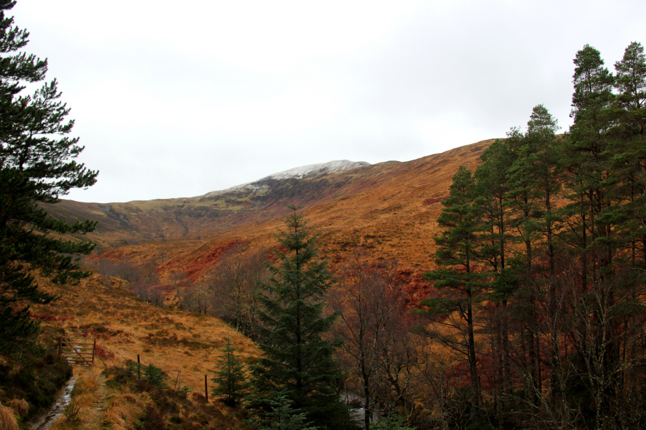
Start of waymarked walk to Stob a' Ghrianain at Inverskilavulin:

Beyond the gate, I followed the wide forestry track which is waymarked for Stob a' Ghrianain, Coire Dubh and Coire Odhar.
Following the forestry track:

On reaching the Allt Coire an Lightuinn, I followed a vehicle track, running alongside the Allt Coire an Lightuinn, leading up and out of the forest. The track was very wet underfoot.
Vehicle track to Stob a' Ghrianain:

During the ascent through the forest, I stopped briefly to take a photo looking across to Beinn Bhan, a Corbett usually ascended from Inverskilavulin.
Looking across to Beinn Bhan:

On reaching the edge of the forest, I passed through a wooden gate and then continued to follow the upper track which leads to a bridge over the Allt Coire an Lightuinn. The lower track also leads to the bridge.
Stob a' Ghrianain from edge of forest:
Bridge over the Allt Coire an Lightuinn:

After crossing the bridge, I continued to follow the vehicle track up and onto the East Ridge of Stob a' Ghrianain. The track continues along the ridge to a height of circa 500m and then peters out.
Carn Mor Dearg and Ben Nevis capped in cloud (zoom):

Ascending Stob a' Ghrianain:

On gaining some more height, Fort William came into view; my base for this weekend.
Fort William (zoom):

I also saw a number of red deer hinds with a single stag.
Red Deer hinds on Stob a' Ghrianain:

Fort William and Loch Linnhe:

The snow line today started at circa 550m. I suspect by tomorrow morning it will be much lower.
Above the snow line on Stob a' Ghrianain:

Small lochan en-route to the summit:

On reaching the summit, I stopped to take a photo and then continued on. It was too cold up there today to hang about.
At the summit of Stob a' Ghrianain:

Before retracing my steps back to Inverskilavulin, I visited a few nearby bumps. It is worth doing so in order to get views of Loch Eil which is not visible from the summit.
Loch Eil:

View from just beyond the summit:

After a brief snow shower, the weather started to improve.
Incoming shower:

Loch Eil:

The forecast was mostly correct. Snow, wind, low-cloud and sun but thankfully no thunder.
Looking back to Stob a' Ghrianain in improving weather:

On reaching my car, I noticed one of my tyres looked very flat. On connecting my air compressor, the pressure was 0. I blew the tyre back up but could hear and see the air bubbling out due to a nail which was unfortunately right next to the side wall. A direct visit to the garage in Fort William was required for a new tyre. An expensive hillwalk. Grrr!