
Date: Sunday 14th May 2017
Company: Just myself
Distance: 30.9km, Ascent: 1070m
Time: 8Hrs 5Mins
On Saturday afternoon I decided to head out in my new van for its first overnighter. It is my intention to convert it into a campervan but at this point in time it is purely a panel van. I had three potential parking locations in mind each with a view to ascending one of my eight remaining Fionas. I opted to drive to and park at Loch Arkaig for an ascent of Mullach Coire nan Geur-oirean. As an ascent of Mullach Coire nan Geur-oirean involves >30km distance, sleeping in the back of the van would allow for a nice early start.
Parked-up at Loch Arkaig:

Before settling down for the night, I spent around 90 minutes walking alongside Loch Arkaig and back for a bit of a leg stretch. The clouds were very atmospheric signalling an incoming storm. During the night there was torrential rain. As my parking place is notorious for flooding, I got up at 4am to move the van just in case the road flooded.
Loch Arkaig with incoming weather:

After another hour or so of sleep, I woke up around 5.45 and was off walking by 6.15. An early start.
Click here to see a map of the route undertaken
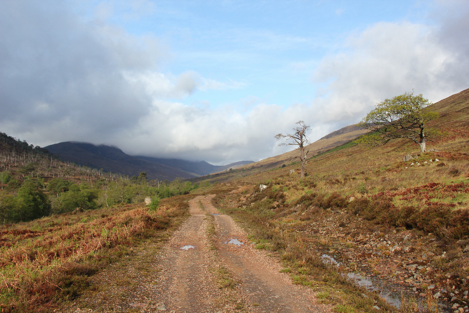
As I had forgotten to pack waterproof trousers, I was relieved that the rain had now stopped. I set off walking from the Eas Chia-aig car park passing the lovely roadside waterfall. Just beyond the cattle grid, I took a left turn to join the excellent vehicle track leading to Glen Mallie.
Loch Arkaig at 6.20am:

The walk in towards Invermallie Bothy involves several ups and downs. It was nice to listen to the birdsong as I progressed along the track. I heard a cuckoo and soon thereafter another and another. To help pass the time during the long walk in, and long walk out, I played music on my iPhone. I found it amusing that one of the cuckoos was cuckooing in the same key as Blondie singing Picture This. Each line of the lyrics was followed by "cuckoo" which was kind of amusing.
All I want is a room with a view "cuckoo"
A sight worth seeing, a vision of you "cuckoo"
All I want is a room with view, oh-oh "cuckoo"
I will give you my finest hour "cuckoo"
The one I spent watching you shower "cuckoo"
I will give you my finest hour, oh yeah "cuckoo"
A short distance before the turn off towards Invermallie Bothy, I passed a private hut/bothy.
Private hut en-route to Invermallie:

Loch Arkaig:

On reaching the turn off towards the bothy, I decided to continue on as my main objective of the day was to ascend Mullach Coire nan Geur-oirean. Besides, if anyone was currently in the bothy I would likely waken them as it was still only just after 7.00am.
Looking towards Invermallie Bothy from the track:

Invermallie Bothy (zoom):

The main track now passes several hundred metres away from the bothy.
The walk along Glen Mallie was enjoyable. It is a lovely glen with numerous Scot's Pine and various other trees. The views to the left are dominated by the Corbett, Beinn Bhan.
Glen Mallie:

As I progressed along the glen I kept an eye out for an ATV track which I had read would lead me up onto the ridge. Easier to follow a vehicle track than bash your way up through heather.
Glen Mallie:
Looking back along Glen Mallie:

I found the start of the ATV track roughly where I expected it to be and followed it up onto the Druim na Giuthsaich ridge. Despite seeing lots of dark clouds and nearby rain showers thus far I had avoided the rain. Excellent, would my good fortune last?
ATV track leading onto the Druim na Giuthsaich ridge:

Looking back towards Loch Arkaig from ATV track:

During the ascent of the ATV track, I passed marker posts with numerous nails hammered in. I have come across such posts many times previously. I assume the nails are hammered in to discourage animals from using the posts as scratching posts and potentially knocking them over.
One of several marker posts waymarking the ATV track:

I was pleasantly surprised to find that the ATV track continued for some distance along the ridge. Eventually however the track disappears into a multitude of peat hags.
Onto the Druim na Giuthsaich ridge:

It was now raining very close-by but not as yet on me.
Raining above nearby Loch Arkaig:

Looking towards Mullach Coire nan Geur-oirean:

One of numerous peat hags to negotiate:

The walk from the top of the ATV track to the summit of Mullach Coire nan Geur-oirean was more distant and took longer than I had anticipated.
At the 614m top of Drium na Giuthsaich looking towards Mullach Coire nan Geur-oirean:

The next photo provides an idea of the less than wonderful terrain to negotiate en-route to this hill. In good visibility, with a bit of careful route-finding, much of the hags can be avoided. Walking in mist would potentially be a nightmare.
Looking back at the peat hags:

Small rainbow above Loch Arkaig:

Ascending Mullach Coire nan Geur-oirean:

After four full hours of walking, I was at last approaching the summit of Mullach Coire nan Geur-oirean. Unfortunately, I was now however in low cloud and was about to experience heavy rain and then painful hail.
On reaching the summit area, I was not convinced that the cairn was the high-point. I therefore walked about ensuring that I visited every potential high point. The low cloud was perhaps creating some kind of optical illusion as each point I visited did not look like the high point on reaching it!
At the summit of Mullach Coire nan Geur-oirean:

I decided to return via the same route to eventually pick up the ATV track leading back down to Glen Mallie. I was aware that I could have bailed-off more directly down steep slopes to reach the Glen Mallie ruin but using the ATV track again seemed like a good option. During the walk back, the sky turned blue for several minutes before disappearing in low cloud. Possibly another optical illusion!
Looking back to Mullach Coire nan Geur-oirean:

As I continued back along the ridge, the weather was very changeable. Rain, sun, rain, sun, rain, sun.
View down to Glen Mallie:

View during walk back along the wide Druim na Giuthsaich ridge:
After walking back circa 3km from the summit, I stopped for my first break of the day. I had some food and a drink before continuing on. I was kind of running on empty having had no breakfast and nothing to eat during the first 18km.
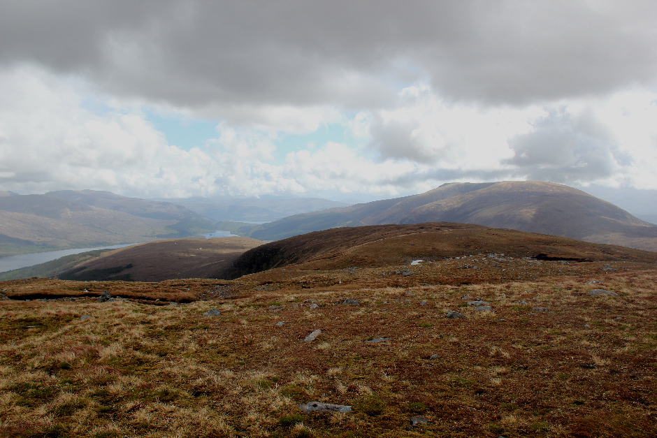
Panorama from ridge:

Mullach Coire nan Geur-oirean is really a bump on the east ridge of the Munro, Gulvain. On looking back, I caught my first view of Gulvain. The weather was now definitely improving and the cloud level was rising.
First sighting of Gulvain:

Despite having already walked 20km the starting point still looked a long way off.
The starting point still a long way off, beyond end of Loch Arkaig:

Beinn Bhan:

On reaching the ATV track, I followed it back down to the main Glen Mallie track which I then followed back out to the van.
Descending the ATV track:

Caterpillar:

A short distance before Invermallie Bothy, I crossed the bridge over the River Mallie and stopped to take some photos. The views from the bridge are lovely.
River Mallie:

I was now in two minds as to whether or not to visit the bothy. Under normal circumstances I would definitely have visited the bothy but my painkillers were wearing off and I was feeling the pain of several ongoing injuries.
During the final walk out to the van, I was passed by several 4x4s heading along Glen Mallie. It was great to reach the Eas Chia-aig waterfall and then the van circa one minute thereafter.
Eas Chia-aig:

Good to get another one of the tougher Fionas complete. Seven now remaining several of which are also tough including An Stac, Meith Bheinn and Slat Bheinn