
Date: Friday 1st March 2019
Company: Just myself
Distance: 29.4km, Ascent: 1320m
Time: 8Hrs 50Mins
On Thursday evening, I drove as far as Achnasheen where I parked-up for the evening. Early on Friday morning, I drove a further ten miles along the A890 to Craig for an ascent of Maoile Lunndaidh.
I last ascended Maoile Lunndaidh in October 2005 just a couple of weeks before ascending my final Munro. In 2005, I used a mountain bike to cycle in as far as Gleuaig Lodge and have not used a bike since. Ascending Maoile Lunndaidh on foot would leave me only two Munros to re-ascend on foot to be able to say I have ascended all Munros, Corbetts, Fionas, Donalds and Furth without use of a bike.
I set off walking circa thirty minutes before sunrise.
Click here to see a map of the route undertaken
After crossing the level crossing, I walked 9.5km along the wide track to reach Glenuaig Lodge and Shelter. The conditions were not ideal for photographs.
Pre-sunrise views from beyond the level crossing:

As I made my way along the track, I spotted numerous dark spots atop the grasses at the side of the track. As suspected, the dark spots were ticks. I counted at least twelve ticks on one tussock! I really hope we get a late winter to kill-off some of these ticks otherwise it might be a horrendous year for them.
Adult Female Deer Tick:

Approaching Sgurr nan Ceannaichean:

As I skirted round Sgurr nan Ceannaichean, I spotted a solitary stag who did not seem overly concerned by my presence.
A solitary stag:

Soon thereafter I passed the double wire bridge, which I have used several times previously en-route to the Achnashellach Munros. I also passed a nice pool which looked ideal for a skinny-dip had it not been so cold.
Nice pool:

From Pollan Buidhe, I still had three kilometres to walk to reach the lodge.
At Pollan Buidhe:

Prior to setting off, I had failed to read the Munros book to remind myself of the standard route. The SMC Munros book suggests I should have left the track before Glenuaig Lodge. I was however happy to have continued further along the track to allow me to visit the Shelter.
Glenuaig Lodge:

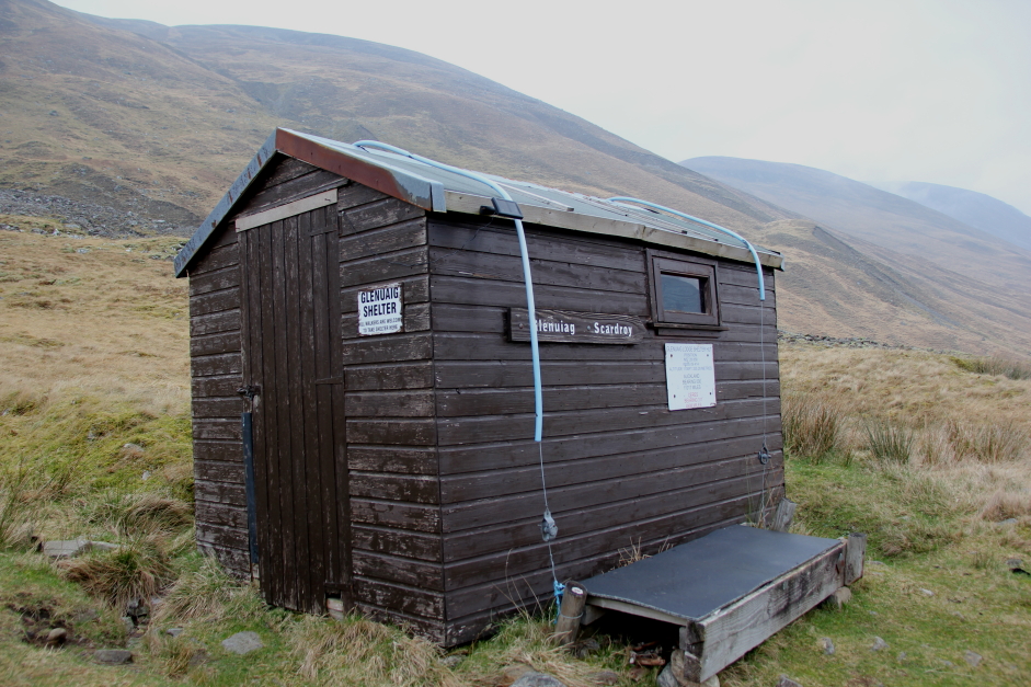
On reaching the shelter I had a quick look inside. It is basically just a strapped-down garden shed but it does have an electric light and an electric heater inside. I didn't check to see if the electricity was operational. It was my intention to spend some more time at the shelter during the walk out.
Glenuaig Shelter:
From the shelter, I made my way across trackless ground towards the SSW ridge of Fuar-tholl Beag. Had I checked the SMC Munro book, I would have known that this is not the standard route up the hill. The SMC book suggests ascending Carn nam Fiaclan more directly.
Looking back towards Glenuaig Lodge and Shelter:

Heading for the SSW ridge of Fuar-tholl Beag:

Once on the ridge I suspected I was not on the standard route due to a complete lack of path or footprints. I checked the map and thought the ridge looked easy enough on paper, so I continued on.
Approaching the SSW ridge of Fuar-tholl Beag

The ridge was certainly steep in places and my leg muscles were screaming by the time I reached the top.
Ascending the wide ridge:

Looking back during steep ascent:

It was a relief to reach much flatter ground as I then made my way round towards the summit of Carn Fiaclan, a Munro Top.
At the summit of Carn Fiaclan:

From Carn Fiaclan, I continued on towards the two tops of Maoile Lunndaidh. I believe the furthest out top, the one with the largest cairn, is the summit.
At the twin-top of Maoile Lunndaidh:

According to the Database of British Hills, the actual summit is a rock located 20m from the large summit cairn. I did also visit the summit rock.
Summit cairn of Maoile Lunndaidh (20m from summit rock):

As there were no views whatsoever from the summit, I decided to continue walking instead of stopping for a break. The initial descent was via lots of small stones and then a via a mix of small stones and grass. I tried to pick out grassy lines to avoid much of the stones.
Although the descent was reasonably steep it was nowhere near as steep as the ascent.
Looking back towards the summit of Maoile Lunndaidh in descent:

Descent:

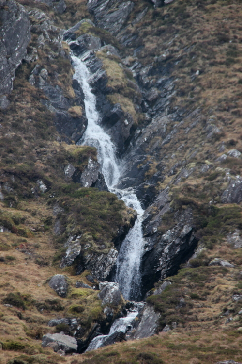
During the descent I passed a nice waterfall and also a deep gully.
Allt an Fhuar-thuill Mhor waterfall:
Once onto easier ground the weather began to improve with the first blue skies of the day. Just my luck for the tops to clear once down!
Looking back towards Maoile Lunndaidh in improving weather:

Panoramic view:

Looking back:

Once onto level ground I initially followed a deer track and then an ATV track back in the general direction of the lodge.
Back onto level ground and heading towards Glenuaig Lodge and Shelter:


It was welcome relief to have a seat inside the Glenuaig Shelter where I drank a litre of water and had some food. I currently have a kidney stone so I need to start drinking more on the hill. An incredibly painful thing! I was now dreading the final 9.5km walk out but once going it was just a case of repeatedly putting one foot in front of the other.
Lunch stop inside Glenuaig Shelter:

The light and conditions were now so much better than earlier in the day. Sgurr nan Ceannaichean is a rocky hill.
Sgurr nan Ceannaichean:

On setting off, I had estimated being back at the van by 16:00. I reached the van at 15:55 so I was not too far out.