
Date: Tuesday 18th May 2021
Company: Myself and Kate
Distance: 6.8km, Ascent: 415m
Time: 2Hrs 25Mins
This morning we parked in the Forestry England Dodd Wood car park for an ascent of Dodd. Dodd Wood has a number of waymarked trails including Sandbed Gill trail, Skill Beck trail, Dodd Summit trail, Douglas Fir trail as well as a lower and upper Osprey viewpoint. Today we would be undertaking the Dodd Summit trail.
The car park utilises number plate recognition with a requirement to pay on exit. There is a charge for the first hour with an additional charge for every 20 minutes thereafter up to a maximum charge of £7 for 24 hours.
Click here to see a map of the route undertaken
From the car park we followed the green waymarkers to the summit and then back to the car park.
Dodd Wood car park and cafe:

Walking through a forest of tall Douglas Fir was much nicer than walking through the standard Sitka Spruce found all over Scotland.
Ascending Dodd:

Views are mostly limited within the forest until approaching the summit with the exception of the following viewpoint en-route to the top.
View towards Kessock and Derwent Water during ascent:

Thanks to the excellent tracks it didn't take long to reach the summit.
Approaching the summit of Dodd:

We spent around fifteen minutes at the summit taking photographs and enjoying the views.
At the summit of Dodd:

At the summit of Dodd:
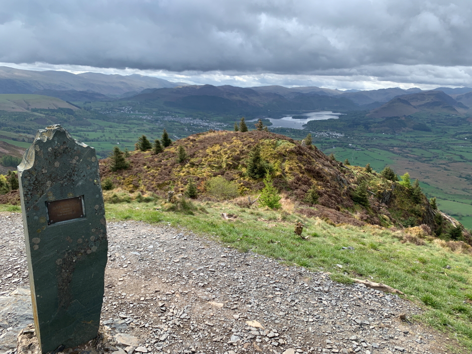
It is worth continuing a short distance beyond the summit to gain a fantastic view down to Bassenthwaite Lake.
Bassenthwaite Lake from just beyond summit:

Skiddaw beyond Carl Side:

View from the summit of Dodd:

From the summit, we continued to follow the waymarked trail which forms a loop round Dodd. During the descent we passed numerous other walkers on their way up.
Bassenthwaite Lake in descent:

On returning to the car, we went for a drive around the Lakes. We initially visited the Stone Circle at Castlerigg before continuing down alongside Thirlmere to Grasmere and on to Ambleside. From Ambleside we drove Wrynose Pass and then Hardknott Pass before stopping for a drink at the Woolpack Inn. During the return to our base in Cockermouth, we stopped for an ascent of Lank Rigg.
Hill: Lank Rigg
Date: Tuesday 18th May 2021
Company: Just myself
Distance: 6.6km, Ascent: 360m
Time: 1Hrs 50Mins
Click here to see a map of the route undertaken
It had been my intention to follow the track all the way to the summit of Lank Rigg, and back. Instead, I opted to take a more direct route which saved some time but resulted in very wet feet.
View towards Lank Rigg:

En-route to Lank Rigg, I passed a number of cows and calves which were not in the slightest bit bothered by my presence.
Cattle en-route to Lank Rigg:

During the ascent I met another walker who was descending via roughly the same route.
Ascent of Lank Rigg:

Looking back towards starting point:

On reaching the summit I stopped to take several photos and then also visited the nearby viewpoint cairn.
At the summit of Lank Rigg:

I think Lank Rigg is the Wainwright closest to Sellafield.
View towards Sellafield from viewpoint cairn:

The descent was initially pleasant however on reaching the lower slopes the boggy terrain was pretty bad. Once across the river the terrain improved for the final walk back to the car.
Looking back to Lank Rigg:
