
Date: Saturday 13th November 2021
Company: Just myself
Distance: 20km, Ascent: 1460m
Time: 7Hrs 40Mins
On Saturday morning, I was dropped-off at the Nevis Range car park an hour before sunrise with the kind offer of being picked-up eight to nine hours later from the upper Glen Nevis car park thus allowing for a traverse of the Aonachs. I last ascended Aonach Mor and Aonach Beag in July 2001 via an entirely different route. On that occasion, I was staying at the CIC hut and from there undertook a circuit of Carn Mor Dearg, Aonach Beag and Aonach Mor. Most of my intended route on this occasion would therefore be new terrain.
The MWIS forecast was about as good as it gets: negligible wind, precipitation unlikely, 90% cloud-free Munros and mention of fog in the glens which meant possible cloud inversion. I was therefore keen to crack-on up the hill at a good pace to hopefully get above the cloud before it lifted to cover the summits.
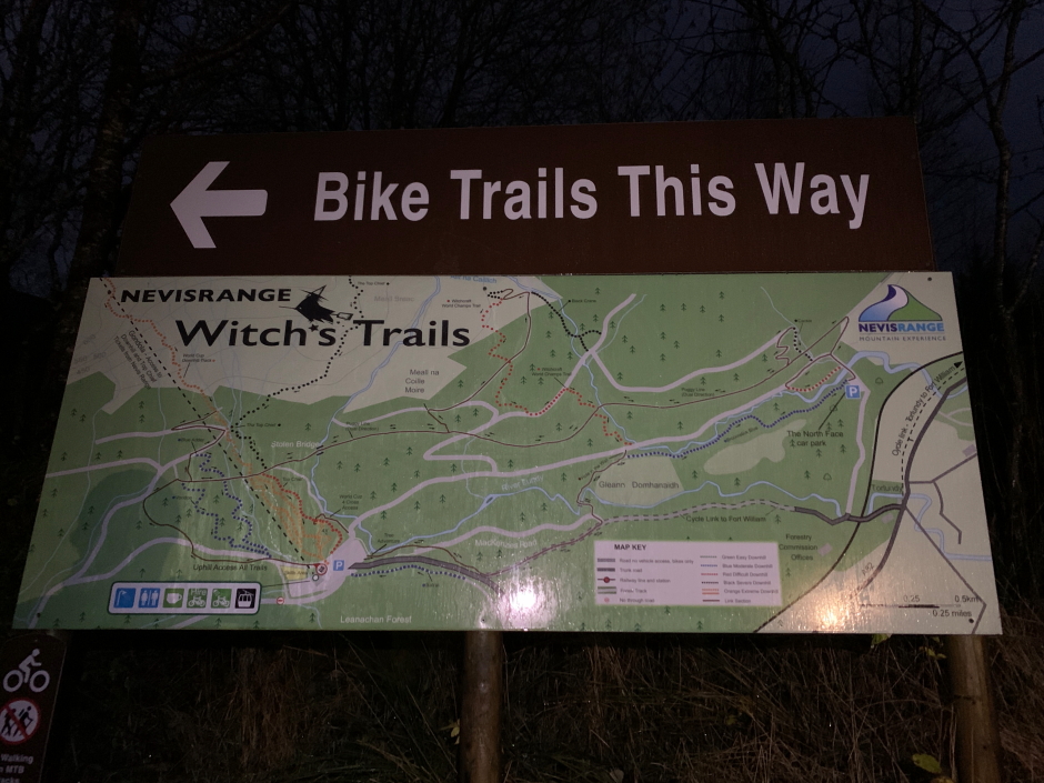
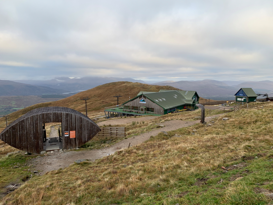
From the car park, I set off walking towards the 'Bike Trails This Way' sign and from there followed the vehicle track which zig-zags up the base of the hill. Circa ten minutes into the walk the batteries in my headtorch died so I stopped to swap out the batteries before continuing on - always carry spare batteries!
Witch's Trails signage at start of walk:
On progressing up the hill I came to a somewhat intrusive over-sized sign which really doesn't need to be there. From the right-hand side of this sign I followed what is marked as a footpath on my Ordnance Survey map.
Silverline sign:
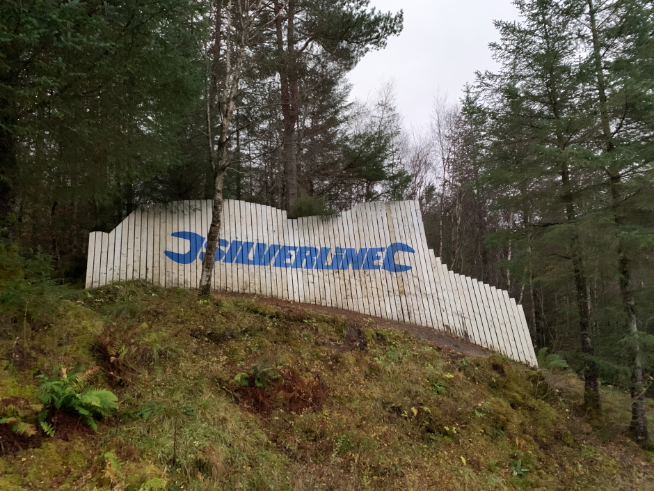
Please note that the footpath marked on the 1:50000 Ordnance Survey Landranger map has been converted by the Nevis Range centre into the 'Top Chief' bike trail. While this trail may be ideal and exciting for mountain bikes in descent, I can confirm it is a b*****d to walk-up (see below). The bike trails would appear to have been constructed with zero thought given to the hillside and zero thought given to walkers. Walkers are told by signage everywhere to stay off the bike trails but at the same time, the bike trails have taken over the walker's footpaths. I am guessing they want walkers to pay to use the gondola which is all well and good if the gondola is actually running and if you don't mind being carried halfway up and/or down the hill.
On the 'Top Chief' bike trail:
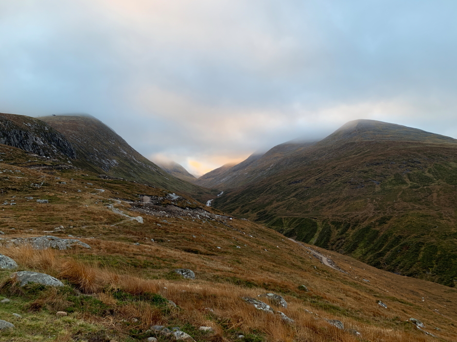
Looking up the Allt Daim between Aonach Mor and Carn Mor Dearg:
On the plus side, the gondola was closed for maintenance so it was highly unlikely I would meet any mountain bikers on the trails. While the black-graded trail was challenging to walk-up, the blue-graded trail was the opposite i.e. unnecessarily long and winding. It was with some relief that I reached the upper gondola station.
Just above the upper gondola station:
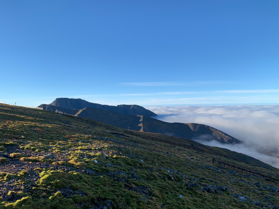
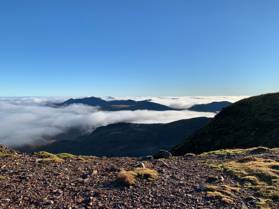
The five hundred metres of ascent beyond the upper gondola station was mostly in low cloud. Thus far the ascent of the hill was grim i.e. up there with ascending The Cairnwell. However, things were about to change considerably
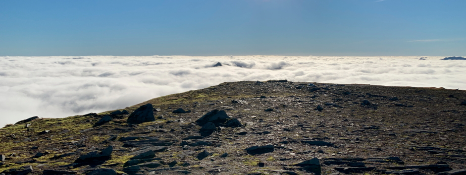
The transition from walking in cloud to walking in blue skies was almost instantaneous.
Above the clouds:
On reaching the summit plateau I made my way across to a sign from which I took a pic looking towards the Grey Corries. While I think the sign is completely unnecssary for walkers, I guess it is primarily there for skiers and snowboarders who generally do not read a map as they move.
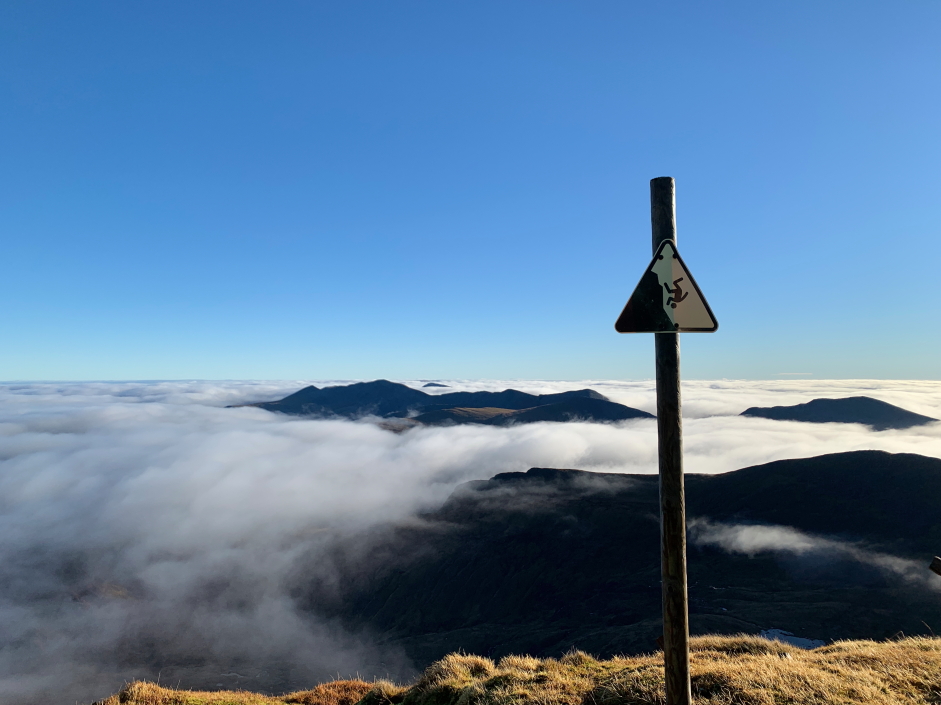
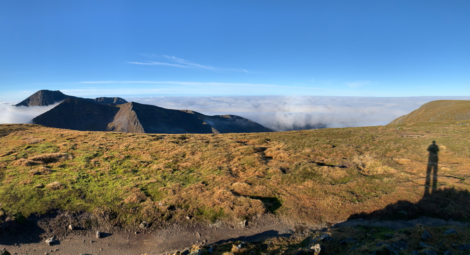
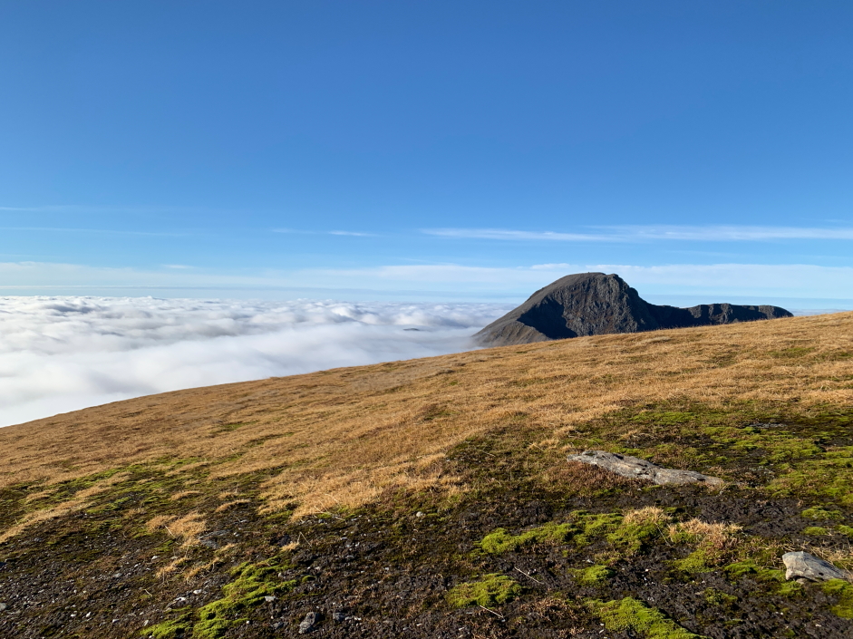
Fantastic cloud inversion but don't fall while admiring the views:
During the walk across the plateau I stopped to put on suncream before continuing on towards the summit of Aonach Mor.
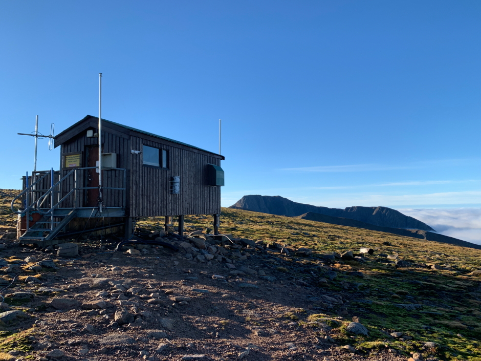
Small hut en-route to Aonach Mor summit:
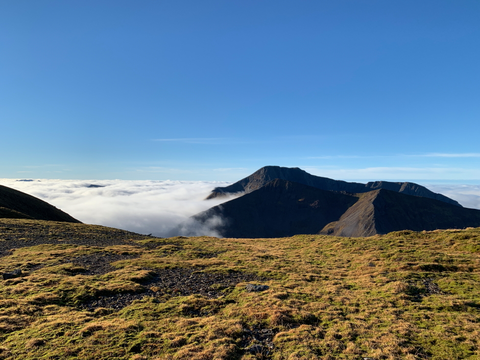
The Grey Corries:
Carn Mor Dearg and Ben Nevis:
Given the time of year, and fact these are big hills with much ascent and descent, I spent only a couple of minutes at the summit to take some photographs before continuing on. I was regretting not carrying my DSLR and taking only a litre of water but at the same time it was nice to travel light.
At Aonach Mor summit:
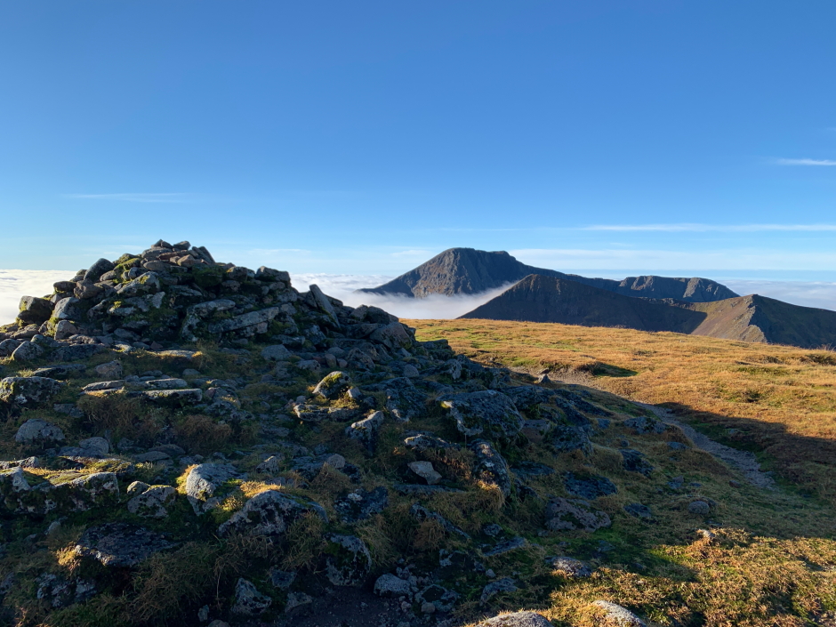
Looking across to Carn Mor Dearg and Ben Nevis from the summit of Aonach Mor:
Panorama from the summit cairn:
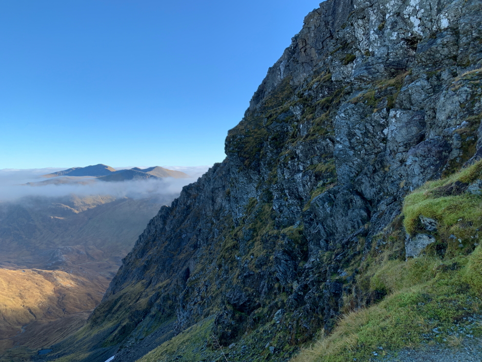
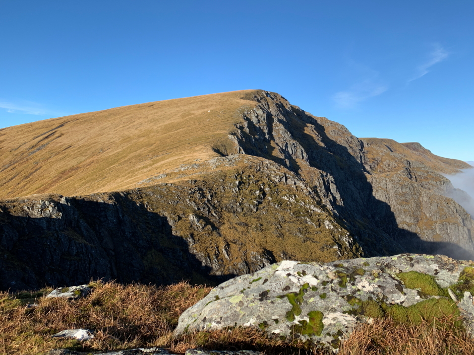
From the summit of Aonach Mor, I continued on across the wide plateau towards Aonach Beag. From the col, I took a photo of the impressive NE ridge of Aonach Beag not realising that I had accidentally photographed part of the one remaining snow patch in the UK from the winter of 2020/21 (bottom left in next pic).
NE ridge of Aonach Beag (with last remaining snow patch):
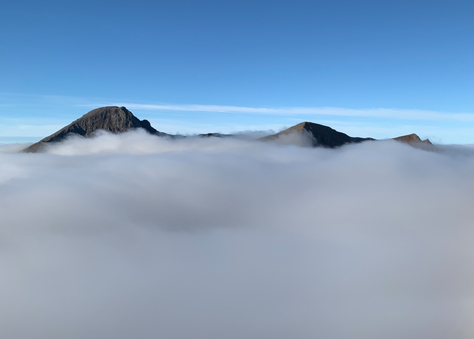
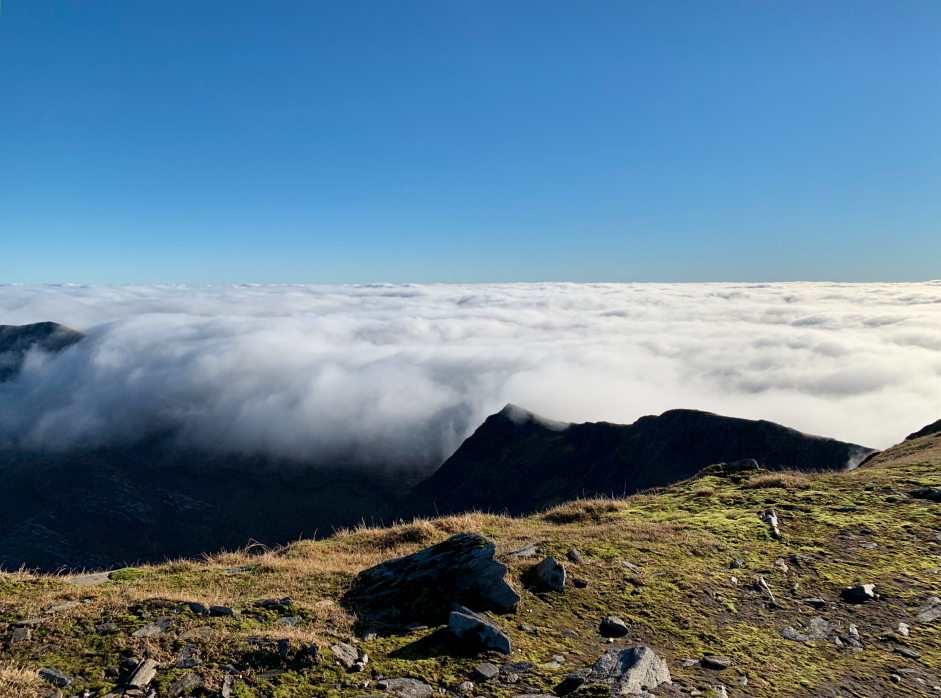
As I made my way up Aonach Beag the cloud level was now rising quite quickly and began to flow like a fluid over the col. Only the tops of Ben Nevis, Carn Mor Dearg and the Aonachs were now visible.
Cloud rising to just below the highest tops:
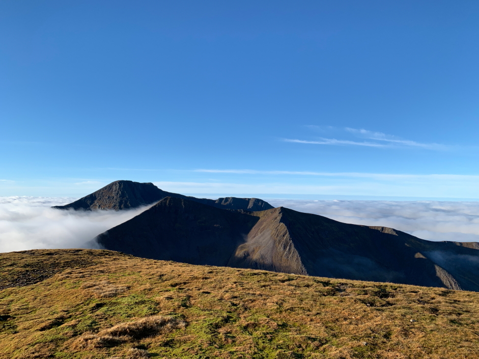
Looking back to Aonach Mor:
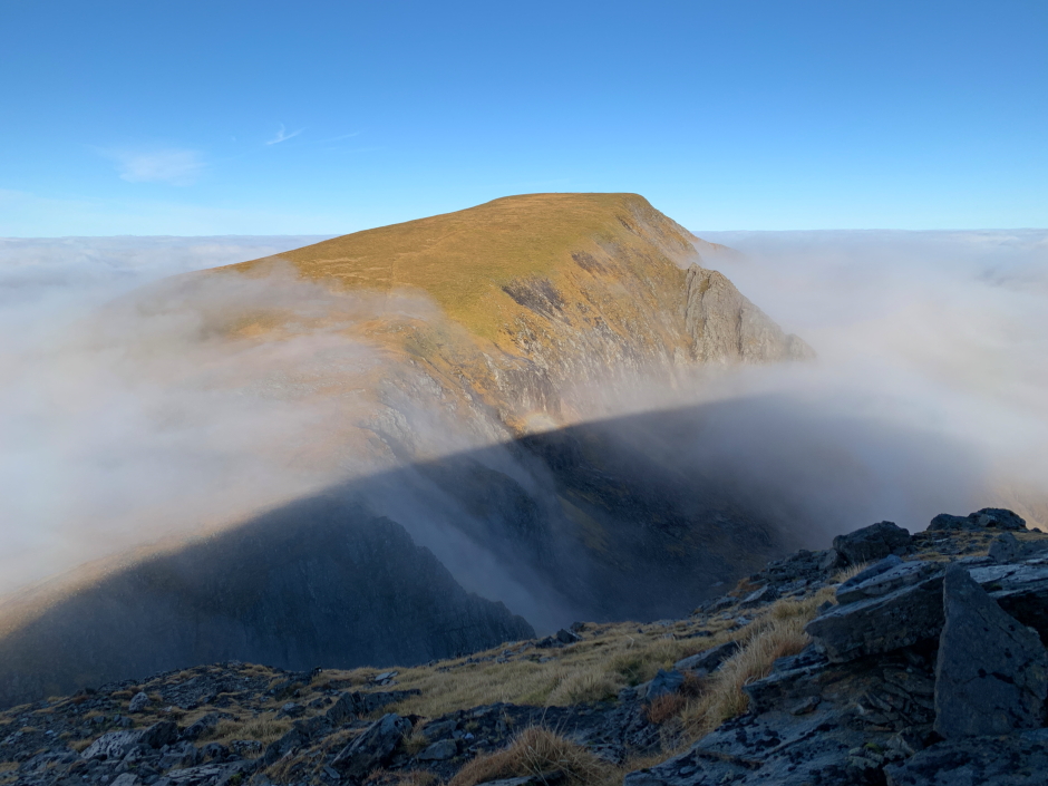
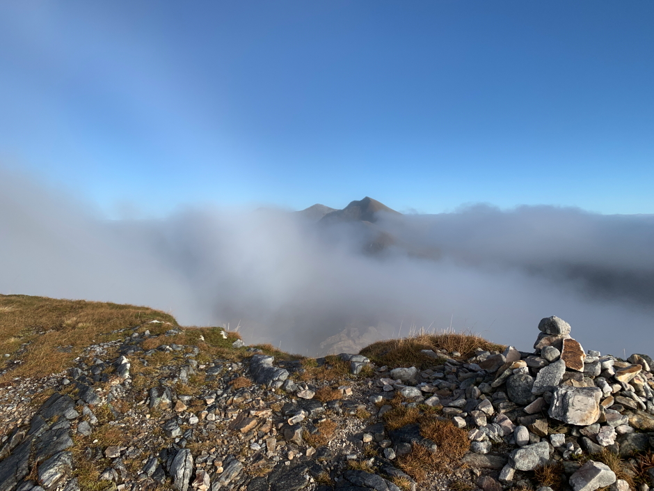
A few minutes later, somewhat to my surprise, the cloud level again dropped to below the col and was ideal for glories. I saw my first glory of the day on approaching the summit of Aonach Beag.
First glory of the day while looking back to Aonach Mor:
Again, on reaching the summit of Aonach Beag, I stopped only for a couple of minutes before continuing on my way.
At Aonach Beag summit:

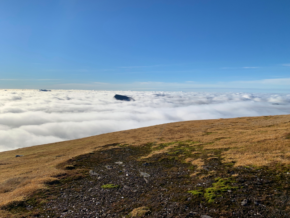
The Mamores were now almost completely covered in cloud with only the top of the highest summits now visible. Anyone walking lower hills, including lower Munros, would be having a fairly bad day walking in cloud with zero visibility.
Some Mamore summits just visible above the clouds:
During the descent I opted to include two Munro Tops, Stob Coire Bhealaich and Sgurr a' Bhuic.
Commencing descent into the cloud:
Mamore summits:
Looking back towards Ben Nevis:
It didn't take long to reach the summit of Stob Coire Bhealaich.
At the summit of Stob Coire Bhealaich:
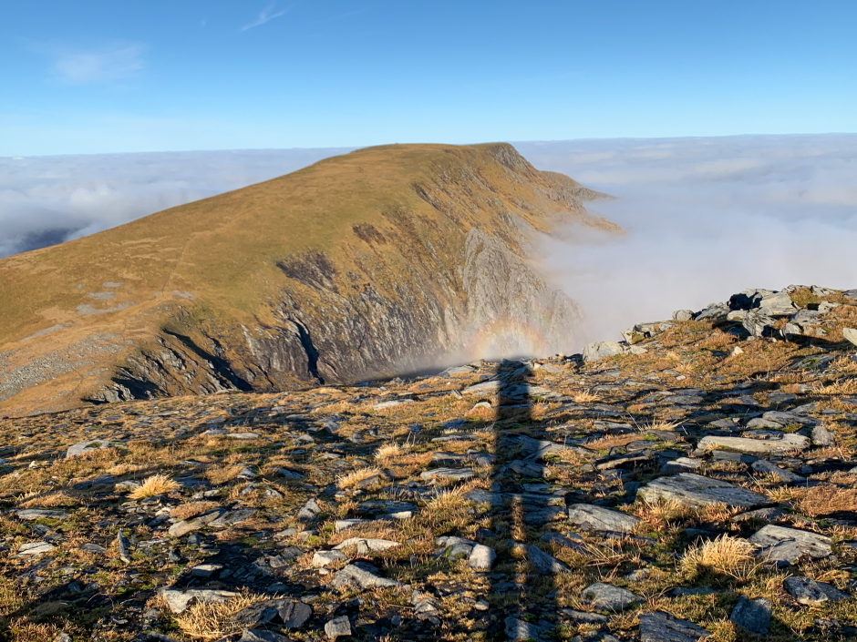
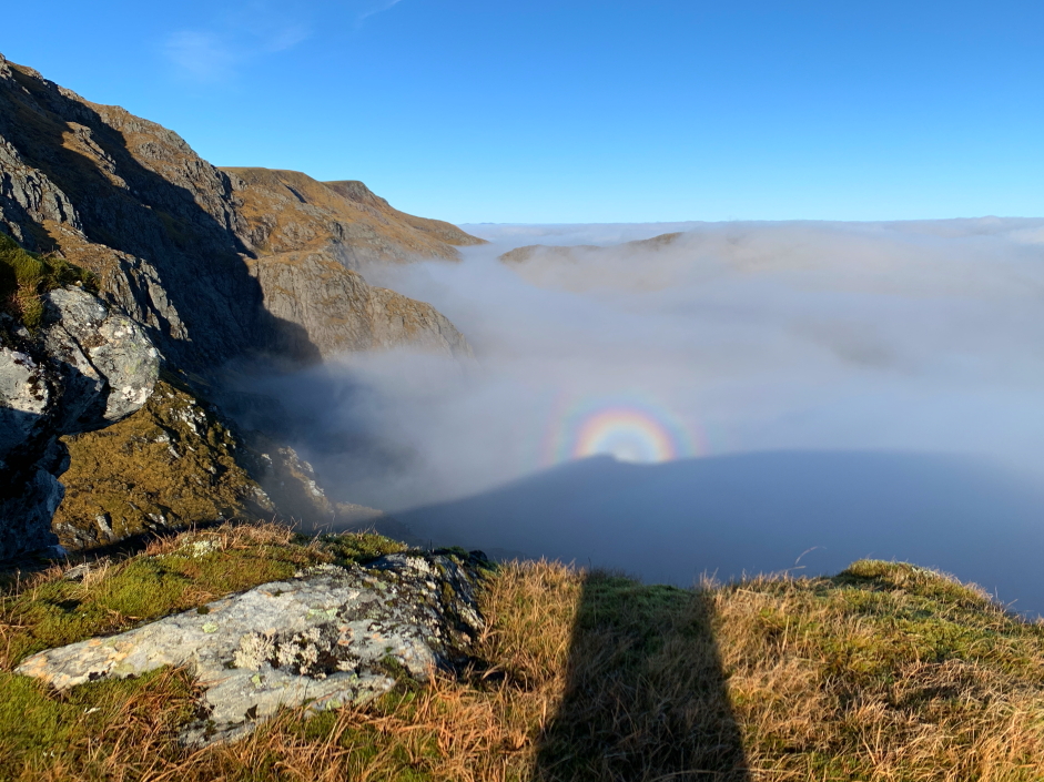
At the summit of Stob Coire Bhealaich, and for the next ten minutes beyond, I witnessed the strongest glory I have ever seen on the hills. Despite trying to position myself correctly between the sun and low cloud, I did not see a spectre. A Brocken spectre consists of a glory (the rainbow) and a spectre (your elongated shadow).
Nice, strong glory from Stob Coire Bhealaich:
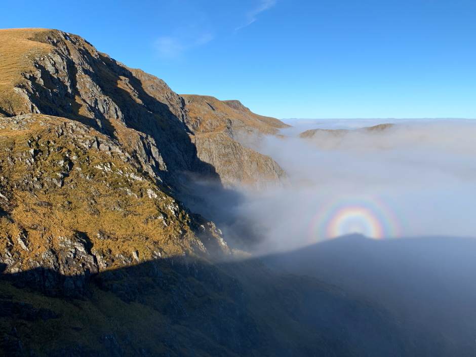
Glory:
Panorama from a short distance beyond summit of Stob Coire Bhealaich:

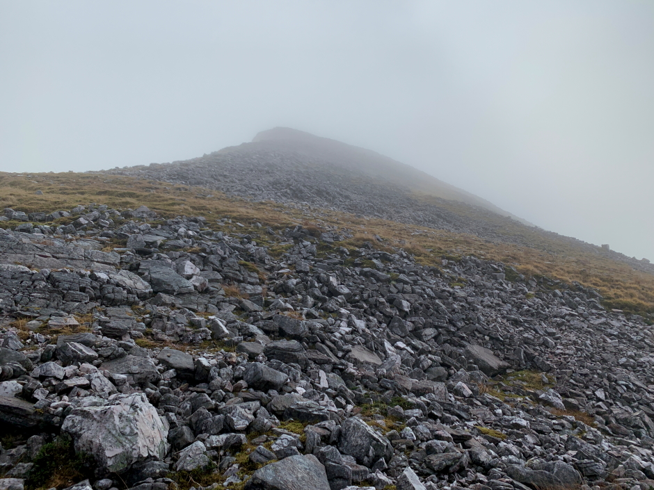
Beyond the summit of Stob Coire Bhealaich I dropped down into the cloud. Instead of walking on grass, the route towards Sgurr a' Bhuic now involved crossing lots of quartzite similar to walking in the Grey Corries.
Sgurr a' Bhuic:
The summit of Sgurr a' Bhuic was pretty-much at cloud level so it was nice to see some blue sky again before dropping down back into the cloud.
Partial fogbow at the summit of Sgurr a' Bhuic:
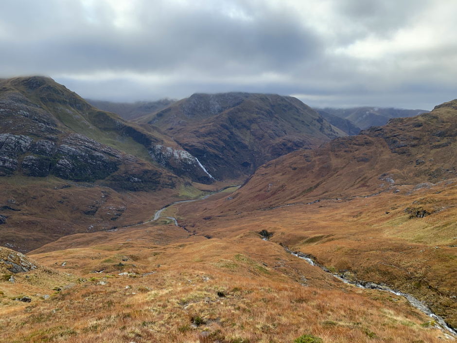
From Sgurr a' Bhuic I descended steeply to the Steall ruin following a nice burn with several small cascading falls.
Descent towards Steall ruin and falls:
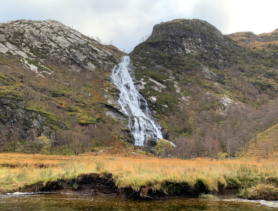
Finally, on reaching the base of the hill, I walked from the Steall ruin back out to the upper Glen Nevis car park with a small diversion en-route to photograph the Steall falls.
Steall falls:
Always great to get above the clouds and an added bonus to see several glories