
Date: Saturday 22nd July 2023
Company: Myself and Ann-Marie
Distance: 27.9km, Ascent: 1480m
Time: 11Hrs
Following an ascent of Ladhar Bheinn on Thursday and a morning spent paddling around Inverie Bay on Friday, on Saturday we set out to ascend Luinne Bheinn and Meall Buidhe.
Despite having ascended Luinne Bheinn and Meall Buidhe previously from Kinloch Hourn via Barrisdale, I had not previously undertaken an ascent from Inverie. I therefore had a look at WalkHighlands for an approximation of time, distance and their suggested route. WalkHighlands suggests 11-13 hours so we knew this would likely be a long day on the hill.
The evening previous, we noted an MWIS forecast of 80% cloud-free Munros with a good breeze which would hopefully keep the midge and clegs at bay.
On Saturday morning we got up nice and early, had some breakfast and were on our way walking by 5.30am. I opted to undertake the WalkHighlands route in reverse which would mean walking into the sun along the track to Mam Barrisdale but with the sun behind us for walking the hills which is better for photography.
Route:
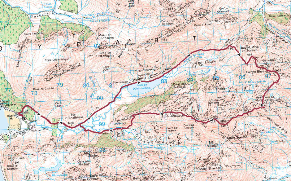
From our weekend base at the Knoydart Foundation Bunkhouse, we walked a few hundred metres towards Inverie before taking the right of way track leading towards Gleann an Dubh-Lochain, Mam Barrisdale and beyond to Barrisdale. It was already a stunningly beautiful morning.
After walking just over two kilometres we passed the Brocket Memorial. The Brocket Memorial was erected by the 2nd Lord Brocket of Knoydart, a despised landowner, "in gratitude for his father and mother, and his wife and children, AD 1938".
On 9th November 1948, seven of Knoydart's residents staked-out some arable land and hill land to be used to rebuild their lives following WWII. The landowner, Lord Brocket, a well known Nazi sympathiser, took the case to the Court of Session which ruled against the land raiders. Despite their unsuccessful attempt, the actions of these seven men sparked new life into the community and set the ground work which led to the eventual community buyout at the turn of the millennium.
Approaching the Brocket Memorial:
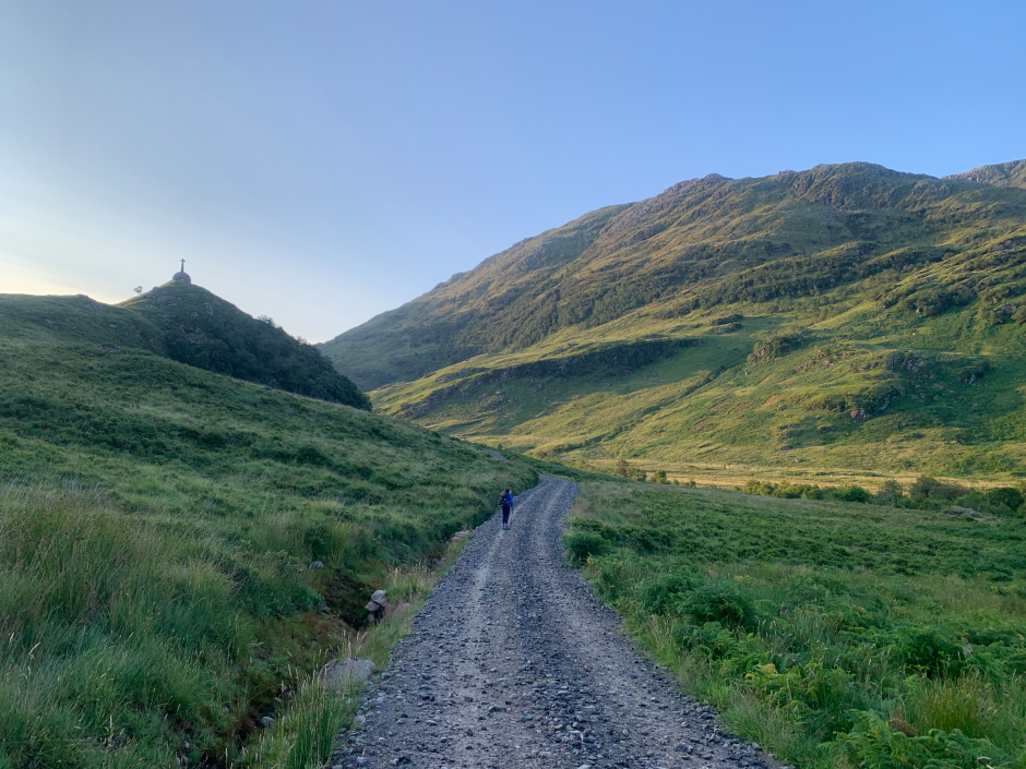
On reaching the west end of Loch an Dubh-Lochain we paid a quick visit to the ruin at Torcuileainn before continuing along the track alongside the loch. As we progressed along this track, the ground became increasingly wet so we stopped briefly to change out of our trail shoes and into our walking boots.
Loch an Dubh-Lochain with Beinn Bhuidhe in background:
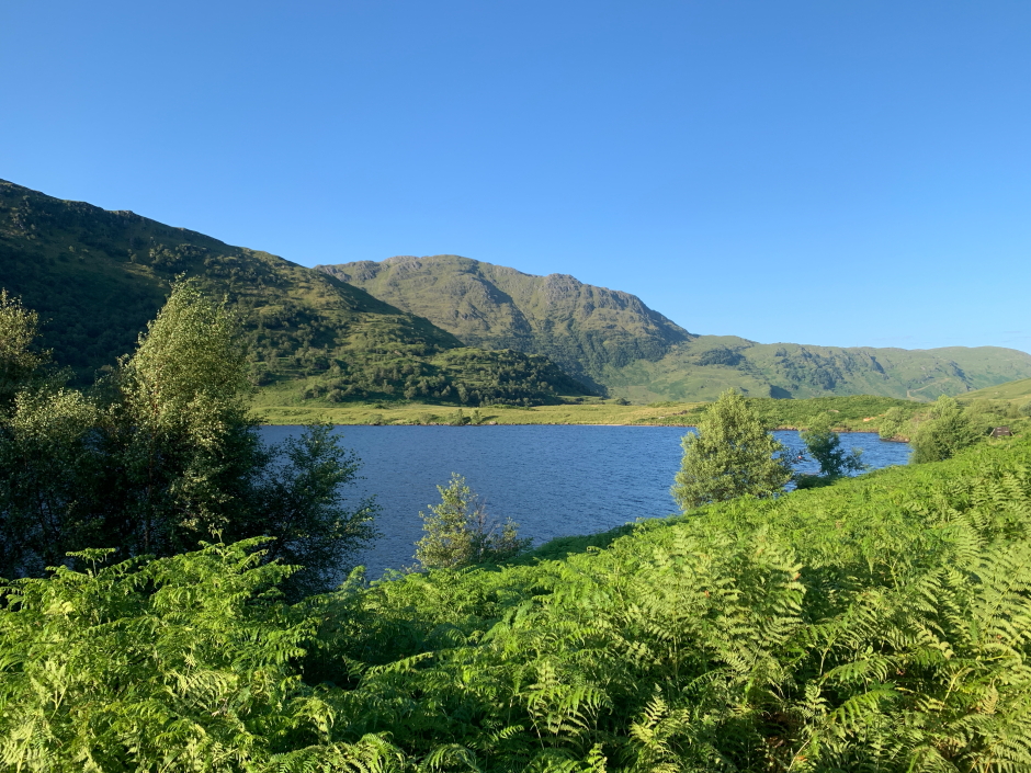
Beyond Loch an Dubh-Lochain (height 70m) we continued along the footpath to Mam Barrisdale (height 450m).
Looking back towards Loch an Dubh-Lochain:
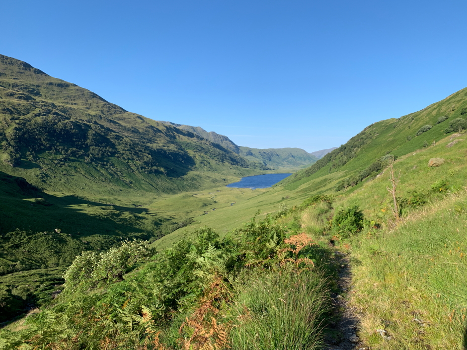
On reaching Mam Barrisdale, c.11km from our starting point, we stopped to take some photographs. Mam Barrisdale is the high-point of the pass between Inverie and Barrisdale. The 14km track between Inverie and Barrisdale forms part of the Cape Wrath Trail.
Looking back from Mam Barrisdale:
From Mam Barrisdale, we followed a path alongside a line of old rusty fenceposts. I noticed however that by following this path we had detoured off the WalkHighlands route. While ascending via the fenceposts path was fine, I decided to cut-back a couple of hundred metres to rejoin the WalkHighlands route which it turned out was a better path than the path next to the rusty fenceposts.
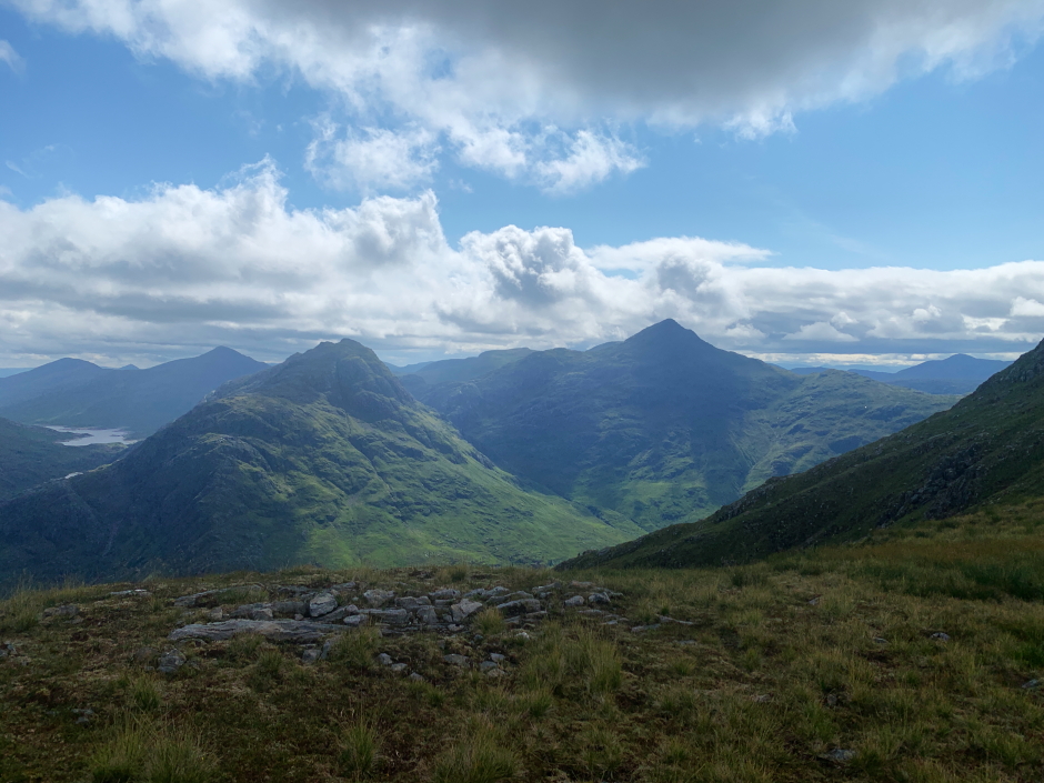
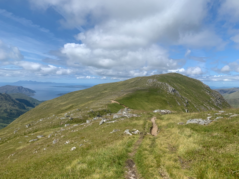
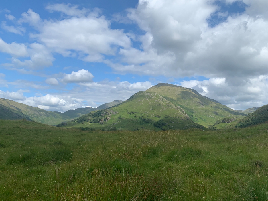
Luinne Bheinn from near Mam Barrisdale:
Meall Buidhe from near Mam Barrisdale:

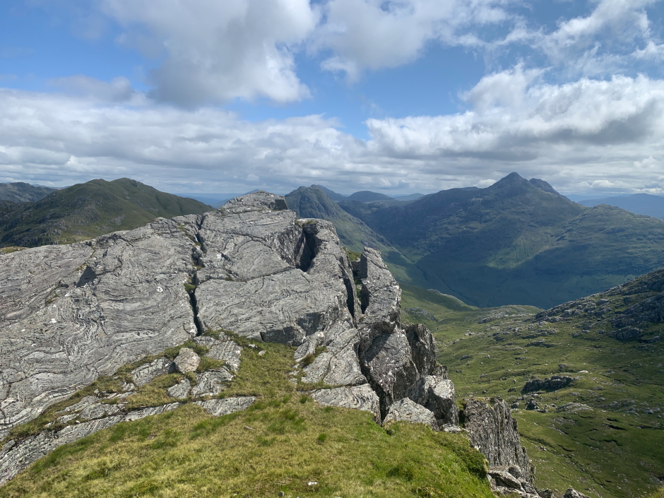
Druim Fada and Meall nan Eun during ascent of Luinne Bheinn:
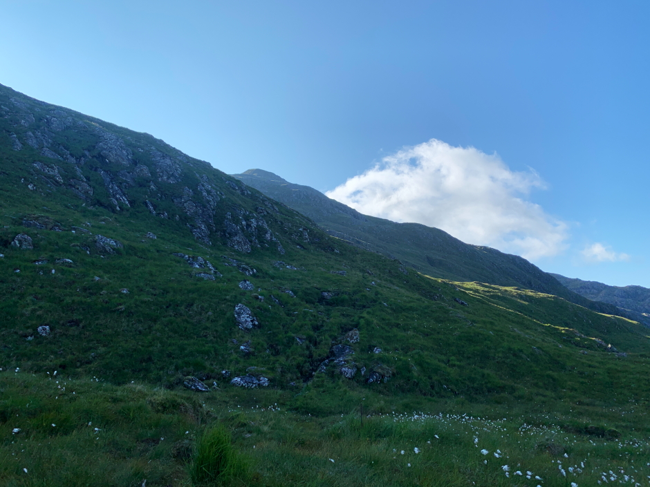
As we gained more and more height, the views got better and better. We could see for miles in all directions.
Ridge from Sgurr Coire Chionnichean to Ladhar Bheinn during ascent of Luinne Bheinn:
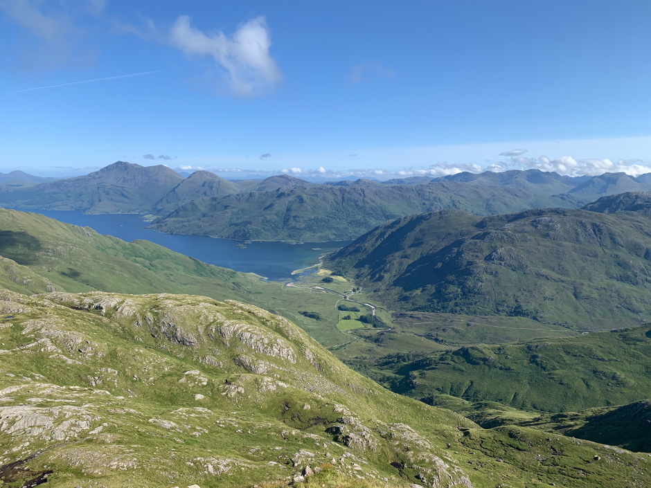
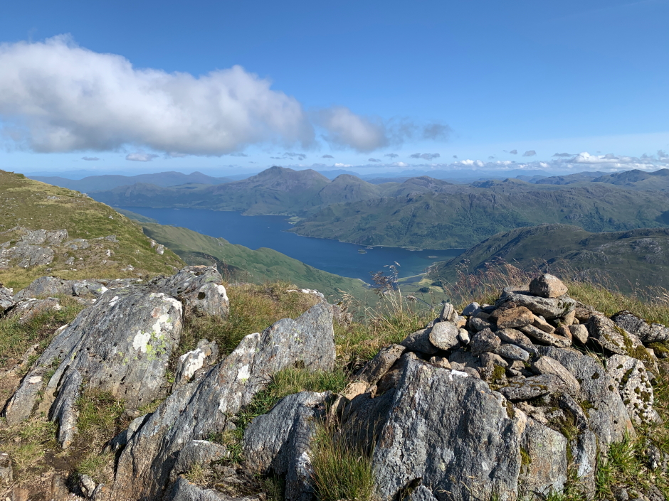
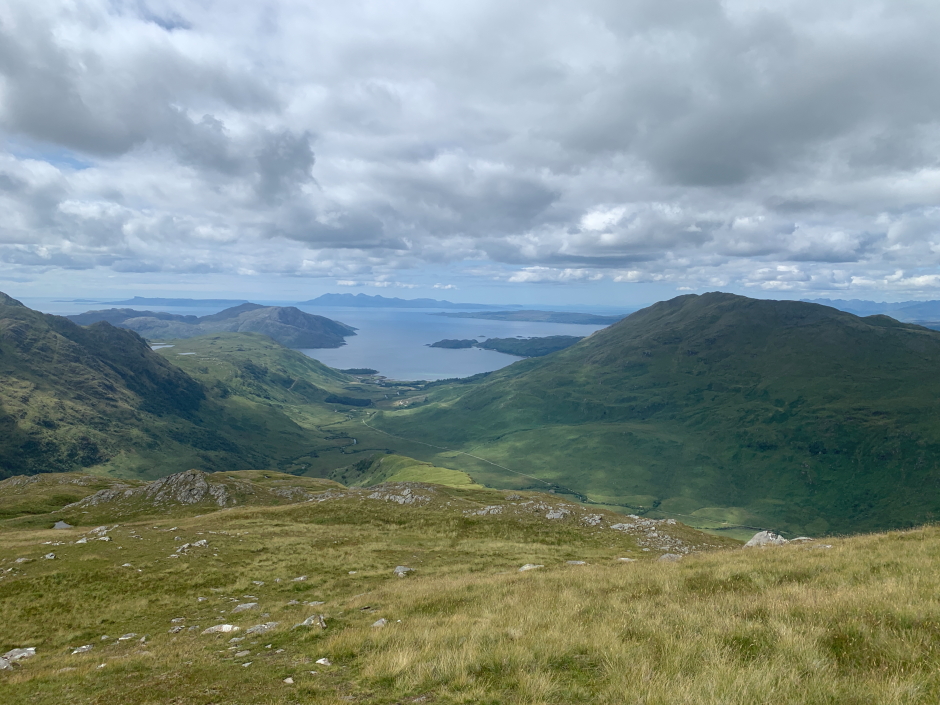
The best view of the walk thus far was when Barrisdale and Loch Hourn came into view.
Barrisdale, Loch Hourn and beyond to Beinn Sgritheall during ascent of Luinne Bheinn:
View towards Meall Buidhe during ascent of Luinne Bheinn:
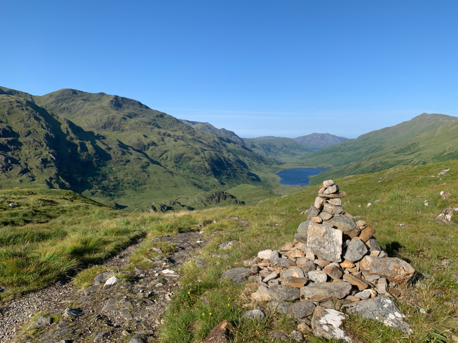
It didn't take long to reach the first of three cairned tops of Luinne Bheinn. The first 938m top provides the best views down to Barrisdale.
Loch Hourn from the 938m viewpoint cairn of Luinne Bheinn:
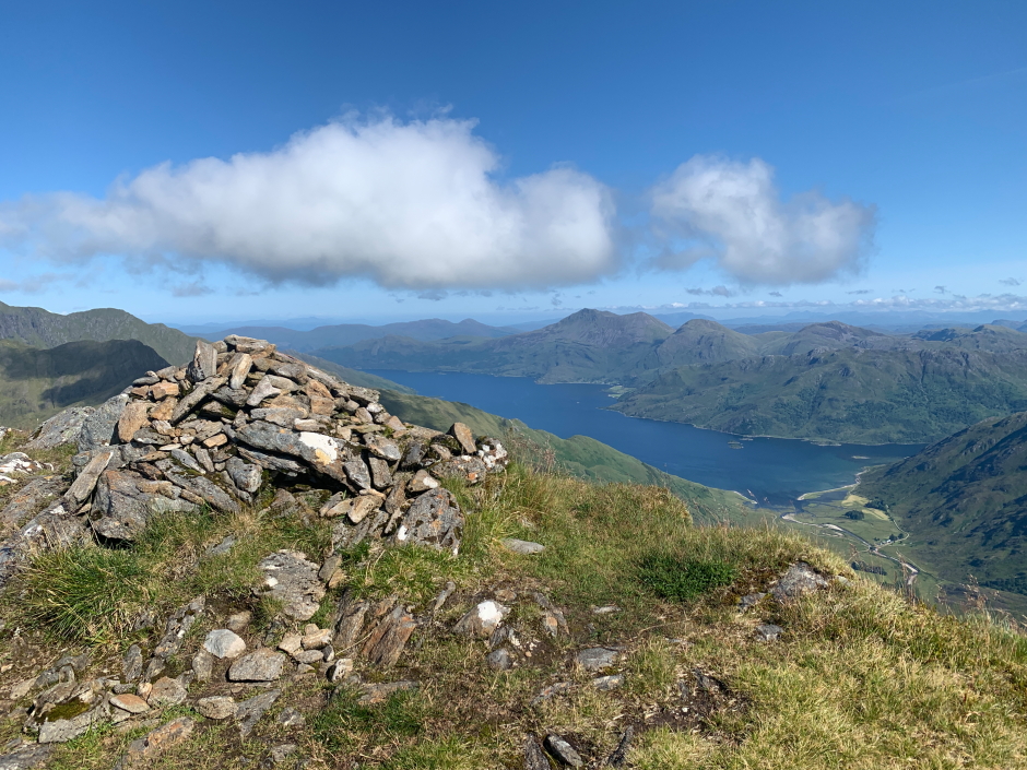
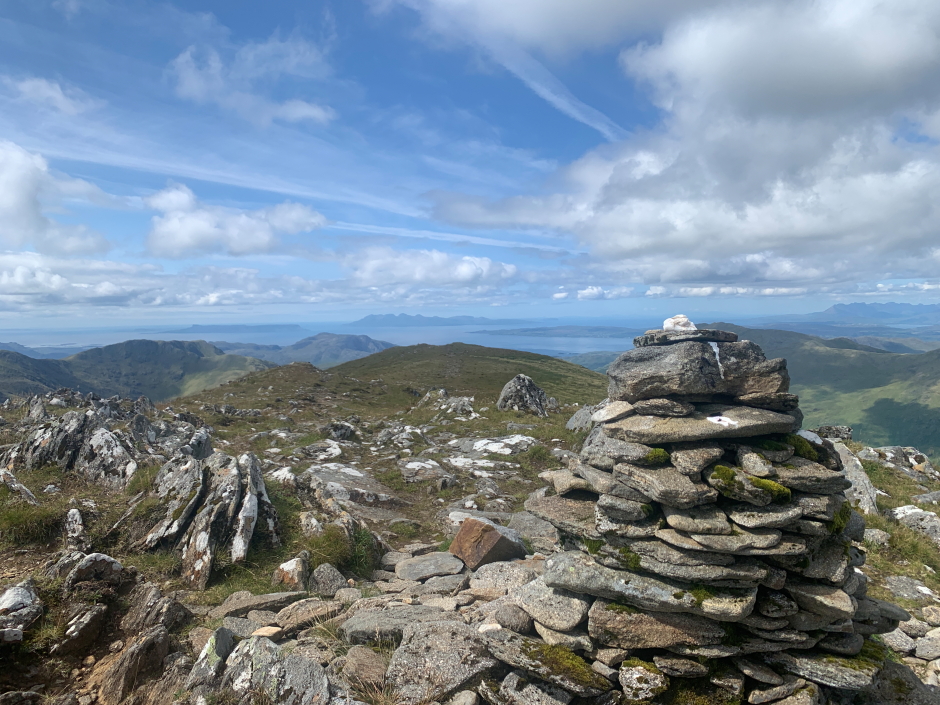
The second top, which according to the map is only one metre higher than the first viewpoint top, is the summit of Luinne Bheinn.
At the 939m summit of Luinne Bheinn:
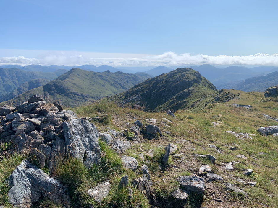
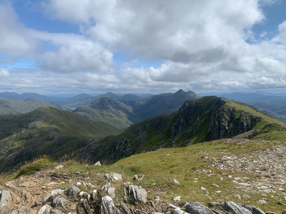
From the summit top, we continued along the ridge to the third top of Luinne Bheinn which is a Munro Top.
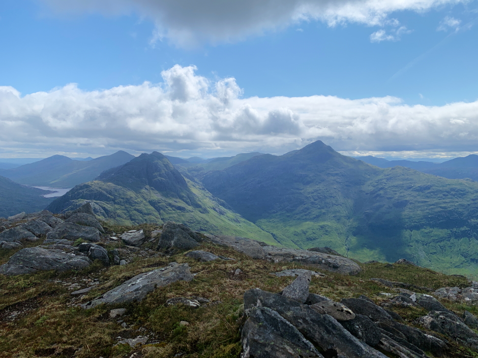
View from the 936m Munro Top of Luinne Bheinn:
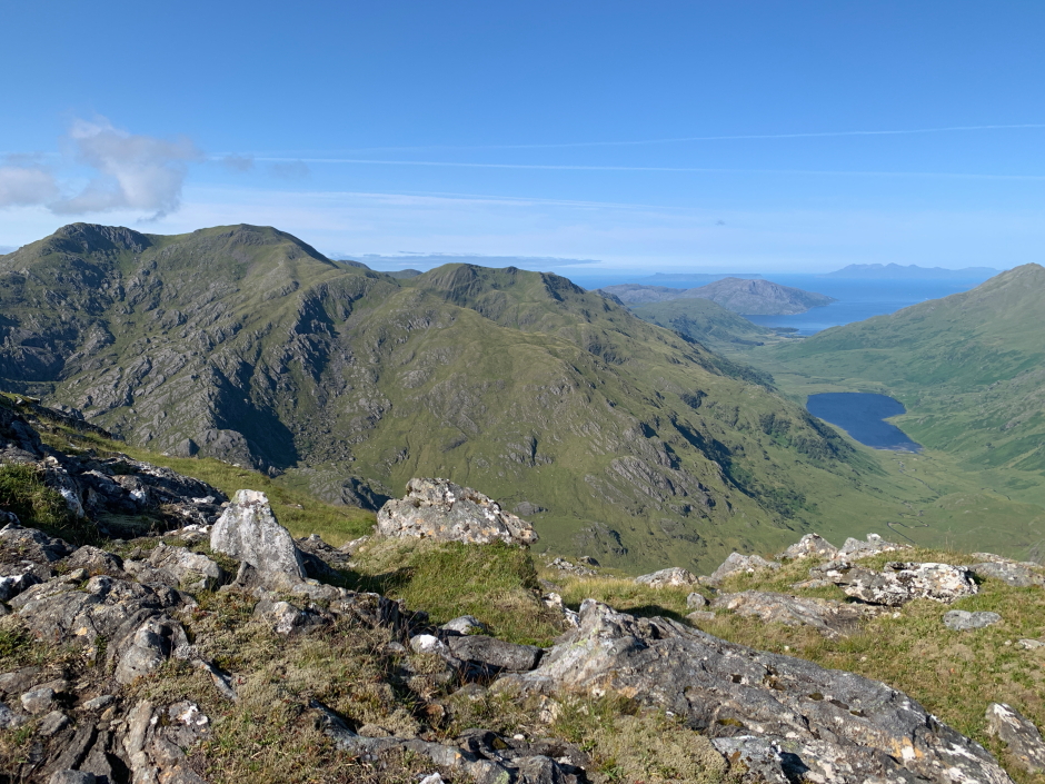
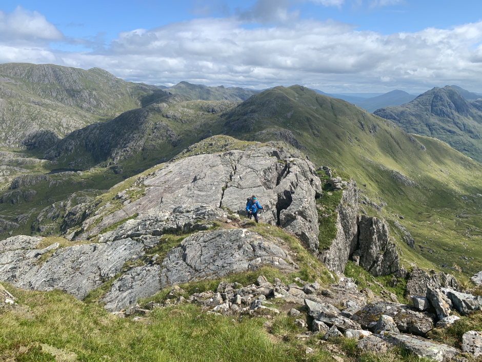
From the Munro Top we could see the undulating ridge ahead to get to our second intended Munro, Meall Buidhe.
Undulating ridge between Luinne Bheinn and Meall Buidhe:
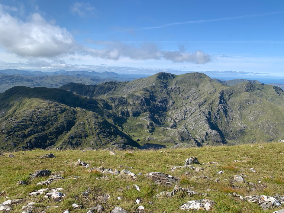
The ridge between the two Munros is mostly wide with numerous ups and downs.
Looking back during descent from the 936m Munro Top of Luinne Bheinn:
Having left the bunkhouse at 5.30am, I wondered when we would meet a group of fell-running lasses, who were also staying at the bunkhouse but departing at 7.30am, undertaking the same circuit in reverse from ourselves. I expected to see them soon.
Meall Coire na Gaoithe 'n Ear, Druim Leac a' Shith and beyond to Meall Buidhe:
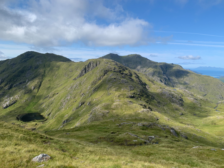
Looking back to Luinne Bheinn:

As we traversed the ridge, seeing Ben Aden and Sgurr na Ciche reminded me of my epic ascent of these hills taking in Sgurr Cos na Breachd-laoigh, Sgurr nan Coireachan, Garbh Chioch Mhor, Sgurr na Ciche and Ben Aden with a drop down to Sourlies Bothy for the night before walking back out to Strathan the following day. This was the first hill report I published on the internet back in 2007.
Ben Aden and Sgurr na Ciche from col below Meall Coire na Gaoithe 'n Ear:
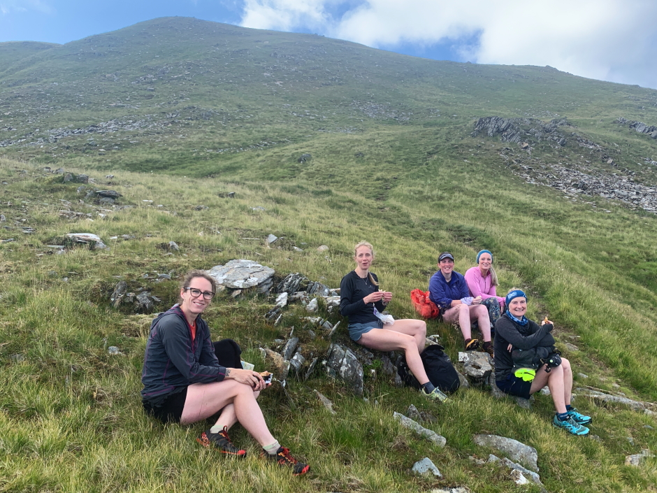
On reaching the top of Meall Coire na Gaoithe 'n Ear, I caught sight of three of the fell runners ahead, shortly followed by another two. They then disappeared out of sight but we were soon to meet up at the col between Meall Coire na Gaoithe 'n Ear and Druim Leac a' Shith for a lunch stop.
Massive respect to these lasses who not only undertook this circuit in circa 8 hours but also on getting back to the bunkhouse two of whom decided to immediately head back out to also run up and down the Corbett, Sgurr Coire Choinnichean
Fell-runners at the col between Meall Coire na Gaoithe 'n Ear and Druim Leac a' Shith:
After having a good chat we parted company as we next made our way towards Druim Leac a' Shith. The WalkHighlands route and the track skirt round this summit. I therefore undertook a small diversion out and back to ascend to the summit as I noticed it was a HuMP (Hundred Metres Prominence hill).
Ben Aden and Sgurr na Ciche from the summit of Druim Leac a' Shith:
I soon caught-up with Ann-Marie who had continued along the track towards Meall Buidhe while I ascended Druim Leac a' Shith.
Meall Buidhe during descent from Druim Leac a' Shith:
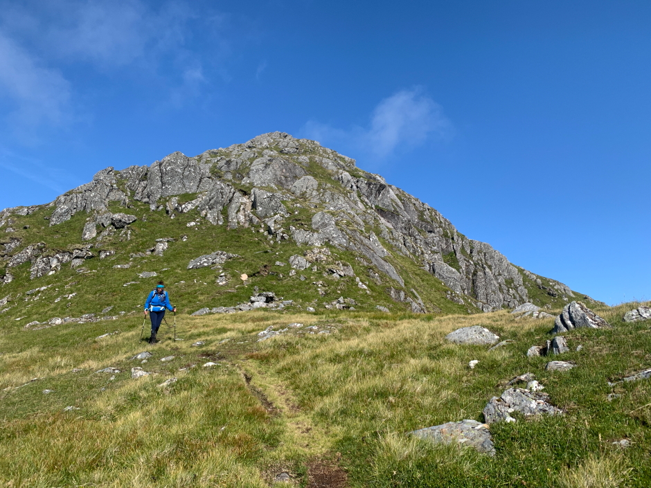
It was great to pass the final col before commencing our ascent of Meall Buidhe's SE Top. During the ascent we passed some nice contorted rock.
Contorted rock passed during ascent of Meall Buidhe:
Looking back during ascent of Meall Buidhe:
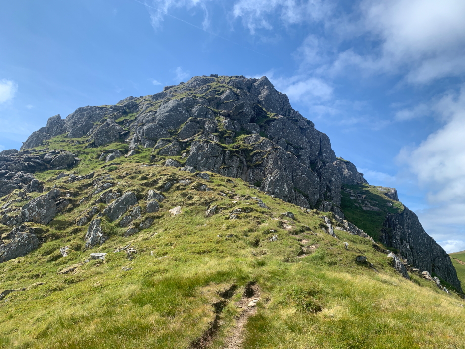
The final ascent of the SE Top involved some easy scrambling most of which could be avoided, if desired, via a short by-pass path.
Easy scramble below the 942m SE Top of Meall Buidhe:
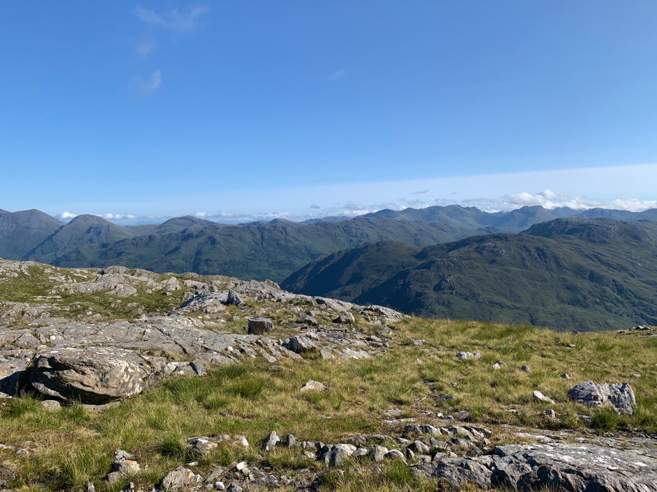
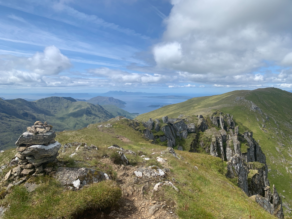
On reaching the Munro Top summit, the views out towards Eigg, Rum, Skye, and around much of the North-West Highlands mainland, were spectacular.
Fantastic view from the 942m SE Munro Top of Meall Buidhe:
From the Munro Top, we continued on to the summit of Meall Buidhe.
Heading from the SE Munro Top to the summit of Meall Buidhe:
It had taken us 2Hrs 50Mins to traverse from Luinne Bheinn to Meall Buidhe but boy it was worth the effort. This is a walk where the journey to the destination is every bit as good as the destination itself.
Reaching the summit of Meall Buidhe has taken me to 280 Munros (Rd 2) with just 2 now remaining
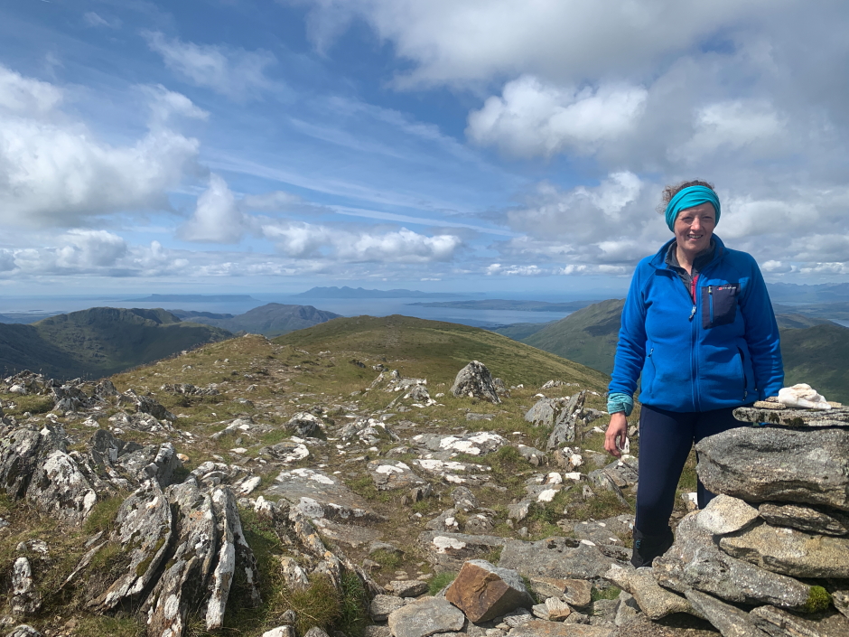
At the summit of Meall Buidhe:
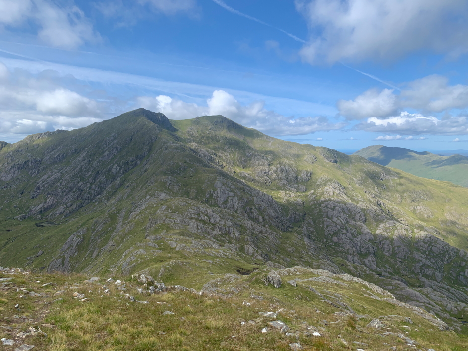
Looking back from the summit of Meall Buidhe:
Ann-Marie at the summit of Meall Buidhe:
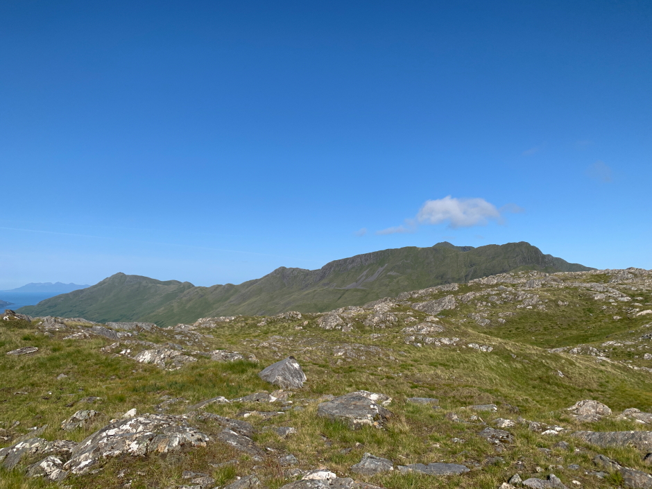
From the summit of Meall Buidhe, we followed the west ridge over the 826m top before descending An t-Uirollach and on towards Druim Righeanaich.
Stunning view towards Loch Nevis, and beyond to Eigg and Rum, during descent of Meall Buidhe:
Until this point, this walk had been one of the best walks I have undertaken. The next section however involved descending the worst terrain I have encountered.
We attempted to follow the WalkHighlands route which took us down literally through hundreds of metres of chest-to-neck high bracken. In hindsight, it would have been much better to disregard the WalkHighlands route instead continuing the descent via the nose of Druim Righeanaich. On eventually reaching the Gleann Meadail track, we stopped to wipe ourselves down to remove ticks.
As far as routes go, any suggestion to go up or down this slope at this time of year will mean you are on terrain that is as bad as it gets. To be fair WalkHighlands does advise "the slope is further defended by high bracken". Shame I failed to read that part. My advice is "don't descend this way between July and October".
Looking back at horrendous descent through chest-high bracken:

While wiping ourselves down to remove ticks, we were passed by an elderly lady who couldn't believe we had just come down through the bracken. She was kind, asking if we still had enough water and offering us some from the nearby private bothy. After declining the kind offer and continuing on we next met an estate worker with a quad bike. He offered us a lift on the quad bike back to Inverie, which would have saved us 3 - 4km of walking along track but we turned-down the offer, as tempting as it was, as certainly in my mind that would have meant we hadn't completed the walk.
New bridge over the Inverie River:
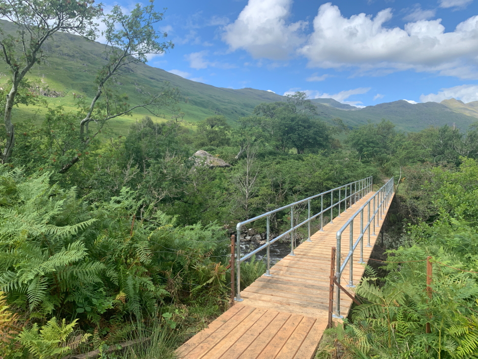
Inverie River:

Looking back towards Meall Buidhe:
We were again soon passing the Brocket Memorial on the track leading back to Inverie. On reaching the bunkhouse, the fell-runners were already back before us
An ascent of Luinne Bheinn and Meall Buidhe, from Inverie, is an outstanding circuit with some of the best views you get in Scotland