
Date: Tuesday 14th October 2025
Company: Myself and Ann-Marie
Distance: 14.5km, Ascent: 754m
Time: 4Hrs 35Mins
We set off this morning to ascend Glenridding Dodd and Sheffield Pike with the possibility of extending the walk to also include Hart Side.
On arrival in Glenridding, we were delighted to find ample available free parking. We happily declined having to pay nine pounds to park in the National Trust car park. Charging an additional sixty pence to use the toilet when you've already paid nine pounds to park is literally taking the piss.
Once suited and booted we walked a short distance along the A592 to pick-up the track leading towards the Helvellyn Youth Hostel.
Route:
After walking c.600m along the track, we commenced our ascent from the waymarker post indicating 'path to Glenridding Dodd'. The path marked on my 1:50000 OS map suggested starting the ascent sooner but a signpost at that point suggests not to do so.
The ascent of Glenridding Dodd was fairly steep, as expected. We could see we were walking up into the cloud but would we be lucky enough to pop-out above the cloud?
Ascending Glenridding Dodd:

Ascending Glenridding Dodd:

The summit of Glenridding Dodd was engulfed in cloud so after a quick summit photograph, we returned to the col between Glenridding Dodd and Sheffield Pike for our ascent of Sheffield Pike.
Glenridding Dodd summit cairn:

At the col between Glenridding Dodd and Sheffield Pike:

I didn't bother taking any photos from the col to the summit of Sheffield Pike as the entire route was undertaken in cloud. The route involves traversing numerous rocky knolls.
On arriving at the summit, we met a couple who advised that had we arrived earlier we would have had fantastic views and that the cloud had now lifted above the summit. Despite this we were still treated to a summit fogbow.
Fogbow at the summit of Sheffield Pike:

As we had not had any views thus far, and given the cloud level was not far above us, I was now keen to also ascend Hart Side and to do so at increased pace just in case the cloud level rose any further.
During our descent from Sheffield Pike we passed a fencepost marked with an 'M' and '1912'. I believe this is an old boundary marker separating the Patterdale estate from the Greystoke estate.
Boundary marker (Marshall estate of Patterdale):

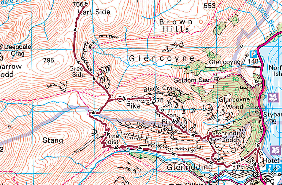
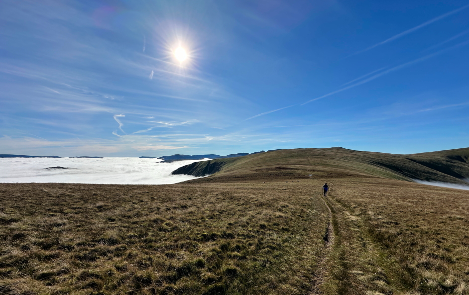
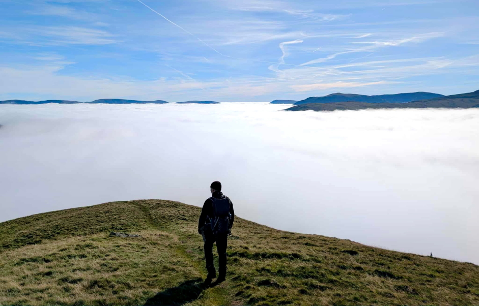
My plan to also ascend Hart Side and to do so quickly paid off. We managed to rise above the clouds on reaching Glencoyne Head.
Above the clouds:
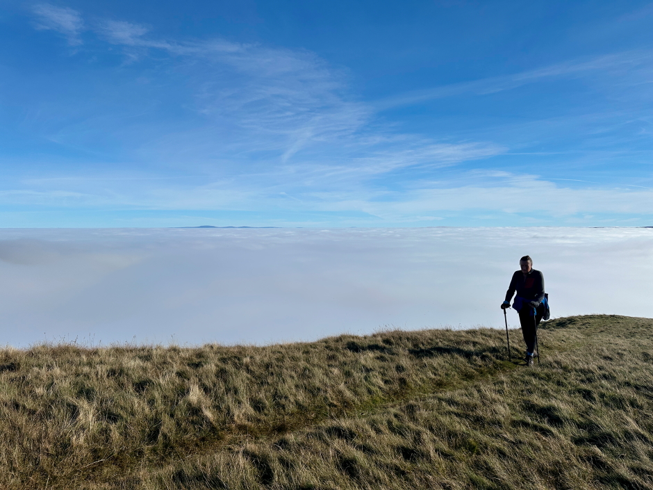
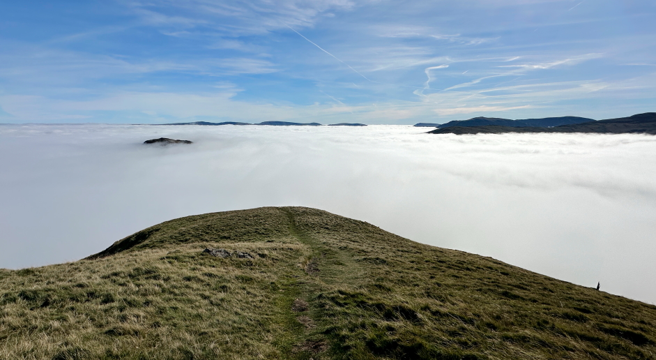
I have seen many cloud inversions (temperature inversions) over my four decades of hillwalking. This was one of the best!
I took many photos and numerous short videos.
Cloud inversion panorama:

Once above the cloud, the heat increased considerably and I stupidly had forgotten to pack suncream. Given I have already had two skin cancers surgically removed from my face and scalp, I was keen to crack-on and get back down into the cloud.
Hart Side above the cloud inversion:
At the large cairn atop Hart Side:

View from Hart Side:

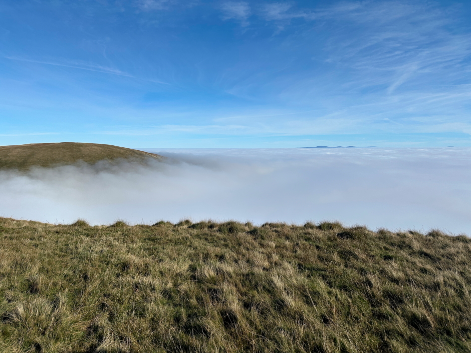
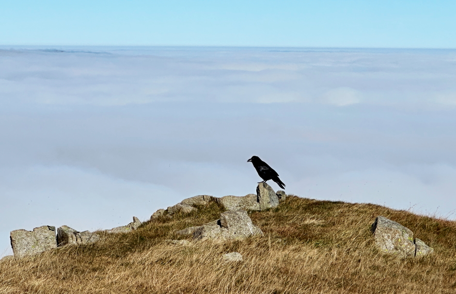
The views across to Skiddaw and Blencathra were sublime. It was nice to also see a raven enjoying the view
Looking across to Skiddaw and Blencathra from Hart Side:

A raven sitting above the cloud inversion:
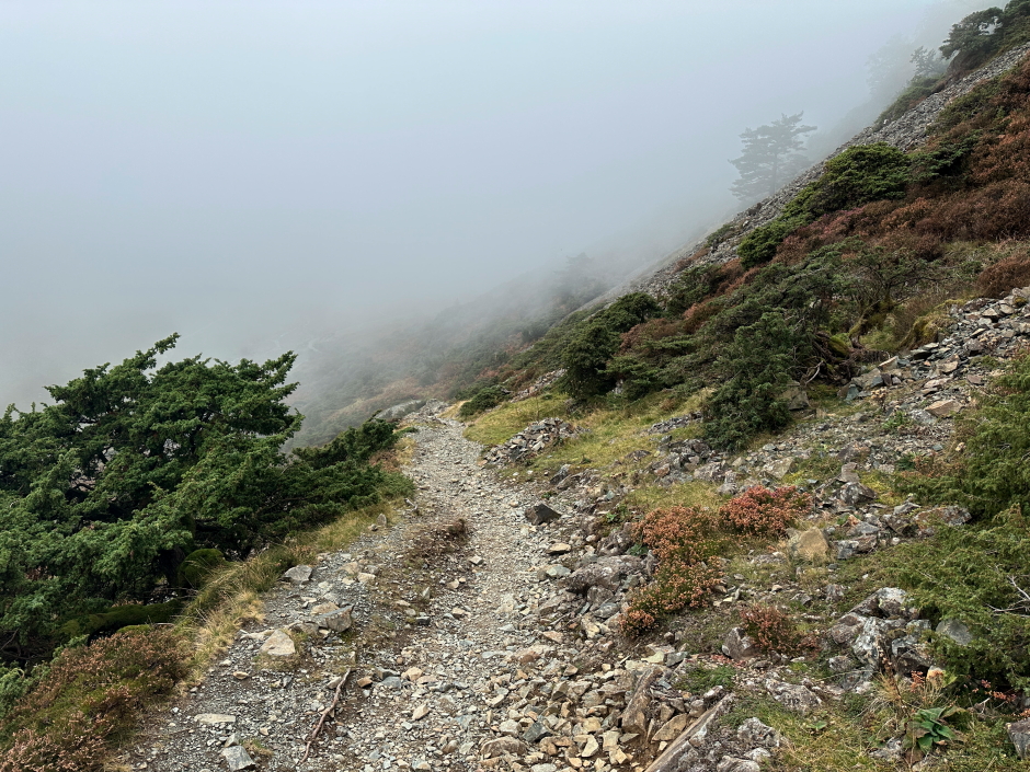
From the summit, we returned back along the top of Glencoyne Head before descending into the cloud.
Ann-Marie leading the way off Hart Side:
The summit of Sheffield Pike poking above the cloud inversion:

About to descend back into the cloud:
Myself enjoying a final view of the cloud inversion (photo by Ann-Marie):
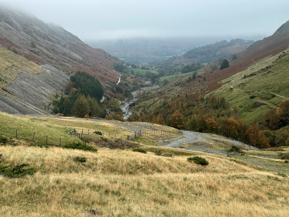
Up until now, I hadn't looked at the map for a way off Hart Side. After a quick look I could see what looked like a good descent route via Stang End down towards the Helvellyn Youth Hostel.
I am old school. I enjoy reading the map and working out my route based on contours and topography. I never use GPX routes created by others.
We passed lots of lovely juniper during the descent.
Descending Stang End towards Helvellyn YHA:
Zig-zag descent at Stang End:
Helvellyn YHA:
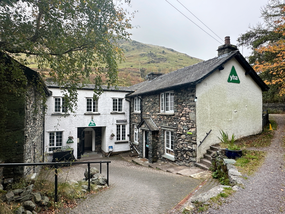
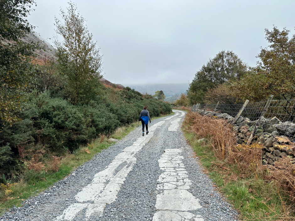
From the hostel, the return to Glenridding was along good track.
Walk out from Helvellyn YHA back to Glenridding:
Having already completed the Northern fells, this walk also completed the Eastern Fells. One more walk should complete the Far-Eastern fells and another should complete the North-Western fells. Most of my remaining Wainwrights are in the Central fells.